TopoQuest Logo
Do you find TopoQuest useful?
Help keep TopoQuest running and adding new maps/features by donating!
Bitcoin:  19c7KJd3qBynnjoSw5npx9KScwjBe4ifkT
Litecoin:  LXs6TkuXGGXo1vDsWCkWVdjQX94eUKd6ui
Home View Maps Find Maps Find Places Resources & Links


Hancock SW, Minnesota Topographic Map

USGS Map Title: Hancock SW, MN
USGS Map MRC: 45095C8
DRG (GeoTIFF) Download: o45095c8.tif


Neighboring USGS Topographic Map Quads:


  Dry Wood Lake, MN  
45096D1
 

  Hancock NW, MN  
45095D8
 

  Hancock, MN  
45095D7
 

  Lake Oliver, MN  
45096C1
 

  Hancock SW, MN  
45095C8
 

  Danvers, MN  
45095C7
 

  Appleton, MN  
45096B1
 

  Milan NW, MN  
45095B8
 

  Big Bend City, MN  
45095B7


Map MRC Location:

N46°
W96°
N46°
W95°
H8 H7 H6 H5 H4 H3 H2 H1
G8 G7 G6 G5 G4 G3 G2 G1
F8 F7 F6 F5 F4 F3 F2 F1
E8 E7 E6 E5 E4 E3 E2 E1
D8 D7 D6 D5 D4 D3 D2 D1
C8 C7 C6 C5 C4 C3 C2 C1
B8 B7 B6 B5 B4 B3 B2 B1
A8 A7 A6 A5 A4 A3 A2 A1
N45°
W96°
N45°
W95°

Hancock SW, MN USGS 1:24K Topographic Map Preview:
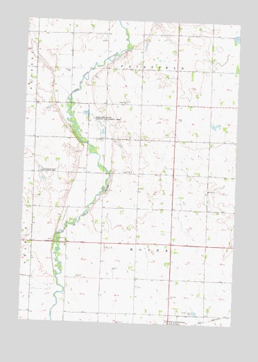
Hancock SW, MN USGS Topographic Map
Click on map above to begin viewing in our Map Viewer.

This topographic map contains these locations and features:
Feature Name Type Latitude Longitude GNIS ID View Map
Berthold Koosmann DamDamN45.3366°W95.9920°1776404View Map
Ehrenberg State Wildlife Management AreaParkN45.3327°W95.9598°643203View Map
Evangelical CemeteryCemeteryN45.3261°W95.9542°643436View Map
Frank Schlieman DamDamN45.3616°W95.9587°1776407View Map
Immanuel CemeteryCemeteryN45.2611°W95.9120°645353View Map
Koosmann FarmsLocaleN45.3383°W95.9786°2630408View Map
Marquardt DamDamN45.3583°W95.9920°1776402View Map
Pomme De Terre Rest AreaLocaleN45.2833°W95.9803°2065795View Map
Pomme De Terre Rest AreaLocaleN45.2833°W95.9803°2066432View Map
Saint John's CemeteryCemeteryN45.3058°W95.8908°2065693View Map
Saint Johns CemeteryCemeteryN45.3539°W95.9745°650680View Map
Saint Johns ChurchChurchN45.3052°W95.8912°650714View Map
Smith-Kepner CemeteryCemeteryN45.3119°W95.9417°652187View Map
Township of FairfieldCivilN45.3691°W95.9324°664131View Map
Township of MoyerCivilN45.2837°W95.9333°665059View Map
Trinity CemeteryCemeteryN45.3414°W95.9403°2065694View Map
Trinity ChurchChurchN45.3411°W95.9417°653313View Map

Note: Coordinates in the location and feature list above are referenced to NAD83 datum.


Copyright (C) 2008-2024 Ryan Niemi / Sunset Dynamics ... All Rights Reserved