TopoQuest Logo
Do you find TopoQuest useful?
Help keep TopoQuest running and adding new maps/features by donating!
Bitcoin:  19c7KJd3qBynnjoSw5npx9KScwjBe4ifkT
Litecoin:  LXs6TkuXGGXo1vDsWCkWVdjQX94eUKd6ui
Home View Maps Find Maps Find Places Resources & Links


Hannapah, Nevada Topographic Map

USGS Map Title: Hannapah, NV
USGS Map MRC: 38116B8
DRG (GeoTIFF) Download: o38116b8.tif


Neighboring USGS Topographic Map Quads:


  Henrys Well, NV  
38117C1
 

  Antelope Spring, NV  
38116C8
 

  Saulsbury Basin, NV  
38116C7
 

  Thunder Mountain, NV  
38117B1
 

  Hannapah, NV  
38116B8
 

  Mud Spring, NV  
38116B7
 

  East of Tonopah, NV  
38117A1
 

  McKinney Tanks, NV  
38116A8
 

  Yellow Cone, NV  
38116A7


Map MRC Location:

N39°
W117°
N39°
W116°
H8 H7 H6 H5 H4 H3 H2 H1
G8 G7 G6 G5 G4 G3 G2 G1
F8 F7 F6 F5 F4 F3 F2 F1
E8 E7 E6 E5 E4 E3 E2 E1
D8 D7 D6 D5 D4 D3 D2 D1
C8 C7 C6 C5 C4 C3 C2 C1
B8 B7 B6 B5 B4 B3 B2 B1
A8 A7 A6 A5 A4 A3 A2 A1
N38°
W117°
N38°
W116°

Hannapah, NV USGS 1:24K Topographic Map Preview:
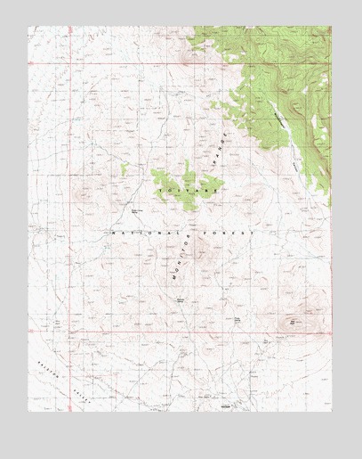
Hannapah, NV USGS Topographic Map
Click on map above to begin viewing in our Map Viewer.

This topographic map contains these locations and features:
Feature Name Type Latitude Longitude GNIS ID View Map
Bannock MineMineN38.1541°W116.9904°853056View Map
Caine SpringSpringN38.1419°W116.9148°851946View Map
Cedar Corral SpringSpringN38.1900°W116.9585°849738View Map
Douglas SpringSpringN38.1879°W116.8753°849796View Map
Hannapah (historical)Populated PlaceN38.1272°W116.9170°854730View Map
Hannapah MineMineN38.1347°W116.9384°853043View Map
Hannapah Silver Star MineMineN38.1299°W116.9215°853045View Map
Mud SpringSpringN38.1302°W116.8801°851947View Map
Parrotte SpringSpringN38.1610°W116.9402°845933View Map
Prody SpringSpringN38.1551°W116.9165°849737View Map
Red PeakSummitN38.1541°W116.8912°849736View Map
Richardson MineMineN38.1299°W116.9259°853042View Map
Silver Glance (historical)LocaleN38.1783°W116.9006°851960View Map
Silver Glance MineMineN38.1444°W116.9387°853044View Map
Silverzone Mining DistrictCivilN38.1272°W116.9170°856556View Map
Thunder Mountain SpringSpringN38.2172°W116.9987°851948View Map
Woodchopper SpringSpringN38.1808°W116.9817°851949View Map
Woodchopper SpringSpringN38.2305°W116.9576°851950View Map

Note: Coordinates in the location and feature list above are referenced to NAD83 datum.


Copyright (C) 2008-2025 Ryan Niemi / Sunset Dynamics ... All Rights Reserved