TopoQuest Logo
Do you find TopoQuest useful?
Help keep TopoQuest running and adding new maps/features by donating!
Bitcoin:  19c7KJd3qBynnjoSw5npx9KScwjBe4ifkT
Litecoin:  LXs6TkuXGGXo1vDsWCkWVdjQX94eUKd6ui
Home View Maps Find Maps Find Places Resources & Links


Avalon, Texas Topographic Map

USGS Map Title: Avalon, TX
USGS Map MRC: 32096B7
DRG (GeoTIFF) Download: o32096b7.tif


Neighboring USGS Topographic Map Quads:


  Boz, TX  
32096C8
 

  Forreston, TX  
32096C7
 

  Ennis West, TX  
32096C6
 

  Italy, TX  
32096B8
 

  Avalon, TX  
32096B7
 

  Cryer Creek, TX  
32096B6
 

  Mertens, TX  
32096A8
 

  Frost, TX  
32096A7
 

  Blooming Grove, TX  
32096A6


Map MRC Location:

N33°
W97°
N33°
W96°
H8 H7 H6 H5 H4 H3 H2 H1
G8 G7 G6 G5 G4 G3 G2 G1
F8 F7 F6 F5 F4 F3 F2 F1
E8 E7 E6 E5 E4 E3 E2 E1
D8 D7 D6 D5 D4 D3 D2 D1
C8 C7 C6 C5 C4 C3 C2 C1
B8 B7 B6 B5 B4 B3 B2 B1
A8 A7 A6 A5 A4 A3 A2 A1
N32°
W97°
N32°
W96°

Avalon, TX USGS 1:24K Topographic Map Preview:
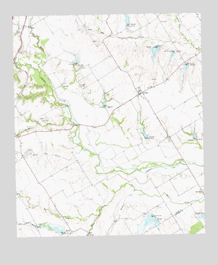
Avalon, TX USGS Topographic Map
Click on map above to begin viewing in our Map Viewer.

This topographic map contains these locations and features:
Feature Name Type Latitude Longitude GNIS ID View Map
AvalonPopulated PlaceN32.2054°W96.7900°1329875View Map
Avalon Post OfficePost OfficeN32.2050°W96.7910°2731731View Map
Avalon Volunteer Fire DepartmentBuildingN32.2047°W96.7916°2551766View Map
Big Onion CreekStreamN32.2329°W96.7583°1330626View Map
Dam Number 100DamN32.1268°W96.8444°1333901View Map
Dam Number 102DamN32.1347°W96.7828°1333904View Map
Dam Number 104BDamN32.1359°W96.7511°1333906View Map
Dam Number 107DamN32.2433°W96.7992°1333909View Map
Dam Number 108DamN32.2317°W96.7796°1333910View Map
Dam Number 109DamN32.2289°W96.7693°1333911View Map
Dam Number 110DamN32.2213°W96.7602°1333913View Map
Dam Number 89DamN32.2226°W96.8342°1334006View Map
Dam Number 92DamN32.1982°W96.8155°1334011View Map
Dam Number 93DamN32.1795°W96.7876°1334012View Map
Dam Number 94DamN32.1787°W96.7552°1334013View Map
Dean CemeteryCemeteryN32.2129°W96.7839°1334160View Map
Elm BranchStreamN32.1482°W96.7900°1335342View Map
Flat Rock BranchStreamN32.1268°W96.8272°1335910View Map
Forreston CemeteryCemeteryN32.2301°W96.8681°1336044View Map
Fort LakeLakeN32.2097°W96.8425°1336055View Map
Hog CreekStreamN32.1374°W96.8197°1337890View Map
Houston CreekStreamN32.1907°W96.8381°1338174View Map
Hughes CemeteryCemeteryN32.2101°W96.8303°1338241View Map
Little Onion CreekStreamN32.2329°W96.7583°1340146View Map
Lone CedarPopulated PlaceN32.1488°W96.7514°1378599View Map
LumkinsPopulated PlaceN32.2438°W96.8644°1378621View Map
Maloney CemeteryCemeteryN32.2451°W96.7775°1340883View Map
Mill BranchStreamN32.2182°W96.8578°1341614View Map
Soil Conservation Service Site 100 DamDamN32.1268°W96.8436°1856693View Map
Soil Conservation Service Site 100 ReservoirReservoirN32.1268°W96.8436°1856694View Map
Soil Conservation Service Site 102 DamDamN32.1352°W96.7836°1856844View Map
Soil Conservation Service Site 102 ReservoirReservoirN32.1352°W96.7836°1856845View Map
Soil Conservation Service Site 104b DamDamN32.1352°W96.7503°1859360View Map
Soil Conservation Service Site 104b ReservoirReservoirN32.1352°W96.7503°1859361View Map
Soil Conservation Service Site 106 DamDamN32.2401°W96.8186°1863128View Map
Soil Conservation Service Site 106 ReservoirReservoirN32.2401°W96.8186°1863129View Map
Soil Conservation Service Site 107 DamDamN32.2435°W96.7986°1856695View Map
Soil Conservation Service Site 107 ReservoirReservoirN32.2435°W96.7986°1856696View Map
Soil Conservation Service Site 108 DamDamN32.2318°W96.7803°1856697View Map
Soil Conservation Service Site 108 ReservoirReservoirN32.2318°W96.7803°1856698View Map
Soil Conservation Service Site 109 DamDamN32.2285°W96.7703°1856699View Map
Soil Conservation Service Site 109 ReservoirReservoirN32.2285°W96.7703°1856700View Map
Soil Conservation Service Site 110 DamDamN32.2235°W96.7603°1856701View Map
Soil Conservation Service Site 110 ReservoirReservoirN32.2235°W96.7603°1856702View Map
Soil Conservation Service Site 89 DamDamN32.2235°W96.8336°1856709View Map
Soil Conservation Service Site 89 ReservoirReservoirN32.2235°W96.8336°1856710View Map
Soil Conservation Service Site 92 DamDamN32.1985°W96.8153°1856707View Map
Soil Conservation Service Site 92 ReservoirReservoirN32.1985°W96.8153°1856708View Map
Soil Conservation Service Site 93 DamDamN32.1801°W96.7869°1856705View Map
Soil Conservation Service Site 93 ReservoirReservoirN32.1801°W96.7869°1856706View Map
Soil Conservation Service Site 94 DamDamN32.1785°W96.7553°1856703View Map
Soil Conservation Service Site 94 ReservoirReservoirN32.1785°W96.7553°1856704View Map
White Rock BranchStreamN32.1743°W96.8303°1349981View Map

Note: Coordinates in the location and feature list above are referenced to NAD83 datum.


Copyright (C) 2008-2025 Ryan Niemi / Sunset Dynamics ... All Rights Reserved