TopoQuest Logo
Do you find TopoQuest useful?
Help keep TopoQuest running and adding new maps/features by donating!
Bitcoin:  19c7KJd3qBynnjoSw5npx9KScwjBe4ifkT
Litecoin:  LXs6TkuXGGXo1vDsWCkWVdjQX94eUKd6ui
Home View Maps Find Maps Find Places Resources & Links


Harding, South Dakota Topographic Map

USGS Map Title: Harding, SD
USGS Map MRC: 45103D7
DRG (GeoTIFF) Download: o45103d7.tif


Neighboring USGS Topographic Map Quads:


  Camp Crook, SD  
45103E8
 

  Pine Spring, SD  
45103E7
 

  Saddle Butte, SD  
45103E6
 

  J K Butte, SD  
45103D8
 

  Harding, SD  
45103D7
 

  Bog Creek, SD  
45103D6
 

  Gustave, SD  
45103C8
 

  Hells Canyon, SD  
45103C7
 

  Moreau Peak, SD  
45103C6


Map MRC Location:

N46°
W104°
N46°
W103°
H8 H7 H6 H5 H4 H3 H2 H1
G8 G7 G6 G5 G4 G3 G2 G1
F8 F7 F6 F5 F4 F3 F2 F1
E8 E7 E6 E5 E4 E3 E2 E1
D8 D7 D6 D5 D4 D3 D2 D1
C8 C7 C6 C5 C4 C3 C2 C1
B8 B7 B6 B5 B4 B3 B2 B1
A8 A7 A6 A5 A4 A3 A2 A1
N45°
W104°
N45°
W103°

Harding, SD USGS 1:24K Topographic Map Preview:
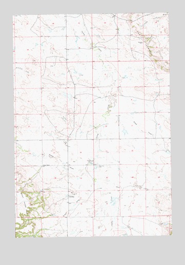
Harding, SD USGS Topographic Map
Click on map above to begin viewing in our Map Viewer.

This topographic map contains these locations and features:
Feature Name Type Latitude Longitude GNIS ID View Map
Brant SchoolSchoolN45.4153°W103.8527°1254046View Map
Brush CreekStreamN45.4525°W103.7969°1254095View Map
Dodge DrawValleyN45.4106°W103.8126°1254714View Map
Floyd Cooper DamDamN45.4350°W103.7871°1259993View Map
Gilbert DrawValleyN45.4054°W103.8100°1255246View Map
HardingPopulated PlaceN45.3983°W103.8327°1261013View Map
Harding (historical)LocaleN45.4000°W103.8374°1263414View Map
Harding Volunteer Fire DepartmentBuildingN45.3973°W103.8321°2580691View Map
John Catron Number 1 DamDamN45.3800°W103.7855°1259991View Map
John Catron Number 2 DamDamN45.3983°W103.8005°1259992View Map
Sand CouleeValleyN45.4078°W103.8027°1257784View Map
Short Pine CemeteryCemeteryN45.4144°W103.8088°1258053View Map
The JumpoffCliffN45.4836°W103.7694°1258524View Map

Note: Coordinates in the location and feature list above are referenced to NAD83 datum.


Copyright (C) 2008-2025 Ryan Niemi / Sunset Dynamics ... All Rights Reserved