TopoQuest Logo
Do you find TopoQuest useful?
Help keep TopoQuest running and adding new maps/features by donating!
Bitcoin:  19c7KJd3qBynnjoSw5npx9KScwjBe4ifkT
Litecoin:  LXs6TkuXGGXo1vDsWCkWVdjQX94eUKd6ui
Home View Maps Find Maps Find Places Resources & Links


Harlan, Michigan Topographic Map

USGS Map Title: Harlan, MI
USGS Map MRC: 44085D7
DRG (GeoTIFF) Download: o44085d7.tif


Neighboring USGS Topographic Map Quads:


  Copemish, MI  
44085D8
 

  Harlan, MI  
44085D7
 

  Mesick, MI  
44085D6
 

  Marilla, MI  
44085C8
 

  Yuma, MI  
44085C7
 

  Harrietta, MI  
44085C6


Map MRC Location:

N45°
W86°
N45°
W85°
H8 H7 H6 H5 H4 H3 H2 H1
G8 G7 G6 G5 G4 G3 G2 G1
F8 F7 F6 F5 F4 F3 F2 F1
E8 E7 E6 E5 E4 E3 E2 E1
D8 D7 D6 D5 D4 D3 D2 D1
C8 C7 C6 C5 C4 C3 C2 C1
B8 B7 B6 B5 B4 B3 B2 B1
A8 A7 A6 A5 A4 A3 A2 A1
N44°
W86°
N44°
W85°

Harlan, MI USGS 1:24K Topographic Map Preview:
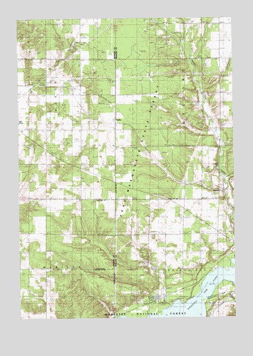
Harlan, MI USGS Topographic Map
Click on map above to begin viewing in our Map Viewer.

This topographic map contains these locations and features:
Feature Name Type Latitude Longitude GNIS ID View Map
BagnallPopulated PlaceN44.4272°W85.7587°1622870View Map
Bagnall Station (historical)LocaleN44.4272°W85.7586°2509048View Map
Bagnell Post Office (historical)Post OfficeN44.4272°W85.7586°2509083View Map
Burton Trailer ParkLocaleN44.3814°W85.7950°2509194View Map
Carpenter SchoolSchoolN44.4906°W85.8398°622772View Map
Cotton CreekStreamN44.4983°W85.7773°1619594View Map
Cripple CreekStreamN44.3833°W85.7653°1619622View Map
Crowell Family CemeteryCemeteryN44.4686°W85.8083°2509257View Map
HarlanPopulated PlaceN44.4569°W85.8195°627797View Map
Harlan CemeteryCemeteryN44.4533°W85.8220°1620129View Map
Harlan Post Office (historical)Post OfficeN44.4569°W85.8189°2499600View Map
Harlan Station (historical)LocaleN44.4567°W85.8189°2499304View Map
Hodenpyl Dam PondReservoirN44.3793°W85.7715°1620219View Map
Kingdom HallChurchN44.4403°W85.8500°2500348View Map
Mesick RV ParkLocaleN44.3819°W85.7847°2509195View Map
Minor CemeteryCemeteryN44.4103°W85.7953°2509258View Map
Sneaky ValleyValleyN44.4331°W85.7550°1621662View Map
Spruce Hollow CampgroundLocaleN44.4758°W85.7514°2509196View Map
Township of SpringvilleCivilN44.3812°W85.7601°1627114View Map
Township of WexfordCivilN44.4686°W85.7579°1627253View Map

Note: Coordinates in the location and feature list above are referenced to NAD83 datum.


Copyright (C) 2008-2025 Ryan Niemi / Sunset Dynamics ... All Rights Reserved