TopoQuest Logo
Do you find TopoQuest useful?
Help keep TopoQuest running and adding new maps/features by donating!
Bitcoin:  19c7KJd3qBynnjoSw5npx9KScwjBe4ifkT
Litecoin:  LXs6TkuXGGXo1vDsWCkWVdjQX94eUKd6ui
Home View Maps Find Maps Find Places Resources & Links


Harlowton, Montana Topographic Map

USGS Map Title: Harlowton, MT
USGS Map MRC: 46109D7
DRG (GeoTIFF) Download: o46109d7.tif


Neighboring USGS Topographic Map Quads:


  Hopley Creek North, MT  
46109E8
 

  Oka, MT  
46109E7
 

  Oxford, MT  
46109E6
 

  Hopley Creek South, MT  
46109D8
 

  Harlowton, MT  
46109D7
 

  Ethels Coulee, MT  
46109D6
 

  Harlowton SW, MT  
46109C8
 

  Ten O'Clock Gate, MT  
46109C7
 

  Devils Pocket, MT  
46109C6


Map MRC Location:

N47°
W110°
N47°
W109°
H8 H7 H6 H5 H4 H3 H2 H1
G8 G7 G6 G5 G4 G3 G2 G1
F8 F7 F6 F5 F4 F3 F2 F1
E8 E7 E6 E5 E4 E3 E2 E1
D8 D7 D6 D5 D4 D3 D2 D1
C8 C7 C6 C5 C4 C3 C2 C1
B8 B7 B6 B5 B4 B3 B2 B1
A8 A7 A6 A5 A4 A3 A2 A1
N46°
W110°
N46°
W109°

Harlowton, MT USGS 1:24K Topographic Map Preview:
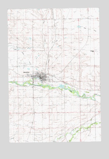
Harlowton, MT USGS Topographic Map
Click on map above to begin viewing in our Map Viewer.

This topographic map contains these locations and features:
Feature Name Type Latitude Longitude GNIS ID View Map
08N15E10____01 WellWellN46.4666°W109.8330°816391View Map
08N15E12ABDB01 WellWellN46.4727°W109.7932°816421View Map
08N15E20____01 WellWellN46.4380°W109.8741°816272View Map
08N15E21C___01 WellWellN46.4347°W109.8588°816254View Map
08N15E22____01 WellWellN46.4380°W109.8330°816271View Map
08N15E22CDA_01 WellWellN46.4347°W109.8341°816253View Map
08N15E23AAAA01 WellWellN46.4458°W109.8082°816302View Map
08N15E23C___01 WellWellN46.4347°W109.8174°816252View Map
08N15E26AAAD01 WellWellN46.4277°W109.8007°816208View Map
08N15E27A___01 WellWellN46.4275°W109.8277°816205View Map
08N15E27B___01 WellWellN46.4275°W109.8380°816206View Map
08N15E34____01 WellWellN46.4097°W109.8330°816090View Map
08N15E35B___01 WellWellN46.4133°W109.8174°816114View Map
Alkali CreekStreamN46.4594°W109.8207°805769View Map
American Lutheran ChurchChurchN46.4363°W109.8277°1725817View Map
Antelope CreekStreamN46.4252°W109.8157°779070View Map
Bair Memorial ClinicHospitalN46.4375°W109.8410°1725836View Map
Catholic CemeteryCemeteryN46.4458°W109.8641°1725813View Map
Chief Joseph ParkParkN46.4333°W109.8368°1725833View Map
Chief Joseph Park CampgroundLocaleN46.4333°W109.8368°1725834View Map
City of HarlowtonCivilN46.4368°W109.8351°2410704View Map
E57B - the Last Electric Locomotive Historical MarkerParkN46.4361°W109.8366°1725831View Map
Faith ChapelChurchN46.4375°W109.8430°1725815View Map
Federated ChurchChurchN46.4355°W109.8335°1725819View Map
General Mills Incorporated ElevatorLocaleN46.4355°W109.8243°1725828View Map
HarlowtonPopulated PlaceN46.4355°W109.8343°772154View Map
Harlowton (historical)LocaleN46.4311°W109.8291°1725896View Map
Harlowton Baptist ChapelChurchN46.4350°W109.8307°1725818View Map
Harlowton CemeteryCemeteryN46.4472°W109.8577°1725812View Map
Harlowton High SchoolSchoolN46.4361°W109.8285°1725853View Map
Harlowton Police DepartmentBuildingN46.4370°W109.8362°1725799View Map
Harlowton Post OfficePost OfficeN46.4350°W109.8304°1725897View Map
Harlowton Public LibraryBuildingN46.4347°W109.8313°1725840View Map
Harlowton Rest AreaLocaleN46.4333°W109.8368°1725829View Map
Harlowton Sewage Lagoon DamDamN46.4333°W109.8041°796550View Map
Harlowton Volunteer Fire Department - Wheatland County Volunteer Fire DepartmentBuildingN46.4362°W109.8441°1725797View Map
Hillcrest Elementary SchoolSchoolN46.4402°W109.8305°1725854View Map
Jawbone CreekStreamN46.4291°W109.8163°805763View Map
Jawbone Creek Country ClubLocaleN46.4458°W109.8369°1725835View Map
Jawbone Dam Number 1DamN46.4383°W109.8407°795046View Map
Jawbone Dam Number 2DamN46.4416°W109.8341°795047View Map
Jawbone Dike Number 1DamN46.4350°W109.8424°795873View Map
Lebo CreekStreamN46.3872°W109.7691°786016View Map
Oka CemeteryCemeteryN46.4849°W109.8421°1725810View Map
Saint Josephs Catholic ChurchChurchN46.4375°W109.8357°1725820View Map
Shepherds Trailer CourtPopulated PlaceN46.4355°W109.8343°1725811View Map
Spring Water Colony SchoolSchoolN46.4594°W109.7563°1725856View Map
Springwater ColonyPopulated PlaceN46.4594°W109.7563°805762View Map
The Church of Jesus Christ of Latter Day SaintsChurchN46.4375°W109.8466°1725816View Map
Trinity Episcopal ChurchChurchN46.4355°W109.8343°1725823View Map
Trinity Lutheran ChurchChurchN46.4355°W109.8343°1725821View Map
Upper Musselshell Historical Society MuseumBuildingN46.4352°W109.8313°1725842View Map
Wesleyan ChurchChurchN46.4355°W109.8343°1725822View Map
Wheatland CountyCivilN46.4663°W109.8445°1719560View Map
Wheatland County Airport at HarlowtonAirportN46.4469°W109.8550°798816View Map
Wheatland County Ambulance HarlowtonBuildingN46.4372°W109.8366°2637915View Map
Wheatland County CourthouseBuildingN46.4366°W109.8360°1725798View Map
Wheatland County Sheriff's OfficeBuildingN46.4368°W109.8360°1725800View Map
Wheatland County Women, Infants and Children HospitalHospitalN46.4375°W109.8410°1725837View Map
Wheatland Memorial HealthcareHospitalN46.4373°W109.8408°1725838View Map
Wheatland Memorial Nursing HomeHospitalN46.4375°W109.8410°1725839View Map

Note: Coordinates in the location and feature list above are referenced to NAD83 datum.


Copyright (C) 2008-2024 Ryan Niemi / Sunset Dynamics ... All Rights Reserved