TopoQuest Logo
Do you find TopoQuest useful?
Help keep TopoQuest running and adding new maps/features by donating!
Bitcoin:  19c7KJd3qBynnjoSw5npx9KScwjBe4ifkT
Litecoin:  LXs6TkuXGGXo1vDsWCkWVdjQX94eUKd6ui
Home View Maps Find Maps Find Places Resources & Links


Avena, California Topographic Map

USGS Map Title: Avena, CA
USGS Map MRC: 37121G1
DRG (GeoTIFF) Download: o37121g1.tif


Neighboring USGS Topographic Map Quads:


  Stockton East, CA  
37121H2
 

  Peters, CA  
37121H1
 

  Farmington, CA  
37120H8
 

  Manteca, CA  
37121G2
 

  Avena, CA  
37121G1
 

  Escalon, CA  
37120G8
 

  Ripon, CA  
37121F2
 

  Salida, CA  
37121F1
 

  Riverbank, CA  
37120F8


Map MRC Location:

N38°
W122°
N38°
W121°
H8 H7 H6 H5 H4 H3 H2 H1
G8 G7 G6 G5 G4 G3 G2 G1
F8 F7 F6 F5 F4 F3 F2 F1
E8 E7 E6 E5 E4 E3 E2 E1
D8 D7 D6 D5 D4 D3 D2 D1
C8 C7 C6 C5 C4 C3 C2 C1
B8 B7 B6 B5 B4 B3 B2 B1
A8 A7 A6 A5 A4 A3 A2 A1
N37°
W122°
N37°
W121°

Avena, CA USGS 1:24K Topographic Map Preview:
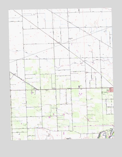
Avena, CA USGS Topographic Map
Click on map above to begin viewing in our Map Viewer.

This topographic map contains these locations and features:
Feature Name Type Latitude Longitude GNIS ID View Map
AlbaPopulated PlaceN37.7980°W121.0397°1657901View Map
AtlantaPopulated PlaceN37.8130°W121.1208°1657962View Map
AvenaPopulated PlaceN37.8430°W121.0663°1657967View Map
Bartelink DairyLocaleN37.8508°W121.0561°2704981View Map
Boscha Lake (historical)LakeN37.7572°W121.0913°1662178View Map
C And G FarmsLocaleN37.7636°W121.0667°2559367View Map
CarroltonPopulated PlaceN37.7985°W121.0702°1658228View Map
Colony Oak Elementary SchoolSchoolN37.7544°W121.1066°1827458View Map
Creekside DairyLocaleN37.8267°W121.0272°2704859View Map
Doornenbal DairyLocaleN37.8256°W121.0742°2704979View Map
El Portal Middle SchoolSchoolN37.7941°W121.0038°1827462View Map
Escalon Consolidated Fire Protection District Station 2BuildingN37.7989°W121.0469°2624097View Map
Escalon DivisionCivilN37.8263°W121.0177°1935094View Map
Faria DairyLocaleN37.8453°W121.0611°2704861View Map
Four Trees SchoolSchoolN37.8463°W121.0527°223748View Map
G and H DairyLocaleN37.8078°W121.0317°2704803View Map
Gomes DairyLocaleN37.8614°W121.0556°2704873View Map
Main District CanalCanalN37.7602°W121.0444°233353View Map
Red Rock DairyLocaleN37.8400°W121.1133°2704806View Map
Ripon Consolidated Fire District Station 2BuildingN37.7901°W121.1063°2623856View Map
Ripon DivisionCivilN37.7723°W121.1220°1935267View Map
River SchoolSchoolN37.7580°W121.0549°231642View Map
SimmsPopulated PlaceN37.7980°W121.0952°1659670View Map
Van AllenPopulated PlaceN37.7983°W121.0524°236991View Map
Van Allen Elementary SchoolSchoolN37.7988°W121.0516°1662193View Map
Vander Schaff DairyLocaleN37.8508°W121.1117°2704819View Map
Vander Schaff Dairy Number 2LocaleN37.8231°W121.0553°2704869View Map
WagnerPopulated PlaceN37.7980°W121.0813°1660114View Map
Wagner DairyLocaleN37.8697°W121.0392°2704820View Map
Weeda DairyLocaleN37.8147°W121.0175°2704870View Map
Wildwood School (historical)SchoolN37.8638°W121.1088°1662197View Map

Note: Coordinates in the location and feature list above are referenced to NAD83 datum.


Copyright (C) 2008-2024 Ryan Niemi / Sunset Dynamics ... All Rights Reserved