TopoQuest Logo
Do you find TopoQuest useful?
Help keep TopoQuest running and adding new maps/features by donating!
Bitcoin:  19c7KJd3qBynnjoSw5npx9KScwjBe4ifkT
Litecoin:  LXs6TkuXGGXo1vDsWCkWVdjQX94eUKd6ui
Home View Maps Find Maps Find Places Resources & Links


Averill Park, New York Topographic Map

USGS Map Title: Averill Park, NY
USGS Map MRC: 42073F5
DRG (GeoTIFF) Download: o42073f5.tif


Neighboring USGS Topographic Map Quads:


  Troy North, NY  
42073G6
 

  Tomhannock, NY  
42073G5
 

  Grafton, NY  
42073G4
 

  Troy South, NY  
42073F6
 

  Averill Park, NY  
42073F5


  East Greenbush, NY  
42073E6
 

  Nassau, NY  
42073E5


Map MRC Location:

N43°
W74°
N43°
W73°
H8 H7 H6 H5 H4 H3 H2 H1
G8 G7 G6 G5 G4 G3 G2 G1
F8 F7 F6 F5 F4 F3 F2 F1
E8 E7 E6 E5 E4 E3 E2 E1
D8 D7 D6 D5 D4 D3 D2 D1
C8 C7 C6 C5 C4 C3 C2 C1
B8 B7 B6 B5 B4 B3 B2 B1
A8 A7 A6 A5 A4 A3 A2 A1
N42°
W74°
N42°
W73°

Averill Park, NY USGS 1:24K Topographic Map Preview:
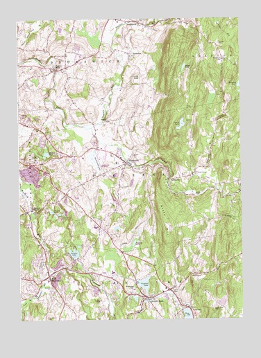
Averill Park, NY USGS Topographic Map
Click on map above to begin viewing in our Map Viewer.

This topographic map contains these locations and features:
Feature Name Type Latitude Longitude GNIS ID View Map
Algonquin Middle SchoolSchoolN42.6635°W73.5823°2669140View Map
Averill ParkPopulated PlaceN42.6340°W73.5537°942730View Map
Averill Park Census Designated PlaceCensusN42.6361°W73.5529°2389161View Map
Averill Park CongregationChurchN42.6572°W73.5708°2513419View Map
Averill Park High SchoolSchoolN42.6448°W73.5726°2669199View Map
Averill Park Post OfficePost OfficeN42.6348°W73.5478°2617801View Map
Averill Park Sand Lake Fire DepartmentBuildingN42.6304°W73.5492°2718502View Map
BarbervillePopulated PlaceN42.6834°W73.5407°942987View Map
Bare Top MountainSummitN42.6292°W73.5154°943004View Map
Bernie PondLakeN42.7297°W73.5314°943744View Map
Bon AcrePopulated PlaceN42.6442°W73.5758°2513214View Map
Bonesteel CemeteryCemeteryN42.7393°W73.5108°944422View Map
Bonesteel CreekStreamN42.6787°W73.5298°944423View Map
Bonesteel SchoolSchoolN42.7331°W73.5098°944425View Map
Brookside CemeteryCemeteryN42.6876°W73.5419°944869View Map
BrunswickPopulated PlaceN42.7359°W73.5615°944971View Map
Brunswick ChurchChurchN42.7347°W73.5614°2513548View Map
Brunswick Community LibraryBuildingN42.7304°W73.5977°2617234View Map
Church of the CovenantChurchN42.6344°W73.5564°2513420View Map
Columbia Hill FarmLocaleN42.6828°W73.5039°2542367View Map
Community Church of GraftonChurchN42.7402°W73.5175°2615802View Map
Coopers PondLakeN42.6701°W73.6066°947401View Map
CropseyvillePopulated PlaceN42.7490°W73.5573°947791View Map
Crystal CliffCliffN42.6331°W73.5826°947890View Map
Crystal LakeLakeN42.6401°W73.5553°947899View Map
Davitt PondLakeN42.7061°W73.5332°948076View Map
Draper SchoolSchoolN42.7079°W73.5746°948636View Map
Eagle MillsPopulated PlaceN42.7292°W73.6037°948928View Map
Eagle Mills Christian ChurchChurchN42.7297°W73.6058°2513949View Map
Eagle Mills Fire DistrictBuildingN42.7316°W73.5936°2718643View Map
Elmwood CemeteryCemeteryN42.6387°W73.6071°949590View Map
Engelke FarmsLocaleN42.7222°W73.5992°2515551View Map
First Bible Baptist ChurchChurchN42.6422°W73.6083°2513920View Map
Glass LakePopulated PlaceN42.6301°W73.5309°951160View Map
Hillside CemeteryCemeteryN42.6937°W73.5607°952845View Map
Hoffay's Gravel PitMineN42.6336°W73.5947°2703583View Map
Hollywood Drive-InLocaleN42.6761°W73.5944°2555089View Map
Hope United Methodist ChurchChurchN42.7286°W73.6006°2513553View Map
Horse Heaven BrookStreamN42.6356°W73.5409°970221View Map
Ives CornerPopulated PlaceN42.6856°W73.5257°972659View Map
Lake Avenue Community ChurchChurchN42.6375°W73.5606°2513422View Map
Links PondLakeN42.7262°W73.5562°955420View Map
Morrison CemeteryCemeteryN42.7493°W73.5557°957703View Map
Moules LakeLakeN42.6940°W73.6091°957797View Map
Newfoundland CreekStreamN42.6995°W73.5798°958514View Map
Pawling SanitoriumHospitalN42.6915°W73.6151°960009View Map
Pine Bowl SpeedwayLocaleN42.6673°W73.6012°974820View Map
PoestenkillPopulated PlaceN42.6904°W73.5646°960804View Map
Poestenkill Census Designated PlaceCensusN42.6941°W73.5546°2389691View Map
Poestenkill Christian ChurchChurchN42.6899°W73.5654°2616795View Map
Poestenkill Elementary SchoolSchoolN42.6900°W73.5698°2668895View Map
Poestenkill Evangelical Lutheran ChurchChurchN42.6889°W73.5647°2616796View Map
Poestenkill Fire CompanyBuildingN42.6962°W73.5782°2718607View Map
Poestenkill LibraryBuildingN42.6898°W73.5636°2617387View Map
Poestenkill Post OfficePost OfficeN42.6897°W73.5632°2618068View Map
Quacken KillStreamN42.7048°W73.5834°962021View Map
Racquet LakeLakeN42.6529°W73.5944°962126View Map
Rensselaer CountyCivilN42.7111°W73.5097°974140View Map
Rensselaer County AirportAirportN42.6919°W73.5793°978336View Map
Saint Marys ChurchChurchN42.6670°W73.5040°963942View Map
Salem United Methodist ChurchChurchN42.6372°W73.6081°2513561View Map
Sand LakePopulated PlaceN42.6373°W73.5407°964388View Map
Sand Lake AmbulanceBuildingN42.6457°W73.6028°2720180View Map
Sand Lake Baptist ChurchChurchN42.6352°W73.5493°2617061View Map
Sand Lake SchoolSchoolN42.6366°W73.5447°2669100View Map
Sand Lake Town LibraryBuildingN42.6382°W73.5413°2617411View Map
Smauder HillSummitN42.6390°W73.5609°965450View Map
Snake HillSummitN42.6631°W73.5418°965558View Map
Snyders CornerPopulated PlaceN42.6701°W73.6204°965607View Map
Town of PoestenkillCivilN42.6865°W73.5263°979380View Map
Town of Sand LakeCivilN42.6285°W73.5477°979455View Map
Trinity Lutheran ChurchChurchN42.6441°W73.6092°2616377View Map
Vosburg PondLakeN42.6570°W73.5605°968608View Map
West Sand LakePopulated PlaceN42.6434°W73.6087°970858View Map
West Sand Lake Census Designated PlaceCensusN42.6403°W73.6033°2390489View Map
West Sand Lake Elementary SchoolSchoolN42.6415°W73.6090°2668927View Map
West Sand Lake Post OfficePost OfficeN42.6464°W73.6079°2618184View Map
West Sand Lake Volunteer Fire DepartmentBuildingN42.6440°W73.6068°2718445View Map

Note: Coordinates in the location and feature list above are referenced to NAD83 datum.


Copyright (C) 2008-2025 Ryan Niemi / Sunset Dynamics ... All Rights Reserved