TopoQuest Logo
Do you find TopoQuest useful?
Help keep TopoQuest running and adding new maps/features by donating!
Bitcoin:  19c7KJd3qBynnjoSw5npx9KScwjBe4ifkT
Litecoin:  LXs6TkuXGGXo1vDsWCkWVdjQX94eUKd6ui
Home View Maps Find Maps Find Places Resources & Links


Harvey, Iowa Topographic Map

USGS Map Title: Harvey, IA
USGS Map MRC: 41092C8
DRG (GeoTIFF) Download: o41092c8.tif


Neighboring USGS Topographic Map Quads:


  Otley, IA  
41093D1
 

  Pella, IA  
41092D8
 

  Peoria, IA  
41092D7
 

  Knoxville, IA  
41093C1
 

  Harvey, IA  
41092C8
 

  Leighton, IA  
41092C7
 

  Attica, IA  
41093B1
 

  Lovilia, IA  
41092B8
 

  Buxton, IA  
41092B7


Map MRC Location:

N42°
W93°
N42°
W92°
H8 H7 H6 H5 H4 H3 H2 H1
G8 G7 G6 G5 G4 G3 G2 G1
F8 F7 F6 F5 F4 F3 F2 F1
E8 E7 E6 E5 E4 E3 E2 E1
D8 D7 D6 D5 D4 D3 D2 D1
C8 C7 C6 C5 C4 C3 C2 C1
B8 B7 B6 B5 B4 B3 B2 B1
A8 A7 A6 A5 A4 A3 A2 A1
N41°
W93°
N41°
W92°

Harvey, IA USGS 1:24K Topographic Map Preview:
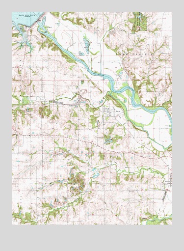
Harvey, IA USGS Topographic Map
Click on map above to begin viewing in our Map Viewer.

This topographic map contains these locations and features:
Feature Name Type Latitude Longitude GNIS ID View Map
Amsterdam Post Office (historical)Post OfficeN41.3706°W92.9627°466590View Map
Assembly of God ChurchChurchN41.3158°W92.9241°1975929View Map
Berry Post Office (historical)Post OfficeN41.2625°W92.9294°1975712View Map
Bethel CemeteryCemeteryN41.2698°W92.9092°454551View Map
Bethel City (historical)LocaleN41.2806°W92.8949°466026View Map
Bethel Post Office (historical)Post OfficeN41.2806°W92.8949°1975711View Map
Breckenridge CemeteryCemeteryN41.3027°W92.9942°454811View Map
City of HarveyCivilN41.3179°W92.9227°2394318View Map
Crooked CreekStreamN41.2825°W92.9321°465402View Map
DurhamPopulated PlaceN41.3203°W92.9558°464525View Map
Durham (historical)LocaleN41.3203°W92.9558°1975709View Map
Durham MineMineN41.3178°W92.9536°2611891View Map
Durham Post Office (historical)Post OfficeN41.3203°W92.9558°1975710View Map
English CreekStreamN41.3283°W92.9213°456378View Map
English SettlementLocaleN41.3064°W92.9758°465499View Map
English Settlement Post Office (historical)Post OfficeN41.3494°W92.9488°1975708View Map
Eureka CemeteryCemeteryN41.3275°W92.9482°456402View Map
Gregory CemeteryCemeteryN41.2861°W92.8808°1975983View Map
HarveyPopulated PlaceN41.3158°W92.9241°457308View Map
HarveyLocaleN41.3139°W92.9227°1975927View Map
Harvey Post OfficePost OfficeN41.3158°W92.9241°1975928View Map
Harvey Railroad BridgeBridgeN41.3144°W92.9171°1975995View Map
Howell Station Campground Lake Red RockLocaleN41.3650°W92.9738°463881View Map
Iola Post Office (historical)Post OfficeN41.3403°W92.9733°466589View Map
Ivan's ParkParkN41.3556°W92.9660°1975675View Map
Loynachan Farm CemeteryCemeteryN41.2972°W92.9919°1975941View Map
Orey CemeteryCemeteryN41.2636°W92.9016°1975982View Map
Pella State Game Management AreaParkN41.3700°W92.9002°460066View Map
Porter Grove CemeteryCemeteryN41.3503°W92.8766°460366View Map
Price CreekStreamN41.3189°W92.8819°460446View Map
Red Rock DamDamN41.3725°W92.9808°463510View Map
Red Rock Visitor CenterBuildingN41.3683°W92.9871°1975817View Map
South Overlook ParkParkN41.3556°W92.9891°1975676View Map
Timber Ridge CemeteryCemeteryN41.3722°W92.9585°1975955View Map
Township of ClayCivilN41.2942°W92.9362°467607View Map
Tracey ChurchChurchN41.2742°W92.8799°462291View Map
TracyLocaleN41.2781°W92.8777°1975916View Map
TracyPopulated PlaceN41.2764°W92.8755°463551View Map
Tracy Christian Reformed ChurchChurchN41.2764°W92.8755°1975919View Map
Tracy Post OfficePost OfficeN41.2764°W92.8755°1975917View Map
Tracy United Methodist ChurchChurchN41.2764°W92.8755°1975918View Map
Volksweg TrailTrailN41.3639°W92.9669°1975818View Map
Wabash Railroad BridgeBridgeN41.3414°W92.9402°1975996View Map
Willow CreekStreamN41.2811°W92.9349°1823442View Map

Note: Coordinates in the location and feature list above are referenced to NAD83 datum.


Copyright (C) 2008-2024 Ryan Niemi / Sunset Dynamics ... All Rights Reserved