TopoQuest Logo
Do you find TopoQuest useful?
Help keep TopoQuest running and adding new maps/features by donating!
Bitcoin:  19c7KJd3qBynnjoSw5npx9KScwjBe4ifkT
Litecoin:  LXs6TkuXGGXo1vDsWCkWVdjQX94eUKd6ui
Home View Maps Find Maps Find Places Resources & Links


Hatch, Utah Topographic Map

USGS Map Title: Hatch, UT
USGS Map MRC: 37112F4
DRG (GeoTIFF) Download: o37112f4.tif


Neighboring USGS Topographic Map Quads:


  Fivemile Ridge, UT  
37112G5
 

  Panguitch, UT  
37112G4
 

  Casto Canyon, UT  
37112G3
 

  Haycock Mountain, UT  
37112F5
 

  Hatch, UT  
37112F4
 

  Wilson Peak, UT  
37112F3
 

  Asay Bench, UT  
37112E5
 

  George Mountain, UT  
37112E4
 

  Tropic Reservoir, UT  
37112E3


Map MRC Location:

N38°
W113°
N38°
W112°
H8 H7 H6 H5 H4 H3 H2 H1
G8 G7 G6 G5 G4 G3 G2 G1
F8 F7 F6 F5 F4 F3 F2 F1
E8 E7 E6 E5 E4 E3 E2 E1
D8 D7 D6 D5 D4 D3 D2 D1
C8 C7 C6 C5 C4 C3 C2 C1
B8 B7 B6 B5 B4 B3 B2 B1
A8 A7 A6 A5 A4 A3 A2 A1
N37°
W113°
N37°
W112°

Hatch, UT USGS 1:24K Topographic Map Preview:
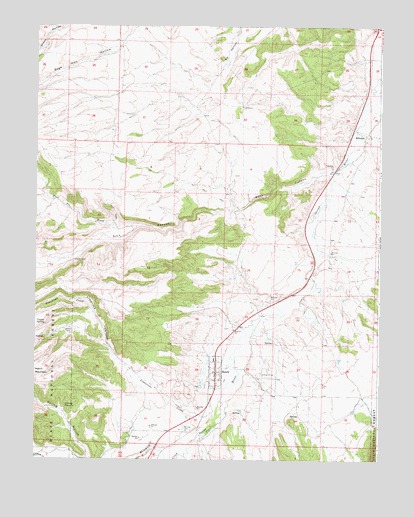
Hatch, UT USGS Topographic Map
Click on map above to begin viewing in our Map Viewer.

This topographic map contains these locations and features:
Feature Name Type Latitude Longitude GNIS ID View Map
Coal Pit WashValleyN37.6922°W112.4727°1426766View Map
Coyote SpringSpringN37.6639°W112.4965°1427057View Map
Garfield County AmbulanceBuildingN37.6537°W112.4325°2768453View Map
Grassy TroughsSpringN37.6406°W112.4891°1428357View Map
HatchPopulated PlaceN37.6497°W112.4344°1428572View Map
Hatch City CemeteryCemeteryN37.6369°W112.4446°1435658View Map
Hatch Post OfficePost OfficeN37.6529°W112.4339°2769098View Map
Hatch Volunteer Fire DepartmentBuildingN37.6539°W112.4325°2627389View Map
HillsdalePopulated PlaceN37.7191°W112.3821°1437588View Map
Hillsdale CemeteryCemeteryN37.7183°W112.3760°2769407View Map
Johnsonville SiteLocaleN37.7166°W112.3846°1435788View Map
Limerock CanyonValleyN37.6500°W112.4647°1429629View Map
Limestone CreekStreamN37.6394°W112.4330°1429632View Map
Mammoth CreekStreamN37.6261°W112.4455°1443115View Map
Mountain Ridge RV ParkParkN37.6497°W112.4347°1436003View Map
Riverside CampgroundLocaleN37.6653°W112.4216°1436235View Map
Rock CanyonValleyN37.7083°W112.3949°1431899View Map
Spring HollowValleyN37.6255°W112.4797°1432857View Map
The Church of Jesus Christ of Latter Day SaintsChurchN37.6491°W112.4349°1436937View Map
Town of HatchCivilN37.6494°W112.4345°2412735View Map

Note: Coordinates in the location and feature list above are referenced to NAD83 datum.


Copyright (C) 2008-2024 Ryan Niemi / Sunset Dynamics ... All Rights Reserved