TopoQuest Logo
Do you find TopoQuest useful?
Help keep TopoQuest running and adding new maps/features by donating!
Bitcoin:  19c7KJd3qBynnjoSw5npx9KScwjBe4ifkT
Litecoin:  LXs6TkuXGGXo1vDsWCkWVdjQX94eUKd6ui
Home View Maps Find Maps Find Places Resources & Links


Hatfield, Wisconsin Topographic Map

USGS Map Title: Hatfield, WI
USGS Map MRC: 44090D6
DRG (GeoTIFF) Download: o44090d6.tif


Neighboring USGS Topographic Map Quads:


  Wildcat Mound, WI  
44090E7
 

  Columbia, WI  
44090E6
 

  Neillsville, WI  
44090E5
 

  Merrillan, WI  
44090D7
 

  Hatfield, WI  
44090D6
 

  Hatfield NE, WI  
44090D5
 

  Black River Falls, WI  
44090C7
 

  Hatfield SW, WI  
44090C6
 

  Hatfield SE, WI  
44090C5


Map MRC Location:

N45°
W91°
N45°
W90°
H8 H7 H6 H5 H4 H3 H2 H1
G8 G7 G6 G5 G4 G3 G2 G1
F8 F7 F6 F5 F4 F3 F2 F1
E8 E7 E6 E5 E4 E3 E2 E1
D8 D7 D6 D5 D4 D3 D2 D1
C8 C7 C6 C5 C4 C3 C2 C1
B8 B7 B6 B5 B4 B3 B2 B1
A8 A7 A6 A5 A4 A3 A2 A1
N44°
W91°
N44°
W90°

Hatfield, WI USGS 1:24K Topographic Map Preview:
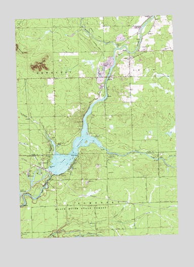
Hatfield, WI USGS Topographic Map
Click on map above to begin viewing in our Map Viewer.

This topographic map contains these locations and features:
Feature Name Type Latitude Longitude GNIS ID View Map
Arnold CreekStreamN44.4233°W90.7207°1560953View Map
Big SpringSpringN44.4411°W90.6988°1561775View Map
Clay (historical)Populated PlaceN44.3960°W90.6805°2741956View Map
Davis CreekStreamN44.4052°W90.7401°1563733View Map
Dells Dam CemeteryCemeteryN44.4758°W90.6596°1563885View Map
Dells Dam School (historical)SchoolN44.4658°W90.6710°1840615View Map
Duck HillSummitN44.4105°W90.7154°1564147View Map
East Fork Black RiverStreamN44.4305°W90.6946°1564319View Map
East Fork Recreation AreaParkN44.4214°W90.6743°1564329View Map
French IslandIslandN44.4480°W90.6929°1840616View Map
HatfieldPopulated PlaceN44.4147°W90.7307°1566129View Map
Hatfield CemeteryCemeteryN44.4130°W90.7429°1566130View Map
Hatfield Census Designated PlaceCensusN44.4165°W90.7410°2586502View Map
Hatfield DamDamN44.4116°W90.7218°1791692View Map
Hatfield Fire and RescueBuildingN44.4153°W90.7305°2698123View Map
Hay CreekStreamN44.3766°W90.7249°1566177View Map
Indian CemeteryCemeteryN44.4436°W90.6754°1840617View Map
Klimas BayBayN44.4214°W90.7035°1567548View Map
Komensky CemeteryCemeteryN44.3758°W90.6907°1567613View Map
Lake ArbutusReservoirN44.4237°W90.7082°1560923View Map
Levis MoundSummitN44.4736°W90.7326°1567995View Map
Mollies CreekStreamN44.3783°W90.7207°1569645View Map
Opelt Sand and Gravel PitMineN44.4914°W90.6567°2711480View Map
Pineview SchoolSchoolN44.4808°W90.6321°1571533View Map
Pollies CreekStreamN44.3841°W90.6785°1571741View Map
Rock CreekStreamN44.4177°W90.6354°1572430View Map
Russell Memorial ParkParkN44.4264°W90.7238°1572752View Map
Town of DewhurstCivilN44.4659°W90.7411°1583082View Map
Upper BackwaterBayN44.4077°W90.7390°1575950View Map
Wedges CreekStreamN44.4825°W90.6693°1576393View Map

Note: Coordinates in the location and feature list above are referenced to NAD83 datum.


Copyright (C) 2008-2024 Ryan Niemi / Sunset Dynamics ... All Rights Reserved