TopoQuest Logo
Do you find TopoQuest useful?
Help keep TopoQuest running and adding new maps/features by donating!
Bitcoin:  19c7KJd3qBynnjoSw5npx9KScwjBe4ifkT
Litecoin:  LXs6TkuXGGXo1vDsWCkWVdjQX94eUKd6ui
Home View Maps Find Maps Find Places Resources & Links


Hawkins, Arkansas Topographic Map

USGS Map Title: Hawkins, AR
USGS Map MRC: 35090A8
DRG (GeoTIFF) Download: o35090a8.tif


Neighboring USGS Topographic Map Quads:


  Fair Oaks, AR  
35091B1
 

  Hamlin, AR  
35090B8
 

  Wynne, AR  
35090B7
 

  Hunter East, AR  
35091A1
 

  Hawkins, AR  
35090A8
 

  Forrest City, AR  
35090A7
 

  Wheatley, AR  
34091H1
 

  Palestine, AR  
34090H8
 

  Haynes, AR  
34090H7


Map MRC Location:

N36°
W91°
N36°
W90°
H8 H7 H6 H5 H4 H3 H2 H1
G8 G7 G6 G5 G4 G3 G2 G1
F8 F7 F6 F5 F4 F3 F2 F1
E8 E7 E6 E5 E4 E3 E2 E1
D8 D7 D6 D5 D4 D3 D2 D1
C8 C7 C6 C5 C4 C3 C2 C1
B8 B7 B6 B5 B4 B3 B2 B1
A8 A7 A6 A5 A4 A3 A2 A1
N35°
W91°
N35°
W90°

Hawkins, AR USGS 1:24K Topographic Map Preview:
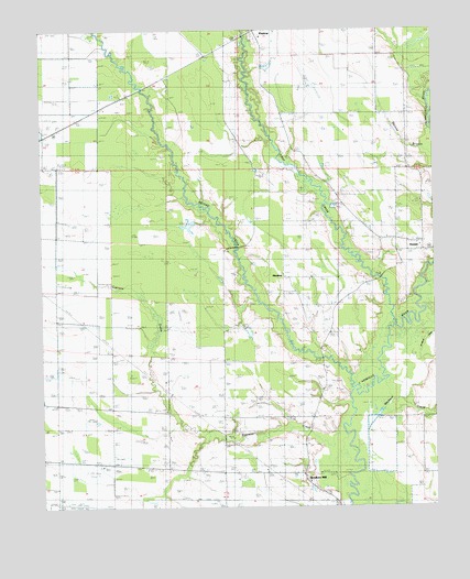
Hawkins, AR USGS Topographic Map
Click on map above to begin viewing in our Map Viewer.

This topographic map contains these locations and features:
Feature Name Type Latitude Longitude GNIS ID View Map
Barnishaw CemeteryCemeteryN35.1231°W90.9334°83065View Map
Bell CemeteryCemeteryN35.0012°W90.9071°83070View Map
Bethel ChurchChurchN35.1070°W90.9737°83073View Map
Center Grove ChurchChurchN35.0104°W90.9610°83100View Map
Cypress CreekStreamN35.0156°W90.9029°83118View Map
First CreekStreamN35.0487°W90.8857°83148View Map
Flournoy ChurchChurchN35.0548°W90.9023°83151View Map
Gaston CemeteryCemeteryN35.0170°W90.9690°83157View Map
HawkinsPopulated PlaceN35.0604°W90.9221°83165View Map
Hawkins School (historical)SchoolN35.0604°W90.9223°83040View Map
Hedge Providence ChurchChurchN35.0240°W90.9143°83167View Map
Johnson ChapelChurchN35.1040°W90.8851°83183View Map
MacedoniaPopulated PlaceN35.1126°W90.9523°83044View Map
Moonlight ChurchChurchN35.0340°W90.9429°83213View Map
Mount Zion ChurchChurchN35.1165°W90.8871°83223View Map
Second CreekStreamN35.0315°W90.9007°83274View Map
Slonikers MillPopulated PlaceN35.0079°W90.9168°83289View Map
Spybuck CreekStreamN35.0193°W90.9015°83292View Map
Stanley Grove CemeteryCemeteryN35.0751°W90.8868°83294View Map
Sweet Home ChurchChurchN35.0095°W90.9690°83297View Map
Tomblin Rest ChurchChurchN35.0601°W90.9237°83305View Map
Township of L'AnguilleCivilN35.0880°W90.9599°82863View Map
Wadell (historical)Populated PlaceN35.0862°W90.9571°82969View Map

Note: Coordinates in the location and feature list above are referenced to NAD83 datum.


Copyright (C) 2008-2024 Ryan Niemi / Sunset Dynamics ... All Rights Reserved