TopoQuest Logo
Do you find TopoQuest useful?
Help keep TopoQuest running and adding new maps/features by donating!
Bitcoin:  19c7KJd3qBynnjoSw5npx9KScwjBe4ifkT
Litecoin:  LXs6TkuXGGXo1vDsWCkWVdjQX94eUKd6ui
Home View Maps Find Maps Find Places Resources & Links


Hawxhurst Creek, Colorado Topographic Map

USGS Map Title: Hawxhurst Creek, CO
USGS Map MRC: 39107C8
DRG (GeoTIFF) Download: o39107c8.tif


Neighboring USGS Topographic Map Quads:


  Parachute, CO  
39108D1
 

  Rulison, CO  
39107D8
 

  North Mamm Peak, CO  
39107D7
 

  Housetop Mountain, CO  
39108C1
 

  Hawxhurst Creek, CO  
39107C8
 

  South Mamm Peak, CO  
39107C7
 

  Molina, CO  
39108B1
 

  Collbran, CO  
39107B8
 

  Vega Reservoir, CO  
39107B7


Map MRC Location:

N40°
W108°
N40°
W107°
H8 H7 H6 H5 H4 H3 H2 H1
G8 G7 G6 G5 G4 G3 G2 G1
F8 F7 F6 F5 F4 F3 F2 F1
E8 E7 E6 E5 E4 E3 E2 E1
D8 D7 D6 D5 D4 D3 D2 D1
C8 C7 C6 C5 C4 C3 C2 C1
B8 B7 B6 B5 B4 B3 B2 B1
A8 A7 A6 A5 A4 A3 A2 A1
N39°
W108°
N39°
W107°

Hawxhurst Creek, CO USGS 1:24K Topographic Map Preview:
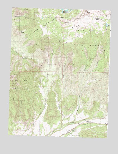
Hawxhurst Creek, CO USGS Topographic Map
Click on map above to begin viewing in our Map Viewer.

This topographic map contains these locations and features:
Feature Name Type Latitude Longitude GNIS ID View Map
Battlement MesaAreaN39.3586°W107.9148°174255View Map
Battlement Number 1 DamDamN39.3750°W107.9390°201546View Map
Battlement Number 1 ReservoirReservoirN39.3745°W107.9366°201547View Map
Battlement Number 2 DamDamN39.3733°W107.9373°201548View Map
Battlement Number 2 ReservoirReservoirN39.3723°W107.9366°201549View Map
Battlement Number 3 DamDamN39.3750°W107.9340°201550View Map
Battlement Number 3 ReservoirReservoirN39.3738°W107.9313°201551View Map
Battlement Number 4 DamDamN39.3750°W107.9290°201552View Map
Battlement Number 4 ReservoirReservoirN39.3750°W107.9290°201553View Map
Battlement Number 5 DamDamN39.3716°W107.9306°201554View Map
Battlement Number 5 ReservoirReservoirN39.3716°W107.9306°201555View Map
Battlement Number 6 DamDamN39.3666°W107.9506°200622View Map
Battlement Number 6 ReservoirReservoirN39.3666°W107.9506°200623View Map
Battlement ReservoirsReservoirN39.3739°W107.9337°202283View Map
Bear GulchValleyN39.3323°W107.9979°174348View Map
Clover CemeteryCemeteryN39.2550°W107.9234°174883View Map
Dry Fork Kimball CreekStreamN39.2661°W107.9667°174871View Map
East Hawxhurst CreekStreamN39.2908°W107.9106°174878View Map
Hawkhurst DamDamN39.3600°W107.8806°199920View Map
Hawxhurst Cow CampLocaleN39.3189°W107.8928°174879View Map
Hawxhurst CreekStreamN39.2630°W107.9201°174876View Map
Hawxhurst TrailTrailN39.3414°W107.8915°196864View Map
Haystack MountainSummitN39.3733°W107.9062°174874View Map
Kennon Cow CampLocaleN39.3261°W107.9834°174880View Map
Kimball Creek TrailTrailN39.3355°W107.9420°196865View Map
McCurry ReservoirReservoirN39.3610°W107.8802°199921View Map
Salt CreekStreamN39.2516°W107.9248°174884View Map
Smalley GulchValleyN39.2587°W107.9328°174885View Map
Smalley Mountain TrailTrailN39.3280°W107.9170°196863View Map
Sugarloaf MountainSummitN39.3516°W107.9887°174872View Map
The PeninsulaCapeN39.2644°W107.9078°202282View Map
Watson ReservoirReservoirN39.3553°W107.9595°174873View Map
West Fork Clover GulchValleyN39.2751°W107.9863°174882View Map
West Fork Kimball CreekStreamN39.2808°W107.9556°174870View Map
West Hawxhurst CreekStreamN39.2908°W107.9106°174877View Map

Note: Coordinates in the location and feature list above are referenced to NAD83 datum.


Copyright (C) 2008-2024 Ryan Niemi / Sunset Dynamics ... All Rights Reserved