TopoQuest Logo
Do you find TopoQuest useful?
Help keep TopoQuest running and adding new maps/features by donating!
Bitcoin:  19c7KJd3qBynnjoSw5npx9KScwjBe4ifkT
Litecoin:  LXs6TkuXGGXo1vDsWCkWVdjQX94eUKd6ui
Home View Maps Find Maps Find Places Resources & Links


Avondale, Texas Topographic Map

USGS Map Title: Avondale, TX
USGS Map MRC: 32097H4
DRG (GeoTIFF) Download: o32097h4.tif


Neighboring USGS Topographic Map Quads:


  Boyd, TX  
33097A5
 

  Rhome, TX  
33097A4
 

  Justin, TX  
33097A3
 

  Azle, TX  
32097H5
 

  Avondale, TX  
32097H4
 

  Keller, TX  
32097H3
 

  Springtown SE, TX  
32097G5
 

  Lake Worth, TX  
32097G4
 

  Haltom City, TX  
32097G3


Map MRC Location:

N33°
W98°
N33°
W97°
H8 H7 H6 H5 H4 H3 H2 H1
G8 G7 G6 G5 G4 G3 G2 G1
F8 F7 F6 F5 F4 F3 F2 F1
E8 E7 E6 E5 E4 E3 E2 E1
D8 D7 D6 D5 D4 D3 D2 D1
C8 C7 C6 C5 C4 C3 C2 C1
B8 B7 B6 B5 B4 B3 B2 B1
A8 A7 A6 A5 A4 A3 A2 A1
N32°
W98°
N32°
W97°

Avondale, TX USGS 1:24K Topographic Map Preview:
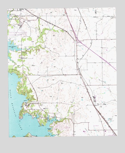
Avondale, TX USGS Topographic Map
Click on map above to begin viewing in our Map Viewer.

This topographic map contains these locations and features:
Feature Name Type Latitude Longitude GNIS ID View Map
AvondalePopulated PlaceN32.9679°W97.4206°1377966View Map
Boswell High SchoolSchoolN32.8810°W97.4150°2008696View Map
Bryson Elementary SchoolSchoolN32.8798°W97.3893°2428789View Map
Carter SloughBayN32.8768°W97.4525°1372964View Map
City of NewarkCivilN32.9995°W97.4884°2411239View Map
Craft PointCapeN32.8851°W97.4634°1333614View Map
Derrett CreekStreamN32.9962°W97.4972°1334276View Map
Dido ChurchChurchN32.9523°W97.4850°1334350View Map
Dido Methodist ChurchChurchN32.9510°W97.4806°2023922View Map
Dosier CreekStreamN32.8926°W97.4397°1334512View Map
Dosier SloughBayN32.8918°W97.4478°1334513View Map
Eagle MountainPopulated PlaceN32.8935°W97.4445°1867548View Map
Eagle Mountain Census Designated Place (historical)CensusN32.8982°W97.4450°2408699View Map
Eagle Mountain Elementary SchoolSchoolN32.9021°W97.4750°2008607View Map
Eagle Mountain LakeReservoirN32.9203°W97.4974°1373517View Map
Eagle Mountain SchoolSchoolN32.9023°W97.4600°1334852View Map
Eagle Mountain Volunteer Fire Department and Emergency Medical ServicesBuildingN32.8976°W97.4580°2551522View Map
Flemming SloughBayN32.9107°W97.4786°1335947View Map
Fort Worth Fire Department Station 40BuildingN32.8788°W97.4267°2551639View Map
Fort Worth Fire Department Station 41BuildingN32.9365°W97.3916°2551641View Map
Gilmore BranchStreamN32.9512°W97.4978°1336538View Map
Hicks AirfieldAirportN32.9312°W97.4117°1386668View Map
Indian CreekStreamN32.9610°W97.4853°1338405View Map
Kenneth Copeland AirportAirportN32.9827°W97.4883°1386666View Map
LakeviewPopulated PlaceN32.8943°W97.4620°2034685View Map
Lakeview Baptist ChurchChurchN32.9148°W97.4684°2024235View Map
Lakeview ChurchChurchN32.9057°W97.4636°1339548View Map
Little Carter SloughBayN32.8821°W97.4522°1340047View Map
Little Dosier CreekStreamN32.8951°W97.4467°1340081View Map
Little Dosier SloughBayN32.8937°W97.4467°1340082View Map
McCann BranchStreamN32.9429°W97.4778°1341147View Map
Moss BranchStreamN32.9718°W97.4636°1341967View Map
Pecan AcresPopulated PlaceN32.9701°W97.4747°1867560View Map
Pecan Acres Census Designated PlaceCensusN32.9703°W97.4727°2409045View Map
Pioneer StadiumParkN32.8779°W97.4131°2027729View Map
William Houston ParkParkN32.8757°W97.3889°2029971View Map

Note: Coordinates in the location and feature list above are referenced to NAD83 datum.


Copyright (C) 2008-2024 Ryan Niemi / Sunset Dynamics ... All Rights Reserved