TopoQuest Logo
Do you find TopoQuest useful?
Help keep TopoQuest running and adding new maps/features by donating!
Bitcoin:  19c7KJd3qBynnjoSw5npx9KScwjBe4ifkT
Litecoin:  LXs6TkuXGGXo1vDsWCkWVdjQX94eUKd6ui
Home View Maps Find Maps Find Places Resources & Links


Hayford Peak, Nevada Topographic Map

USGS Map Title: Hayford Peak, NV
USGS Map MRC: 36115F2
DRG (GeoTIFF) Download: o36115f2.tif


Neighboring USGS Topographic Map Quads:


  Dead Horse Ridge, NV  
36115G3
 

  Mule Deer Ridge, NV  
36115G2
 

  Mule Deer Ridge SE, NV  
36115G1
 

  White Sage Flat, NV  
36115F3
 

  Hayford Peak, NV  
36115F2
 

  Mormon Well, NV  
36115F1
 

  Black Hills, NV  
36115E3
 

  Sheep Peak, NV  
36115E2
 

  Hayford Peak SE, NV  
36115E1


Map MRC Location:

N37°
W116°
N37°
W115°
H8 H7 H6 H5 H4 H3 H2 H1
G8 G7 G6 G5 G4 G3 G2 G1
F8 F7 F6 F5 F4 F3 F2 F1
E8 E7 E6 E5 E4 E3 E2 E1
D8 D7 D6 D5 D4 D3 D2 D1
C8 C7 C6 C5 C4 C3 C2 C1
B8 B7 B6 B5 B4 B3 B2 B1
A8 A7 A6 A5 A4 A3 A2 A1
N36°
W116°
N36°
W115°

Hayford Peak, NV USGS 1:24K Topographic Map Preview:
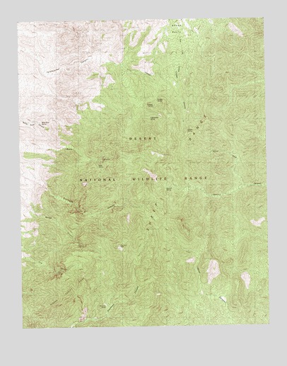
Hayford Peak, NV USGS Topographic Map
Click on map above to begin viewing in our Map Viewer.

This topographic map contains these locations and features:
Feature Name Type Latitude Longitude GNIS ID View Map
Basin SpringSpringN36.6905°W115.2109°838635View Map
Bootleg SpringSpringN36.7170°W115.1806°838977View Map
Canyon SpringSpringN36.6587°W115.2190°839310View Map
Deadman SpringSpringN36.7450°W115.2108°851391View Map
Hayford PeakSummitN36.6572°W115.2006°840925View Map
Hidden Forest CabinLocaleN36.6314°W115.2078°845861View Map
Hidden Forest RidgeRidgeN36.6425°W115.2208°845184View Map
Johns CanyonValleyN36.7316°W115.1983°841393View Map
Johns PeakSummitN36.6833°W115.1878°856776View Map
Negrohead PeakSummitN36.6519°W115.1578°863163View Map
North Fork Sawmill CanyonValleyN36.6825°W115.1367°842519View Map
Perkins SpringSpringN36.7046°W115.1658°842780View Map
Pine SpringSpringN36.6477°W115.2329°842835View Map
Quijinump SpringSpringN36.6616°W115.2036°849506View Map
Sawmill SpringSpringN36.6808°W115.1772°843521View Map
Shalecut SpringSpringN36.7150°W115.1823°843596View Map
Sheep BasinBasinN36.7450°W115.1670°843610View Map
Timber CanyonValleyN36.7230°W115.1697°844316View Map
White Rock SpringSpringN36.7081°W115.2395°844803View Map
Wiregrass SpringSpringN36.6333°W115.2083°845010View Map
Yellowjacket SpringSpringN36.7097°W115.1844°845066View Map

Note: Coordinates in the location and feature list above are referenced to NAD83 datum.


Copyright (C) 2008-2024 Ryan Niemi / Sunset Dynamics ... All Rights Reserved