TopoQuest Logo
Do you find TopoQuest useful?
Help keep TopoQuest running and adding new maps/features by donating!
Bitcoin:  19c7KJd3qBynnjoSw5npx9KScwjBe4ifkT
Litecoin:  LXs6TkuXGGXo1vDsWCkWVdjQX94eUKd6ui
Home View Maps Find Maps Find Places Resources & Links


Hazelhurst, Illinois Topographic Map

USGS Map Title: Hazelhurst, IL
USGS Map MRC: 41089H6
DRG (GeoTIFF) Download: o41089h6.tif


Neighboring USGS Topographic Map Quads:


  Lanark, IL  
42089A7
 

  Brookville, IL  
42089A6
 

  Forreston South, IL  
42089A5
 

  Milledgeville, IL  
41089H7
 

  Hazelhurst, IL  
41089H6
 

  Polo, IL  
41089H5
 

  Como, IL  
41089G7
 

  Sterling, IL  
41089G6
 

  Dixon West, IL  
41089G5


Map MRC Location:

N42°
W90°
N42°
W89°
H8 H7 H6 H5 H4 H3 H2 H1
G8 G7 G6 G5 G4 G3 G2 G1
F8 F7 F6 F5 F4 F3 F2 F1
E8 E7 E6 E5 E4 E3 E2 E1
D8 D7 D6 D5 D4 D3 D2 D1
C8 C7 C6 C5 C4 C3 C2 C1
B8 B7 B6 B5 B4 B3 B2 B1
A8 A7 A6 A5 A4 A3 A2 A1
N41°
W90°
N41°
W89°

Hazelhurst, IL USGS 1:24K Topographic Map Preview:
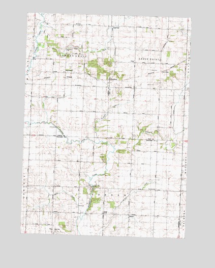
Hazelhurst, IL USGS Topographic Map
Click on map above to begin viewing in our Map Viewer.

This topographic map contains these locations and features:
Feature Name Type Latitude Longitude GNIS ID View Map
Barcley School (historical)SchoolN41.9456°W89.6682°403892View Map
Buffalo CreekStreamN41.9245°W89.6804°405156View Map
Buffalo Creek FarmsLocaleN41.9358°W89.6486°2680881View Map
Carter SidingLocaleN41.9700°W89.6446°405655View Map
Compton School (historical)SchoolN41.9170°W89.7062°406432View Map
Donaldson School (historical)SchoolN41.9878°W89.6426°407301View Map
Doty School (historical)SchoolN41.9606°W89.6279°407331View Map
Eagle CreekStreamN41.9798°W89.7407°407565View Map
Eagle PointPopulated PlaceN41.9936°W89.6848°407575View Map
Eagle Point CemeteryCemeteryN41.9959°W89.6854°1808213View Map
East Jordan CemeteryCemeteryN41.9022°W89.6476°1954890View Map
East Jordan United Methodist ChurchChurchN41.9023°W89.6479°411239View Map
Elkhorn CemeteryCemeteryN41.9742°W89.6673°1808216View Map
Elkhorn ChurchChurchN41.9736°W89.6676°407877View Map
Elkhorn Creek BridgeBridgeN41.9028°W89.6954°1705905View Map
Eller QuarryMineN41.9814°W89.7118°1983528View Map
Fairview School (historical)SchoolN41.8878°W89.6476°408230View Map
Goose CreekStreamN41.9295°W89.6929°409160View Map
Gould School (historical)SchoolN41.9203°W89.7446°409217View Map
HazelhurstPopulated PlaceN41.9634°W89.6862°409992View Map
HittPopulated PlaceN41.9948°W89.7357°410321View Map
Hitt School (historical)SchoolN41.9956°W89.7429°410323View Map
Johnson BridgeBridgeN41.9356°W89.7248°425059View Map
Jordan CenterLocaleN41.8875°W89.6868°411236View Map
Jordan ChurchChurchN41.8775°W89.7251°420858View Map
Maple Ridge CemeteryCemeteryN41.8775°W89.7245°1705906View Map
Nichols CemeteryCemeteryN41.9700°W89.6501°414509View Map
Olin BridgeBridgeN41.9748°W89.7440°425281View Map
Paynter School (historical)SchoolN41.9456°W89.7009°415475View Map
PenrosePopulated PlaceN41.8875°W89.6679°415533View Map
Penrose Friends CemeteryCemeteryN41.8853°W89.6684°1954928View Map
Sanfordville (historical)Populated PlaceN41.9278°W89.6321°1824106View Map
Siers QuarryMineN41.9017°W89.6973°1968083View Map
Skunk CreekStreamN41.8850°W89.7051°418589View Map
South ElkhornPopulated PlaceN41.9667°W89.7123°418748View Map
South Elkhorn Methodist CemeteryCemeteryN41.9672°W89.7126°1785447View Map
Talbott School (historical)SchoolN41.9159°W89.6484°419525View Map
Township of Eagle PointCivilN41.9780°W89.6569°428926View Map
Township of Elkhorn GroveCivilN41.9775°W89.7151°422233View Map
Township of JordanCivilN41.8872°W89.6878°429190View Map
Webster CemeteryCemeteryN41.9614°W89.6523°1808313View Map
Weidenhamer BridgeBridgeN41.9803°W89.7182°1705904View Map
Wolf BridgeBridgeN41.8917°W89.7062°425645View Map

Note: Coordinates in the location and feature list above are referenced to NAD83 datum.


Copyright (C) 2008-2025 Ryan Niemi / Sunset Dynamics ... All Rights Reserved