TopoQuest Logo
Do you find TopoQuest useful?
Help keep TopoQuest running and adding new maps/features by donating!
Bitcoin:  19c7KJd3qBynnjoSw5npx9KScwjBe4ifkT
Litecoin:  LXs6TkuXGGXo1vDsWCkWVdjQX94eUKd6ui
Home View Maps Find Maps Find Places Resources & Links


Healdton, Oklahoma Topographic Map

USGS Map Title: Healdton, OK
USGS Map MRC: 34097B4
DRG (GeoTIFF) Download: o34097b4.tif


Neighboring USGS Topographic Map Quads:


  Cottonwood Creek, OK  
34097C5
 

  Fox, OK  
34097C4
 

  Milo, OK  
34097C3
 

  Ringling, OK  
34097B5
 

  Healdton, OK  
34097B4
 

  Lone Grove, OK  
34097B3
 

  Orr, OK  
34097A5
 

  Healdton SW, OK  
34097A4
 

  Healdton SE, OK  
34097A3


Map MRC Location:

N35°
W98°
N35°
W97°
H8 H7 H6 H5 H4 H3 H2 H1
G8 G7 G6 G5 G4 G3 G2 G1
F8 F7 F6 F5 F4 F3 F2 F1
E8 E7 E6 E5 E4 E3 E2 E1
D8 D7 D6 D5 D4 D3 D2 D1
C8 C7 C6 C5 C4 C3 C2 C1
B8 B7 B6 B5 B4 B3 B2 B1
A8 A7 A6 A5 A4 A3 A2 A1
N34°
W98°
N34°
W97°

Healdton, OK USGS 1:24K Topographic Map Preview:
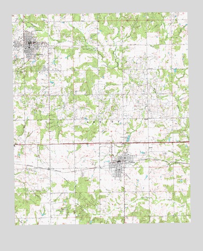
Healdton, OK USGS Topographic Map
Click on map above to begin viewing in our Map Viewer.

This topographic map contains these locations and features:
Feature Name Type Latitude Longitude GNIS ID View Map
Anthis ParkParkN34.2298°W97.4961°1089644View Map
Bailey CemeteryCemeteryN34.1913°W97.4907°2582482View Map
Bethel Baptist ChurchChurchN34.2340°W97.4884°1798304View Map
Bomar Point CemeteryCemeteryN34.1548°W97.4516°1090389View Map
Carter County Sheriff's OfficeBuildingN34.1628°W97.4219°2757473View Map
Church of ChristChurchN34.1631°W97.4253°1790141View Map
City of HealdtonCivilN34.2335°W97.4868°2410727View Map
City of WilsonCivilN34.1685°W97.4260°2412275View Map
Cockwell Airport (historical)AirportN34.1484°W97.4256°1763561View Map
DillardPopulated PlaceN34.1873°W97.4047°1100354View Map
Dillard Volunteer Fire DepartmentBuildingN34.1896°W97.4042°2658566View Map
First Baptist ChurchChurchN34.1643°W97.4253°1790139View Map
First Baptist Church-HealdtonChurchN34.2323°W97.4881°1798305View Map
First United Methodist ChurchChurchN34.2337°W97.4889°1798306View Map
First United Methodist ChurchChurchN34.1643°W97.4250°1790140View Map
HealdtonPopulated PlaceN34.2331°W97.4878°1093636View Map
Healdton Assembly of God ChurchChurchN34.2281°W97.4870°1798307View Map
Healdton Elementary SchoolSchoolN34.2294°W97.4931°2712837View Map
Healdton Fire Department StorageBuildingN34.2343°W97.4870°2658565View Map
Healdton High SchoolSchoolN34.2306°W97.4883°1793701View Map
Healdton LakeReservoirN34.2396°W97.4373°1763562View Map
Healdton Middle SchoolSchoolN34.2304°W97.4935°1793700View Map
Healdton Municipal HospitalHospitalN34.2228°W97.4915°2695773View Map
Healdton Police DepartmentBuildingN34.2338°W97.4870°2757513View Map
Healdton Volunteer Fire DepartmentBuildingN34.2337°W97.4874°2658315View Map
HewittPopulated PlaceN34.1690°W97.4047°1100489View Map
Hewitt CemeteryCemeteryN34.1665°W97.3933°1093685View Map
Jehovah Witnesses ChurchChurchN34.2312°W97.4781°1798308View Map
Mount Olive CemeteryCemeteryN34.2256°W97.4845°1095582View Map
Oil BranchStreamN34.2284°W97.4403°1096183View Map
Red Oak CreekStreamN34.2184°W97.4261°1097115View Map
RexroatPopulated PlaceN34.2165°W97.4047°1100786View Map
Southern Oklahoma Ambulance ServiceBuildingN34.2235°W97.4920°2695829View Map
Township of HewittCivilN34.1862°W97.4364°1824722View Map
Upper Bayou Site 10 DamDamN34.2318°W97.4486°1755017View Map
Upper Bayou Site 10 ReservoirReservoirN34.2318°W97.4486°1755018View Map
Upper Bayou Site 17 DamDamN34.1834°W97.4436°1754817View Map
Upper Bayou Site 17 ReservoirReservoirN34.1841°W97.4446°1754818View Map
Upper Bayou Site 18 DamDamN34.1818°W97.4120°1754819View Map
Upper Bayou Site 18 ReservoirReservoirN34.1820°W97.4105°1754820View Map
Upper Bayou Site 8 DamDamN34.2334°W97.3920°1754815View Map
Upper Bayou Site 8 ReservoirReservoirN34.2353°W97.3904°1754816View Map
Whisky CreekStreamN34.2406°W97.4828°1099680View Map
WilsonPopulated PlaceN34.1620°W97.4259°1099874View Map
Wilson DivisionCivilN34.1559°W97.4217°1937927View Map
Wilson Elementary SchoolSchoolN34.1660°W97.4173°1819471View Map
Wilson Fire DepartmentBuildingN34.1625°W97.4245°2658382View Map
Wilson High SchoolSchoolN34.1661°W97.4192°1819470View Map
Wilson Police DepartmentBuildingN34.1620°W97.4248°2757557View Map
ZaneisPopulated PlaceN34.1726°W97.4992°1100068View Map

Note: Coordinates in the location and feature list above are referenced to NAD83 datum.


Copyright (C) 2008-2025 Ryan Niemi / Sunset Dynamics ... All Rights Reserved