TopoQuest Logo
Do you find TopoQuest useful?
Help keep TopoQuest running and adding new maps/features by donating!
Bitcoin:  19c7KJd3qBynnjoSw5npx9KScwjBe4ifkT
Litecoin:  LXs6TkuXGGXo1vDsWCkWVdjQX94eUKd6ui
Home View Maps Find Maps Find Places Resources & Links


Hebert Lake, Louisiana Topographic Map

USGS Map Title: Hebert Lake, LA
USGS Map MRC: 29092G1
DRG (GeoTIFF) Download: o29092g1.tif


Neighboring USGS Topographic Map Quads:


  Abbeville West, LA  
29092H2
 

  Abbeville East, LA  
29092H1
 

  Delcambre, LA  
29091H8
 

  Intracoastal City, LA  
29092G2
 

  Hebert Lake, LA  
29092G1
 

  Tigre Lagoon, LA  
29091G8


  Cypremort Point, LA  
29091F8


Map MRC Location:

N30°
W93°
N30°
W92°
H8 H7 H6 H5 H4 H3 H2 H1
G8 G7 G6 G5 G4 G3 G2 G1
F8 F7 F6 F5 F4 F3 F2 F1
E8 E7 E6 E5 E4 E3 E2 E1
D8 D7 D6 D5 D4 D3 D2 D1
C8 C7 C6 C5 C4 C3 C2 C1
B8 B7 B6 B5 B4 B3 B2 B1
A8 A7 A6 A5 A4 A3 A2 A1
N29°
W93°
N29°
W92°

Hebert Lake, LA USGS 1:24K Topographic Map Preview:
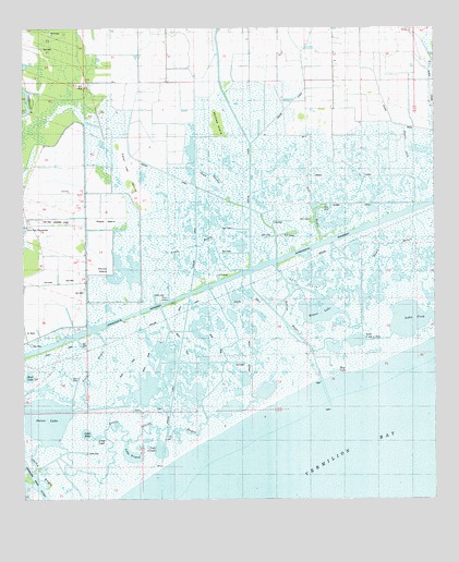
Hebert Lake, LA USGS Topographic Map
Click on map above to begin viewing in our Map Viewer.

This topographic map contains these locations and features:
Feature Name Type Latitude Longitude GNIS ID View Map
Bayou ChinBayN29.8045°W92.0540°532518View Map
Bayou HebertBayN29.7958°W92.0227°532626View Map
Bayou JackStreamN29.8363°W92.0087°532634View Map
Bayou MountineStreamN29.8344°W92.0646°532700View Map
Boston BayouBayN29.7972°W92.0458°533338View Map
Boston Bayou Oil and Gas FieldOilfieldN29.8072°W92.0404°544177View Map
Boston CanalCanalN29.8458°W92.0568°533339View Map
Deer BayouStreamN29.8185°W92.0346°534457View Map
Dugas CanalCanalN29.8513°W92.0004°534644View Map
Green Island BayouBayN29.7574°W92.1000°535388View Map
Gum IslandIslandN29.8030°W92.0832°535455View Map
Hebert LakeBayN29.7989°W92.0378°554687View Map
Hog LakeLakeN29.7837°W92.0309°554724View Map
Lake BebeBayN29.7678°W92.1063°553561View Map
Lake CleodisBayN29.7634°W92.0835°554027View Map
Lake CockBayN29.7978°W92.0068°554031View Map
Lake L'isle a PeteBayN29.7922°W92.0241°554948View Map
Lake TripodBayN29.7618°W92.0925°556270View Map
Landry CanalCanalN29.8358°W92.0329°536321View Map
Live Oak Landing StripAirportN29.8237°W92.1231°1632588View Map
Live Oak PlantationLocaleN29.8224°W92.1243°555110View Map
Long LakeBayN29.7668°W92.1029°555137View Map
Magee CanalCanalN29.8383°W92.0851°536822View Map
Maple IslandIslandN29.8263°W92.1004°536885View Map
Marklee IslandIslandN29.8502°W92.0660°536902View Map
Mayer CanalCanalN29.8610°W92.0396°536944View Map
Mud LakeBayN29.7826°W92.1233°555430View Map
North BayouBayN29.7739°W92.1067°537711View Map
Nugier CanalCanalN29.8285°W92.0246°537763View Map
Onion BayouBayN29.7588°W92.1211°537882View Map
Onion LakeBayN29.7703°W92.1189°555565View Map
Peter Lee IslandIslandN29.8358°W92.0926°538084View Map
South Erath Gas FieldOilfieldN29.8391°W92.0307°544288View Map
Stump IslandIslandN29.8110°W92.0987°539701View Map

Note: Coordinates in the location and feature list above are referenced to NAD83 datum.


Copyright (C) 2008-2024 Ryan Niemi / Sunset Dynamics ... All Rights Reserved