TopoQuest Logo
Do you find TopoQuest useful?
Help keep TopoQuest running and adding new maps/features by donating!
Bitcoin:  19c7KJd3qBynnjoSw5npx9KScwjBe4ifkT
Litecoin:  LXs6TkuXGGXo1vDsWCkWVdjQX94eUKd6ui
Home View Maps Find Maps Find Places Resources & Links


Henry Creek, Montana Topographic Map

USGS Map Title: Henry Creek, MT
USGS Map MRC: 47112C1
DRG (GeoTIFF) Download: o47112c1.tif


Neighboring USGS Topographic Map Quads:


  Bowmans Corners NW, MT  
47112D2
 

  Bowmans Corners NE, MT  
47112D1
 

  Simms, MT  
47111D8
 

  Bowmans Corners, MT  
47112C2
 

  Henry Creek, MT  
47112C1
 

  Telegraph Mountain, MT  
47111C8
 

  Comb Rock, MT  
47112B2
 

  Coburn Mountain, MT  
47112B1
 

  Mid Canon, MT  
47111B8


Map MRC Location:

N48°
W113°
N48°
W112°
H8 H7 H6 H5 H4 H3 H2 H1
G8 G7 G6 G5 G4 G3 G2 G1
F8 F7 F6 F5 F4 F3 F2 F1
E8 E7 E6 E5 E4 E3 E2 E1
D8 D7 D6 D5 D4 D3 D2 D1
C8 C7 C6 C5 C4 C3 C2 C1
B8 B7 B6 B5 B4 B3 B2 B1
A8 A7 A6 A5 A4 A3 A2 A1
N47°
W113°
N47°
W112°

Henry Creek, MT USGS 1:24K Topographic Map Preview:
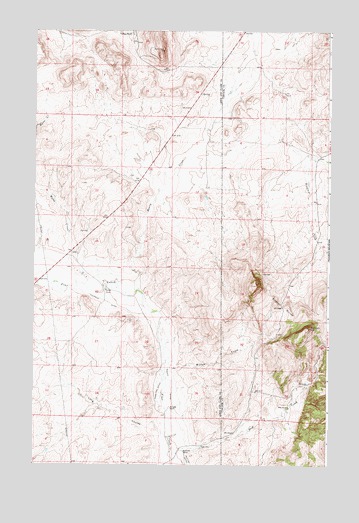
Henry Creek, MT USGS Topographic Map
Click on map above to begin viewing in our Map Viewer.

This topographic map contains these locations and features:
Feature Name Type Latitude Longitude GNIS ID View Map
Beartooth RanchLocaleN47.2538°W112.0614°800420View Map
Birdtail Divide School (historical)SchoolN47.3138°W112.0169°1761891View Map
Bullwhacker SpringsSpringN47.2916°W112.0175°1762310View Map
Dear RanchLocaleN47.2669°W112.0169°770539View Map
Frank Thompson DamDamN47.2616°W112.0825°795549View Map
Garino DitchCanalN47.2755°W112.0667°800828View Map
Garlipee RanchLocaleN47.3741°W112.0844°800829View Map
Hamilton DitchCanalN47.2719°W112.0717°800906View Map
Henry CreekStreamN47.3002°W112.0808°800932View Map
Hultine DitchCanalN47.2502°W112.0589°800965View Map
Kennedy RanchLocaleN47.2663°W112.0669°801010View Map
Knudson DitchCanalN47.2972°W112.0942°801020View Map
Lees Halfway House (historical)LocaleN47.3138°W112.0036°1762356View Map
Levine RanchLocaleN47.3002°W112.0950°801053View Map
Long CouleeValleyN47.2605°W112.0714°801093View Map
Slew CreekStreamN47.2544°W112.0653°801468View Map
Sullivan HillSummitN47.2897°W112.0089°801561View Map
Willow CreekStreamN47.2794°W112.0678°801699View Map

Note: Coordinates in the location and feature list above are referenced to NAD83 datum.


Copyright (C) 2008-2025 Ryan Niemi / Sunset Dynamics ... All Rights Reserved