TopoQuest Logo
Do you find TopoQuest useful?
Help keep TopoQuest running and adding new maps/features by donating!
Bitcoin:  19c7KJd3qBynnjoSw5npx9KScwjBe4ifkT
Litecoin:  LXs6TkuXGGXo1vDsWCkWVdjQX94eUKd6ui
Home View Maps Find Maps Find Places Resources & Links


Hesperus, Colorado Topographic Map

USGS Map Title: Hesperus, CO
USGS Map MRC: 37108C1
DRG (GeoTIFF) Download: o37108c1.tif


Neighboring USGS Topographic Map Quads:


  Rampart Hills, CO  
37108D2
 

  La Plata, CO  
37108D1
 

  Monument Hill, CO  
37107D8
 

  Thompson Park, CO  
37108C2
 

  Hesperus, CO  
37108C1
 

  Durango West, CO  
37107C8
 

  Mormon Reservoir, CO  
37108B2
 

  Kline, CO  
37108B1
 

  Basin Mountain, CO  
37107B8


Map MRC Location:

N38°
W109°
N38°
W108°
H8 H7 H6 H5 H4 H3 H2 H1
G8 G7 G6 G5 G4 G3 G2 G1
F8 F7 F6 F5 F4 F3 F2 F1
E8 E7 E6 E5 E4 E3 E2 E1
D8 D7 D6 D5 D4 D3 D2 D1
C8 C7 C6 C5 C4 C3 C2 C1
B8 B7 B6 B5 B4 B3 B2 B1
A8 A7 A6 A5 A4 A3 A2 A1
N37°
W109°
N37°
W108°

Hesperus, CO USGS 1:24K Topographic Map Preview:
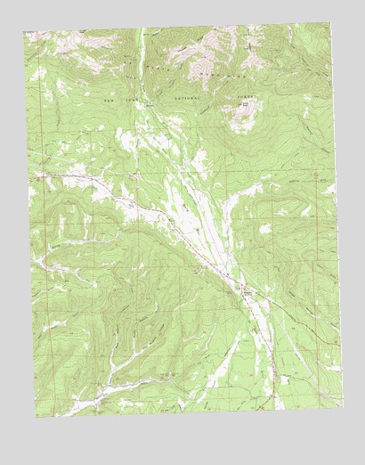
Hesperus, CO USGS Topographic Map
Click on map above to begin viewing in our Map Viewer.

This topographic map contains these locations and features:
Feature Name Type Latitude Longitude GNIS ID View Map
Baldy PeakSummitN37.3494°W108.0373°179114View Map
Bay City GulchValleyN37.3593°W108.0791°179127View Map
Bay City MineMineN37.3650°W108.0795°179129View Map
Big Stick DitchCanalN37.3222°W108.0340°202640View Map
Blackhawk MineMineN37.2875°W108.0390°1734440View Map
Blue Flame MineMineN37.2506°W108.1079°1734441View Map
Brawner Tunnel MineMineN37.2875°W108.0390°1734442View Map
Burnt Timber CreekStreamN37.3731°W108.0765°178936View Map
Burnwell Mine Number 1MineN37.2544°W108.0984°179118View Map
Burnwell Mine Number 2MineN37.2550°W108.0984°179119View Map
Carbon Junction Strip MineMineN37.2597°W108.0906°1734469View Map
Cherry Creek CampgroundLocaleN37.3289°W108.1179°179133View Map
Coal King MineMineN37.2519°W108.1001°179116View Map
Cunningham MineMineN37.3544°W108.0790°1734443View Map
Deadwood CreekStreamN37.3317°W108.0606°178993View Map
East Fork Cherry CreekStreamN37.3278°W108.1187°179142View Map
East Roberts CanyonValleyN37.2650°W108.0918°179146View Map
Escalante MineMineN37.2875°W108.0390°1734444View Map
Farmer Boy MineMineN37.3661°W108.0704°1734445View Map
Former Bay MineMineN37.3658°W108.0706°179130View Map
Fort Lewis Mesa Fire Protection District Station 3BuildingN37.2839°W108.0367°2667321View Map
Gold BarFlatN37.3131°W108.0579°179143View Map
Golden Girl MineMineN37.2875°W108.0390°1734446View Map
Gustas Brothers MineMineN37.3506°W108.0654°1734447View Map
Hay Gulch Mine Number 1MineN37.2603°W108.0981°179120View Map
HesperusPopulated PlaceN37.2861°W108.0395°179135View Map
Hesperus Baptist ChurchChurchN37.2853°W108.0376°1795348View Map
Hesperus CemeteryCemeteryN37.2722°W108.0284°179124View Map
Hesperus MineMineN37.2883°W108.0442°179122View Map
Hesperus MineMineN37.3733°W108.1154°1734410View Map
Hesperus Post OfficePost OfficeN37.2908°W108.0405°2750886View Map
Hesperus Ski CenterLocaleN37.2978°W108.0551°179121View Map
Idaho MineMineN37.3542°W108.0751°1734448View Map
Inca ClaimsMineN37.3675°W108.0590°1734449View Map
Jumbo MineMineN37.3561°W108.0806°1734450View Map
King Coal MineMineN37.2517°W108.0998°179117View Map
King MineMineN37.2508°W108.0998°1734439View Map
Klondyke MineMineN37.2925°W108.0912°1734451View Map
La Plata River and Cherry Creek DitchCanalN37.3239°W108.0526°179141View Map
Lady Eleanora MineMineN37.3631°W108.0767°1734452View Map
Little Deadwood GulchValleyN37.3500°W108.0739°179128View Map
Little Nona MineMineN37.3572°W108.0798°1734453View Map
Lucky Four MineMineN37.3678°W108.0620°1734454View Map
Mammoth MineMineN37.3747°W108.0617°1734455View Map
May Day MineMineN37.3531°W108.0695°1734456View Map
MaydayPopulated PlaceN37.3506°W108.0767°179132View Map
Middle Roberts CanyonValleyN37.2694°W108.0839°179145View Map
Minoletti MineMineN37.2572°W108.0854°1734457View Map
Morovoratz MineMineN37.3556°W108.0798°1734458View Map
Ohwiler RidgeRidgeN37.3719°W108.0515°202619View Map
Oro Negro Group MineMineN37.3556°W108.0567°1734459View Map
Paine RidgeRidgeN37.3725°W108.0337°202618View Map
Parrott CreekStreamN37.3292°W108.0601°179140View Map
Parrott PeakSummitN37.3750°W108.1029°202620View Map
Pat Lode MineMineN37.2875°W108.0390°1734460View Map
Rasmussen MineMineN37.2617°W108.0904°1734461View Map
Roberts CanyonValleyN37.2584°W108.0947°179144View Map
Ruby Tunnel MineMineN37.3564°W108.0809°1734462View Map
Small Hope MineMineN37.2553°W108.0804°1734395View Map
Snowslide GulchValleyN37.3656°W108.0781°179131View Map
Southern Boy and Girl MineMineN37.3700°W108.0681°1734463View Map
Supreme MineMineN37.2553°W108.0804°1734464View Map
Texas Chief MineMineN37.3669°W108.0217°179134View Map
Ute MineMineN37.3053°W108.0176°1734466View Map
Van Emmett MineMineN37.3675°W108.0590°1734467View Map
West Roberts CanyonValleyN37.2646°W108.0922°179115View Map
Western View Mining Group MineMineN37.3431°W108.0881°1734468View Map
Wright Number 1 MineMineN37.2631°W108.0695°179112View Map
Wright Number 2 MineMineN37.2631°W108.0701°179111View Map

Note: Coordinates in the location and feature list above are referenced to NAD83 datum.


Copyright (C) 2008-2025 Ryan Niemi / Sunset Dynamics ... All Rights Reserved