TopoQuest Logo
Do you find TopoQuest useful?
Help keep TopoQuest running and adding new maps/features by donating!
Bitcoin:  19c7KJd3qBynnjoSw5npx9KScwjBe4ifkT
Litecoin:  LXs6TkuXGGXo1vDsWCkWVdjQX94eUKd6ui
Home View Maps Find Maps Find Places Resources & Links


Hessler Ridge, Montana Topographic Map

USGS Map Title: Hessler Ridge, MT
USGS Map MRC: 47108E6
DRG (GeoTIFF) Download: o47108e6.tif


Neighboring USGS Topographic Map Quads:


  Grand Island, MT  
47108F7
 

  Bell Ridge West, MT  
47108F6
 

  Bell Ridge East, MT  
47108F5
 

  Mitchell Crossing, MT  
47108E7
 

  Hessler Ridge, MT  
47108E6
 

  Carter Coulee, MT  
47108E5
 

  Griffee Coulee, MT  
47108D7
 

  Sloan Reservoir, MT  
47108D6
 

  Kachia Reservoir, MT  
47108D5


Map MRC Location:

N48°
W109°
N48°
W108°
H8 H7 H6 H5 H4 H3 H2 H1
G8 G7 G6 G5 G4 G3 G2 G1
F8 F7 F6 F5 F4 F3 F2 F1
E8 E7 E6 E5 E4 E3 E2 E1
D8 D7 D6 D5 D4 D3 D2 D1
C8 C7 C6 C5 C4 C3 C2 C1
B8 B7 B6 B5 B4 B3 B2 B1
A8 A7 A6 A5 A4 A3 A2 A1
N47°
W109°
N47°
W108°

Hessler Ridge, MT USGS 1:24K Topographic Map Preview:
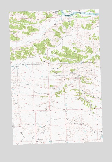
Hessler Ridge, MT USGS Topographic Map
Click on map above to begin viewing in our Map Viewer.

This topographic map contains these locations and features:
Feature Name Type Latitude Longitude GNIS ID View Map
21N23E12AD__01 WellWellN47.5983°W108.7035°823974View Map
21N23E13CBBB01 WellWellN47.5822°W108.7190°823884View Map
21N24E06BB__01 WellWellN47.6158°W108.6977°824079View Map
Armells CreekStreamN47.6214°W108.6763°801999View Map
Bundane School (historical)SchoolN47.5242°W108.7404°1722732View Map
Cope DamDamN47.5217°W108.6924°795144View Map
Downer CouleeValleyN47.5461°W108.6499°770736View Map
Fergus Number 1 DamDamN47.5017°W108.6974°797867View Map
Galhand RidgeRidgeN47.5708°W108.6885°771680View Map
Gardipee BottomsBendN47.6228°W108.6707°771707View Map
Hessler RidgeRidgeN47.5639°W108.6938°772360View Map
King CouleeValleyN47.5742°W108.6565°773040View Map
King Coulee Number 1 DamDamN47.5700°W108.7474°797969View Map
King IslandIslandN47.6189°W108.6474°773046View Map
Mobridge (historical)Populated PlaceN47.6194°W108.6807°1722929View Map
Musselman CouleeValleyN47.5589°W108.6607°774523View Map
Roach GulchValleyN47.5525°W108.6849°775803View Map
Sagebrush Number 3 DamDamN47.5300°W108.6774°797866View Map
Sand Creek Wildlife Station AirportAirportN47.5840°W108.7105°806515View Map
White CouleeValleyN47.5689°W108.6571°778371View Map

Note: Coordinates in the location and feature list above are referenced to NAD83 datum.


Copyright (C) 2008-2025 Ryan Niemi / Sunset Dynamics ... All Rights Reserved