TopoQuest Logo
Do you find TopoQuest useful?
Help keep TopoQuest running and adding new maps/features by donating!
Bitcoin:  19c7KJd3qBynnjoSw5npx9KScwjBe4ifkT
Litecoin:  LXs6TkuXGGXo1vDsWCkWVdjQX94eUKd6ui
Home View Maps Find Maps Find Places Resources & Links


Higbee, Missouri Topographic Map

USGS Map Title: Higbee, MO
USGS Map MRC: 39092C5
DRG (GeoTIFF) Download: o39092c5.tif


Neighboring USGS Topographic Map Quads:


  Clifton Hill, MO  
39092D6
 

  Huntsville, MO  
39092D5
 

  Moberly, MO  
39092D4
 

  Armstrong, MO  
39092C6
 

  Higbee, MO  
39092C5
 

  Renick, MO  
39092C4
 

  Fayette, MO  
39092B6
 

  Burton, MO  
39092B5
 

  Harrisburg, MO  
39092B4


Map MRC Location:

N40°
W93°
N40°
W92°
H8 H7 H6 H5 H4 H3 H2 H1
G8 G7 G6 G5 G4 G3 G2 G1
F8 F7 F6 F5 F4 F3 F2 F1
E8 E7 E6 E5 E4 E3 E2 E1
D8 D7 D6 D5 D4 D3 D2 D1
C8 C7 C6 C5 C4 C3 C2 C1
B8 B7 B6 B5 B4 B3 B2 B1
A8 A7 A6 A5 A4 A3 A2 A1
N39°
W93°
N39°
W92°

Higbee, MO USGS 1:24K Topographic Map Preview:
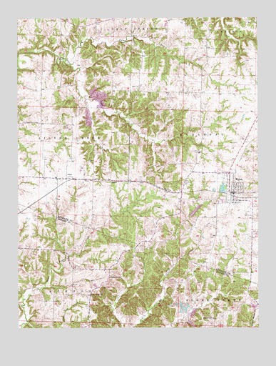
Higbee, MO USGS Topographic Map
Click on map above to begin viewing in our Map Viewer.

This topographic map contains these locations and features:
Feature Name Type Latitude Longitude GNIS ID View Map
Bagby CemeteryCemeteryN39.3475°W92.5613°748636View Map
City of HigbeeCivilN39.3060°W92.5128°2394372View Map
Coal CreekStreamN39.3423°W92.5893°716030View Map
Dover School (historical)SchoolN39.3634°W92.5371°743907View Map
Ebenezer School (historical)SchoolN39.3098°W92.5685°743909View Map
Hickory Grove School (historical)SchoolN39.2873°W92.5182°743911View Map
HigbeePopulated PlaceN39.3048°W92.5127°719507View Map
Higbee Area Fire Protection DistrictBuildingN39.3072°W92.5143°2620255View Map
Higbee CemeteryCemeteryN39.3217°W92.5035°719508View Map
Higbee Elementary SchoolSchoolN39.3065°W92.5120°2571154View Map
Higbee High SchoolSchoolN39.3060°W92.5119°2571155View Map
Higbee LakeReservoirN39.3061°W92.5188°760555View Map
Higbee Lake DamDamN39.3050°W92.5185°760554View Map
Higbee Post OfficePost OfficeN39.3043°W92.5135°2782664View Map
McDonald MineMineN39.2895°W92.5285°743745View Map
Mount Ararat ChurchChurchN39.2636°W92.5871°722709View Map
Old Higbee School (historical)SchoolN39.2973°W92.5027°743910View Map
Pemberton School (historical)SchoolN39.2706°W92.5777°724187View Map
Possum School (historical)SchoolN39.2538°W92.5240°729372View Map
Ross Lake DamDamN39.2567°W92.5018°761857View Map
Russell (historical)BuildingN39.2695°W92.5488°743550View Map
Shady Oaks Lake DamDamN39.2953°W92.5357°760390View Map
Township of MoniteauCivilN39.3159°W92.5191°767260View Map
Turner ForkStreamN39.3561°W92.5977°727901View Map
Walnut Grove School (historical)SchoolN39.3684°W92.5671°743906View Map
Whitmore CemeteryCemeteryN39.3089°W92.5385°728798View Map
YatesPopulated PlaceN39.3103°W92.5993°729415View Map
Yates School (historical)SchoolN39.3109°W92.6018°743908View Map

Note: Coordinates in the location and feature list above are referenced to NAD83 datum.


Copyright (C) 2008-2024 Ryan Niemi / Sunset Dynamics ... All Rights Reserved