TopoQuest Logo
Do you find TopoQuest useful?
Help keep TopoQuest running and adding new maps/features by donating!
Bitcoin:  19c7KJd3qBynnjoSw5npx9KScwjBe4ifkT
Litecoin:  LXs6TkuXGGXo1vDsWCkWVdjQX94eUKd6ui
Home View Maps Find Maps Find Places Resources & Links


Hightower Mountain, Colorado Topographic Map

USGS Map Title: Hightower Mountain, CO
USGS Map MRC: 39107C6
DRG (GeoTIFF) Download: o39107c6.tif


Neighboring USGS Topographic Map Quads:


  North Mamm Peak, CO  
39107D7
 

  Hunter Mesa, CO  
39107D6
 

  Gibson Gulch, CO  
39107D5
 

  South Mamm Peak, CO  
39107C7
 

  Hightower Mountain, CO  
39107C6
 

  Flatiron Mountain, CO  
39107C5
 

  Vega Reservoir, CO  
39107B7
 

  Porter Mountain, CO  
39107B6
 

  Spruce Mountain, CO  
39107B5


Map MRC Location:

N40°
W108°
N40°
W107°
H8 H7 H6 H5 H4 H3 H2 H1
G8 G7 G6 G5 G4 G3 G2 G1
F8 F7 F6 F5 F4 F3 F2 F1
E8 E7 E6 E5 E4 E3 E2 E1
D8 D7 D6 D5 D4 D3 D2 D1
C8 C7 C6 C5 C4 C3 C2 C1
B8 B7 B6 B5 B4 B3 B2 B1
A8 A7 A6 A5 A4 A3 A2 A1
N39°
W108°
N39°
W107°

Hightower Mountain, CO USGS 1:24K Topographic Map Preview:
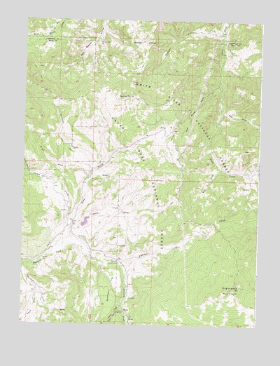
Hightower Mountain, CO USGS Topographic Map
Click on map above to begin viewing in our Map Viewer.

This topographic map contains these locations and features:
Feature Name Type Latitude Longitude GNIS ID View Map
Bear GulchValleyN39.3395°W107.6459°174927View Map
Beaver CreekStreamN39.2569°W107.6976°174913View Map
Bogue GulchValleyN39.2639°W107.7410°174914View Map
Buzzard CampgroundLocaleN39.2555°W107.6956°174916View Map
Cheney CreekStreamN39.2908°W107.7234°174897View Map
Currier Number 2 DamDamN39.2866°W107.7173°199908View Map
Currier Number 2 ReservoirReservoirN39.2866°W107.7173°199909View Map
East Road GulchValleyN39.3476°W107.6471°174923View Map
Hightower CreekStreamN39.2750°W107.6998°174918View Map
Hightower Guard StationLocaleN39.2755°W107.6989°174919View Map
Hightower MountainSummitN39.2653°W107.6367°174917View Map
Middleton CreekStreamN39.3130°W107.7139°174899View Map
Mud HillSummitN39.3439°W107.6964°174925View Map
Mud SpringSpringN39.3313°W107.6753°196624View Map
North Fork Cheney CreekStreamN39.3116°W107.7470°174898View Map
Reservoir GulchValleyN39.3694°W107.6452°174924View Map
Road GulchValleyN39.2843°W107.7239°174920View Map
Sheep CreekStreamN39.2908°W107.7226°174921View Map
Sunflower FlatFlatN39.2658°W107.7028°174915View Map
Uhl CreekStreamN39.3108°W107.7159°174900View Map
West Branch Dry HollowValleyN39.3680°W107.7108°174926View Map
West Prong Alkali CreekStreamN39.3150°W107.6476°174922View Map

Note: Coordinates in the location and feature list above are referenced to NAD83 datum.


Copyright (C) 2008-2024 Ryan Niemi / Sunset Dynamics ... All Rights Reserved