TopoQuest Logo
Do you find TopoQuest useful?
Help keep TopoQuest running and adding new maps/features by donating!
Bitcoin:  19c7KJd3qBynnjoSw5npx9KScwjBe4ifkT
Litecoin:  LXs6TkuXGGXo1vDsWCkWVdjQX94eUKd6ui
Home View Maps Find Maps Find Places Resources & Links


Hinckley, Illinois Topographic Map

USGS Map Title: Hinckley, IL
USGS Map MRC: 41088G6
DRG (GeoTIFF) Download: o41088g6.tif


Neighboring USGS Topographic Map Quads:


  DeKalb, IL  
41088H7
 

  Sycamore, IL  
41088H6
 

  Maple Park, IL  
41088H5
 

  Waterman, IL  
41088G7
 

  Hinckley, IL  
41088G6
 

  Big Rock, IL  
41088G5
 

  Shabbona Grove, IL  
41088F7
 

  Somonauk, IL  
41088F6
 

  Plano, IL  
41088F5


Map MRC Location:

N42°
W89°
N42°
W88°
H8 H7 H6 H5 H4 H3 H2 H1
G8 G7 G6 G5 G4 G3 G2 G1
F8 F7 F6 F5 F4 F3 F2 F1
E8 E7 E6 E5 E4 E3 E2 E1
D8 D7 D6 D5 D4 D3 D2 D1
C8 C7 C6 C5 C4 C3 C2 C1
B8 B7 B6 B5 B4 B3 B2 B1
A8 A7 A6 A5 A4 A3 A2 A1
N41°
W89°
N41°
W88°

Hinckley, IL USGS 1:24K Topographic Map Preview:
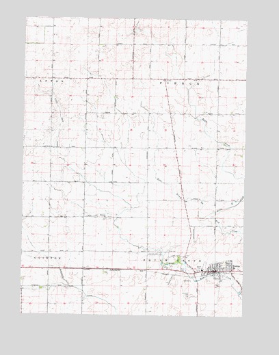
Hinckley, IL USGS Topographic Map
Click on map above to begin viewing in our Map Viewer.

This topographic map contains these locations and features:
Feature Name Type Latitude Longitude GNIS ID View Map
Ballek Landing Area (historical)AirportN41.7723°W88.6737°427381View Map
Battle CreekStreamN41.7917°W88.6437°421701View Map
Gallagher School (historical)SchoolN41.8492°W88.6993°1719068View Map
Granart School (historical)SchoolN41.7773°W88.6895°1719064View Map
Greenwood CemeteryCemeteryN41.7584°W88.6562°421833View Map
HinckleyPopulated PlaceN41.7689°W88.6409°421851View Map
Hinckley AirportAirportN41.7706°W88.7039°427380View Map
Hinckley Elementary SchoolSchoolN41.7695°W88.6484°1807818View Map
Hinckley Fire Protection DistrictBuildingN41.7793°W88.6420°2681775View Map
Hinckley Police DepartmentBuildingN41.7706°W88.6302°2757141View Map
Hinckley Post OfficePost OfficeN41.7690°W88.6334°2788763View Map
Hinckley-Big Rock High SchoolSchoolN41.7703°W88.6304°1807819View Map
Hipple School (historical)SchoolN41.7620°W88.7356°1719072View Map
Horan School (historical)SchoolN41.8209°W88.6995°1719066View Map
Immanuel Lutheran ChurchChurchN41.7909°W88.7034°421864View Map
Immanuel School (historical)SchoolN41.7906°W88.7037°1719065View Map
Immauel Lutheran CemeteryCemeteryN41.7909°W88.7026°1807821View Map
McGirr School (historical)SchoolN41.8206°W88.7343°1719070View Map
Miller CemeteryCemeteryN41.7772°W88.6673°421943View Map
Pierceville Post Office (historical)Post OfficeN41.8320°W88.6667°1807833View Map
Pioneer ParkParkN41.7695°W88.6504°422004View Map
Pooler School (historical)SchoolN41.8492°W88.7340°1719069View Map
Saint Pauls United Church of ChristChurchN41.7706°W88.6445°1983614View Map
Swift School (historical)SchoolN41.7906°W88.7351°1719071View Map
Township of PierceCivilN41.8497°W88.6584°429561View Map
Township of Squaw GroveCivilN41.7625°W88.6587°429791View Map
Village of HinckleyCivilN41.7714°W88.6396°2398512View Map
Walter AirportAirportN41.8725°W88.7235°427213View Map
Ziegler School (historical)SchoolN41.8503°W88.6595°1719067View Map

Note: Coordinates in the location and feature list above are referenced to NAD83 datum.


Copyright (C) 2008-2024 Ryan Niemi / Sunset Dynamics ... All Rights Reserved