TopoQuest Logo
Do you find TopoQuest useful?
Help keep TopoQuest running and adding new maps/features by donating!
Bitcoin:  19c7KJd3qBynnjoSw5npx9KScwjBe4ifkT
Litecoin:  LXs6TkuXGGXo1vDsWCkWVdjQX94eUKd6ui
Home View Maps Find Maps Find Places Resources & Links


Hindsboro, Illinois Topographic Map

USGS Map Title: Hindsboro, IL
USGS Map MRC: 39088F2
DRG (GeoTIFF) Download: o39088f2.tif


Neighboring USGS Topographic Map Quads:


  Tuscola, IL  
39088G3
 

  Villa Grove, IL  
39088G2
 

  Murdock, IL  
39088G1
 

  Arcola, IL  
39088F3
 

  Hindsboro, IL  
39088F2
 

  Oakland, IL  
39088F1
 

  Humboldt, IL  
39088E3
 

  Charleston North, IL  
39088E2
 

  Ashmore, IL  
39088E1


Map MRC Location:

N40°
W89°
N40°
W88°
H8 H7 H6 H5 H4 H3 H2 H1
G8 G7 G6 G5 G4 G3 G2 G1
F8 F7 F6 F5 F4 F3 F2 F1
E8 E7 E6 E5 E4 E3 E2 E1
D8 D7 D6 D5 D4 D3 D2 D1
C8 C7 C6 C5 C4 C3 C2 C1
B8 B7 B6 B5 B4 B3 B2 B1
A8 A7 A6 A5 A4 A3 A2 A1
N39°
W89°
N39°
W88°

Hindsboro, IL USGS 1:24K Topographic Map Preview:
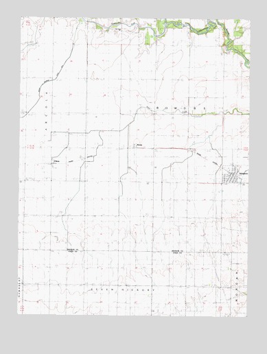
Hindsboro, IL USGS Topographic Map
Click on map above to begin viewing in our Map Viewer.

This topographic map contains these locations and features:
Feature Name Type Latitude Longitude GNIS ID View Map
Arcola Drainage Ditch Number 4CanalN39.7325°W88.2237°424575View Map
Ashland School (historical)SchoolN39.7425°W88.1862°403674View Map
Chocktaw School (historical)SchoolN39.7461°W88.1250°406077View Map
Dickey School (historical)SchoolN39.7339°W88.2320°407198View Map
Dry Point School (historical)SchoolN39.7459°W88.1428°407431View Map
Duffle School (historical)SchoolN39.7100°W88.1587°407465View Map
Eversole School (historical)SchoolN39.6511°W88.1956°408131View Map
FilsonPopulated PlaceN39.6895°W88.2320°408369View Map
Filson Post Office (historical)Post OfficeN39.6886°W88.2323°1807775View Map
Filson School (historical)SchoolN39.6809°W88.2325°408370View Map
Hemingway School (historical)SchoolN39.6817°W88.1959°410045View Map
Henson PondLakeN39.7473°W88.1725°410084View Map
HindsboroPopulated PlaceN39.6850°W88.1337°410307View Map
Hindsboro Christian ChurchChurchN39.6814°W88.1339°1807776View Map
Hindsboro Community Fire Protection DistrictBuildingN39.6838°W88.1335°2682576View Map
Hindsboro Post OfficePost OfficeN39.6842°W88.1341°2788513View Map
KempPopulated PlaceN39.6956°W88.1853°411385View Map
Kemp Post Office (historical)Post OfficeN39.6956°W88.1864°1807777View Map
Mount Gilead United Methodist ChurchChurchN39.7448°W88.1959°413962View Map
Scattering ForkStreamN39.7484°W88.1709°418065View Map
Shiloh School (historical)SchoolN39.6517°W88.2323°418425View Map
Town Line School (historical)SchoolN39.7053°W88.2139°419808View Map
Township of BowdreCivilN39.7100°W88.1573°428697View Map
Village of HindsboroCivilN39.6850°W88.1349°2398513View Map
Wheatley School (historical)SchoolN39.6517°W88.1587°420988View Map

Note: Coordinates in the location and feature list above are referenced to NAD83 datum.


Copyright (C) 2008-2025 Ryan Niemi / Sunset Dynamics ... All Rights Reserved