TopoQuest Logo
Do you find TopoQuest useful?
Help keep TopoQuest running and adding new maps/features by donating!
Bitcoin:  19c7KJd3qBynnjoSw5npx9KScwjBe4ifkT
Litecoin:  LXs6TkuXGGXo1vDsWCkWVdjQX94eUKd6ui
Home View Maps Find Maps Find Places Resources & Links


Badger, Minnesota Topographic Map

USGS Map Title: Badger, MN
USGS Map MRC: 48096G1
DRG (GeoTIFF) Download: o48096g1.tif


Neighboring USGS Topographic Map Quads:


  Badger NW, MN  
48096H2
 

  Badger NE, MN  
48096H1
 

  Pinecreek, MN  
48095H8
 

  Haug, MN  
48096G2
 

  Badger, MN  
48096G1
 

  Fox, MN  
48095G8
 

  Greenbush, MN  
48096F2
 

  Greenbush NE, MN  
48096F1
 

  Thief Lake NW, MN  
48095F8


Map MRC Location:

N49°
W97°
N49°
W96°
H8 H7 H6 H5 H4 H3 H2 H1
G8 G7 G6 G5 G4 G3 G2 G1
F8 F7 F6 F5 F4 F3 F2 F1
E8 E7 E6 E5 E4 E3 E2 E1
D8 D7 D6 D5 D4 D3 D2 D1
C8 C7 C6 C5 C4 C3 C2 C1
B8 B7 B6 B5 B4 B3 B2 B1
A8 A7 A6 A5 A4 A3 A2 A1
N48°
W97°
N48°
W96°

Badger, MN USGS 1:24K Topographic Map Preview:
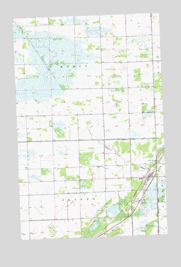
Badger, MN USGS Topographic Map
Click on map above to begin viewing in our Map Viewer.

This topographic map contains these locations and features:
Feature Name Type Latitude Longitude GNIS ID View Map
BadgerPopulated PlaceN48.7825°W96.0144°639556View Map
Badger City CemeteryCemeteryN48.7702°W96.0281°639557View Map
Badger CreekStreamN48.8128°W96.0653°639561View Map
Badger Creek CemeteryCemeteryN48.7916°W96.0069°639562View Map
Badger Creek Free Lutheran ChurchChurchN48.7825°W96.0142°2108499View Map
Badger Fire DepartmentBuildingN48.7823°W96.0152°2666596View Map
Badger Post OfficePost OfficeN48.7825°W96.0142°2108524View Map
Badger StationLocaleN48.7828°W96.0142°2108522View Map
City of BadgerCivilN48.7768°W96.0213°2394049View Map
County Ditch Number FiveCanalN48.7675°W96.0075°642157View Map
Lolita Post Office (historical)Post OfficeN48.8708°W96.0833°2107704View Map
Oak View Mobile Home ParkPopulated PlaceN48.7825°W96.0142°2108530View Map
Our Redeemer Lutheran ChurchChurchN48.7839°W96.0117°2108531View Map
Palisade Mobile Home ParkPopulated PlaceN48.7825°W96.0142°2108497View Map
Pioneer Mobile Home ParkPopulated PlaceN48.7708°W96.0208°2108500View Map
Roselund CemeteryCemeteryN48.8555°W96.0494°2107738View Map
Roselund ChurchChurchN48.8558°W96.0514°650289View Map
Saint Mary CemeteryCemeteryN48.7677°W96.0222°650833View Map
Saint Mary's Catholic ChurchChurchN48.7850°W96.0106°2108533View Map
Swedish CemeteryCemeteryN48.7910°W96.0078°652931View Map
Township of MooseCivilN48.8482°W96.0740°665021View Map
Township of SkagenCivilN48.7606°W96.0759°665624View Map
Whitney Lake DitchCanalN48.8478°W96.0986°654117View Map

Note: Coordinates in the location and feature list above are referenced to NAD83 datum.


Copyright (C) 2008-2024 Ryan Niemi / Sunset Dynamics ... All Rights Reserved