TopoQuest Logo
Do you find TopoQuest useful?
Help keep TopoQuest running and adding new maps/features by donating!
Bitcoin:  19c7KJd3qBynnjoSw5npx9KScwjBe4ifkT
Litecoin:  LXs6TkuXGGXo1vDsWCkWVdjQX94eUKd6ui
Home View Maps Find Maps Find Places Resources & Links


Holly Creek, Idaho Topographic Map

USGS Map Title: Holly Creek, ID
USGS Map MRC: 46115D2
DRG (GeoTIFF) Download: o46115d2.tif


Neighboring USGS Topographic Map Quads:


  Cook Mountain, ID  
46115E3
 

  Lookout Peak, ID  
46115E2
 

  Horseshoe Lake, ID  
46115E1
 

  Liz Butte, ID  
46115D3
 

  Holly Creek, ID  
46115D2
 

  Greystone Butte, ID  
46115D1
 

  Huckleberry Butte, ID  
46115C3
 

  Greenside Butte, ID  
46115C2
 

  Fish Lake, ID  
46115C1


Map MRC Location:

N47°
W116°
N47°
W115°
H8 H7 H6 H5 H4 H3 H2 H1
G8 G7 G6 G5 G4 G3 G2 G1
F8 F7 F6 F5 F4 F3 F2 F1
E8 E7 E6 E5 E4 E3 E2 E1
D8 D7 D6 D5 D4 D3 D2 D1
C8 C7 C6 C5 C4 C3 C2 C1
B8 B7 B6 B5 B4 B3 B2 B1
A8 A7 A6 A5 A4 A3 A2 A1
N46°
W116°
N46°
W115°

Holly Creek, ID USGS 1:24K Topographic Map Preview:
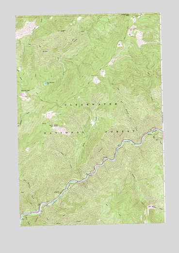
Holly Creek, ID USGS Topographic Map
Click on map above to begin viewing in our Map Viewer.

This topographic map contains these locations and features:
Feature Name Type Latitude Longitude GNIS ID View Map
Bald MountainSummitN46.4544°W115.2426°376886View Map
Bald Mountain CreekStreamN46.3838°W115.2323°376892View Map
Bald Mountain LakeLakeN46.4596°W115.2254°376895View Map
Castle ButteSummitN46.4341°W115.2201°378996View Map
Castle Butte CampLocaleN46.4044°W115.1907°395182View Map
Castle CreekStreamN46.4013°W115.1957°379000View Map
Corral CreekStreamN46.4827°W115.2415°379800View Map
Dutch CreekStreamN46.3821°W115.2337°380955View Map
Eagle Mountain CreekStreamN46.4302°W115.1293°380990View Map
Eagle Mountain Pack BridgeBridgeN46.4299°W115.1335°395345View Map
Fro CreekStreamN46.4785°W115.2226°382097View Map
Gold Meadows CreekStreamN46.3838°W115.1415°382390View Map
Green Flat CampgroundLocaleN46.3941°W115.2148°382636View Map
Greensward CampLocaleN46.4532°W115.2482°395432View Map
Hard CreekStreamN46.3819°W115.2476°382895View Map
Holly CreekStreamN46.4044°W115.1904°399919View Map
Hungry PointSummitN46.4902°W115.2123°383552View Map
Indian Grave CampLocaleN46.4985°W115.1473°383677View Map
Ninemile Rest AreaLocaleN46.3894°W115.2237°394001View Map
Skookum CreekStreamN46.4221°W115.1479°390526View Map
Stanley CreekStreamN46.4210°W115.1618°391341View Map
The Smoking Place CampLocaleN46.4908°W115.1529°395961View Map

Note: Coordinates in the location and feature list above are referenced to NAD83 datum.


Copyright (C) 2008-2025 Ryan Niemi / Sunset Dynamics ... All Rights Reserved