TopoQuest Logo
Do you find TopoQuest useful?
Help keep TopoQuest running and adding new maps/features by donating!
Bitcoin:  19c7KJd3qBynnjoSw5npx9KScwjBe4ifkT
Litecoin:  LXs6TkuXGGXo1vDsWCkWVdjQX94eUKd6ui
Home View Maps Find Maps Find Places Resources & Links


Holly West, Colorado Topographic Map

USGS Map Title: Holly West, CO
USGS Map MRC: 38102A2
DRG (GeoTIFF) Download: o38102a2.tif


Neighboring USGS Topographic Map Quads:


  Granada NE, CO  
38102B3
 

  Holly NW, CO  
38102B2
 

  Holly NE, CO  
38102B1
 

  Granada, CO  
38102A3
 

  Holly West, CO  
38102A2
 

  Holly East, CO  
38102A1
 

  North Plum Creek NE, CO  
37102H3
 

  Durkee Creek NW, CO  
37102H2
 

  Durkee Creek NE, CO  
37102H1


Map MRC Location:

N39°
W103°
N39°
W102°
H8 H7 H6 H5 H4 H3 H2 H1
G8 G7 G6 G5 G4 G3 G2 G1
F8 F7 F6 F5 F4 F3 F2 F1
E8 E7 E6 E5 E4 E3 E2 E1
D8 D7 D6 D5 D4 D3 D2 D1
C8 C7 C6 C5 C4 C3 C2 C1
B8 B7 B6 B5 B4 B3 B2 B1
A8 A7 A6 A5 A4 A3 A2 A1
N38°
W103°
N38°
W102°

Holly West, CO USGS 1:24K Topographic Map Preview:
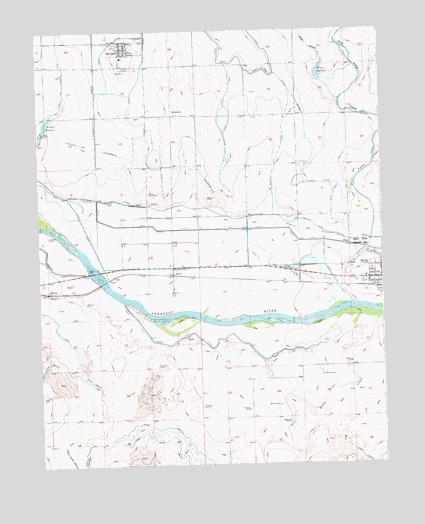
Holly West, CO USGS Topographic Map
Click on map above to begin viewing in our Map Viewer.

This topographic map contains these locations and features:
Feature Name Type Latitude Longitude GNIS ID View Map
Air-Sprayers Number 2 AirportAirportN38.1087°W102.2152°204438View Map
AmityLocaleN38.0547°W102.2016°195602View Map
Amity CemeteryCemeteryN38.0786°W102.2098°195596View Map
BartonLocaleN38.0500°W102.2469°195601View Map
Buffalo CanalCanalN38.0750°W102.1977°203841View Map
Chenoweth LateralCanalN38.1167°W102.2291°203823View Map
Crowley LateralCanalN38.0945°W102.1549°195598View Map
East Fork Dead DitchCanalN38.1111°W102.2402°203824View Map
HartmanPopulated PlaceN38.1203°W102.2199°195605View Map
Hartman CemeteryCemeteryN38.1147°W102.2191°195606View Map
Hartman Fire DepartmentBuildingN38.1171°W102.2194°2667336View Map
Hartman Post OfficePost OfficeN38.1210°W102.2188°2750960View Map
Holly DitchCanalN38.0645°W102.1505°203842View Map
Jones LateralCanalN38.1000°W102.1799°195597View Map
MillwoodLocaleN38.1014°W102.2005°195607View Map
Pauls ArroyoStreamN38.1047°W102.1399°195466View Map
Romer ReservoirReservoirN38.1126°W102.1475°195600View Map
Sisson CanalCanalN38.0361°W102.1838°195603View Map
Swede LateralCanalN38.1139°W102.2252°203825View Map
Town of HartmanCivilN38.1211°W102.2217°2412730View Map
Trotter LateralCanalN38.0917°W102.1610°195599View Map
Two Butte CreekStreamN38.0425°W102.1257°201785View Map
Verhoeff ReservoirReservoirN38.0982°W102.2473°195604View Map

Note: Coordinates in the location and feature list above are referenced to NAD83 datum.


Copyright (C) 2008-2024 Ryan Niemi / Sunset Dynamics ... All Rights Reserved