TopoQuest Logo
Do you find TopoQuest useful?
Help keep TopoQuest running and adding new maps/features by donating!
Bitcoin:  19c7KJd3qBynnjoSw5npx9KScwjBe4ifkT
Litecoin:  LXs6TkuXGGXo1vDsWCkWVdjQX94eUKd6ui
Home View Maps Find Maps Find Places Resources & Links


Homan, Arkansas Topographic Map

USGS Map Title: Homan, AR
USGS Map MRC: 33093E8
DRG (GeoTIFF) Download: o33093e8.tif


Neighboring USGS Topographic Map Quads:


  Ashdown East, AR  
33094F1
 

  Red Bluff, AR  
33093F8
 

  McNab, AR  
33093F7
 

  Ogden, AR  
33094E1
 

  Homan, AR  
33093E8
 

  Fulton, AR  
33093E7
 

  Texarkana, TX  
33094D1
 

  Mandeville, AR  
33093D8
 

  Fouke NE, AR  
33093D7


Map MRC Location:

N34°
W94°
N34°
W93°
H8 H7 H6 H5 H4 H3 H2 H1
G8 G7 G6 G5 G4 G3 G2 G1
F8 F7 F6 F5 F4 F3 F2 F1
E8 E7 E6 E5 E4 E3 E2 E1
D8 D7 D6 D5 D4 D3 D2 D1
C8 C7 C6 C5 C4 C3 C2 C1
B8 B7 B6 B5 B4 B3 B2 B1
A8 A7 A6 A5 A4 A3 A2 A1
N33°
W94°
N33°
W93°

Homan, AR USGS 1:24K Topographic Map Preview:
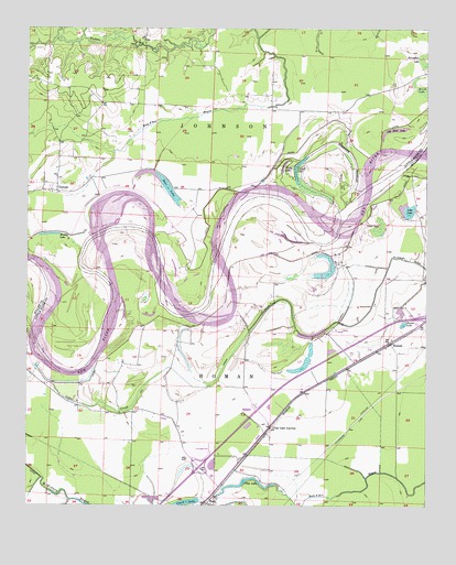
Homan, AR USGS Topographic Map
Click on map above to begin viewing in our Map Viewer.

This topographic map contains these locations and features:
Feature Name Type Latitude Longitude GNIS ID View Map
Bear LakeLakeN33.5844°W93.9583°74642View Map
Brush LakeSwampN33.6090°W93.8757°47050View Map
Cedar CreekStreamN33.5318°W93.9427°47588View Map
Clark LakeLakeN33.5010°W93.9502°74740View Map
Clear LakeLakeN33.5069°W93.9314°74741View Map
Clear Lake JunctionPopulated PlaceN33.5210°W93.9238°56961View Map
Cut-off LakeLakeN33.5902°W93.9146°74777View Map
Gillespie DitchCanalN33.5654°W93.8860°49421View Map
Harper LakeLakeN33.5479°W93.8823°74882View Map
HomanPopulated PlaceN33.5429°W93.8863°57062View Map
Homan DitchCanalN33.5448°W93.9316°50273View Map
Interchange 7CrossingN33.5104°W93.9460°75246View Map
Muddy LakeLakeN33.5711°W93.9931°75047View Map
Old River LakeLakeN33.5984°W93.8853°75054View Map
PaupPopulated PlaceN33.5021°W93.9427°57154View Map
Paup CemeteryCemeteryN33.5354°W93.9202°53230View Map
Silver LakeSwampN33.5732°W93.8894°54849View Map
TemplePopulated PlaceN33.5823°W93.9907°55486View Map
Tobe LakeLakeN33.5775°W93.8814°75172View Map
Township of HomanCivilN33.5422°W93.8819°68864View Map
Township of JohnsonCivilN33.5972°W93.9719°66839View Map
Young LakeLakeN33.5887°W93.9200°75237View Map

Note: Coordinates in the location and feature list above are referenced to NAD83 datum.


Copyright (C) 2008-2024 Ryan Niemi / Sunset Dynamics ... All Rights Reserved