TopoQuest Logo
Do you find TopoQuest useful?
Help keep TopoQuest running and adding new maps/features by donating!
Bitcoin:  19c7KJd3qBynnjoSw5npx9KScwjBe4ifkT
Litecoin:  LXs6TkuXGGXo1vDsWCkWVdjQX94eUKd6ui
Home View Maps Find Maps Find Places Resources & Links


Homer, Kansas Topographic Map

USGS Map Title: Homer, KS
USGS Map MRC: 38098G7
DRG (GeoTIFF) Download: o38098g7.tif


Neighboring USGS Topographic Map Quads:


  Russell NW, KS  
38098H8
 

  Russell, KS  
38098H7
 

  Dorrance NW, KS  
38098H6
 

  Russell SW, KS  
38098G8
 

  Homer, KS  
38098G7
 

  Dorrance SW, KS  
38098G6
 

  Galatia, KS  
38098F8
 

  Susank, KS  
38098F7
 

  Beaver, KS  
38098F6


Map MRC Location:

N39°
W99°
N39°
W98°
H8 H7 H6 H5 H4 H3 H2 H1
G8 G7 G6 G5 G4 G3 G2 G1
F8 F7 F6 F5 F4 F3 F2 F1
E8 E7 E6 E5 E4 E3 E2 E1
D8 D7 D6 D5 D4 D3 D2 D1
C8 C7 C6 C5 C4 C3 C2 C1
B8 B7 B6 B5 B4 B3 B2 B1
A8 A7 A6 A5 A4 A3 A2 A1
N38°
W99°
N38°
W98°

Homer, KS USGS 1:24K Topographic Map Preview:
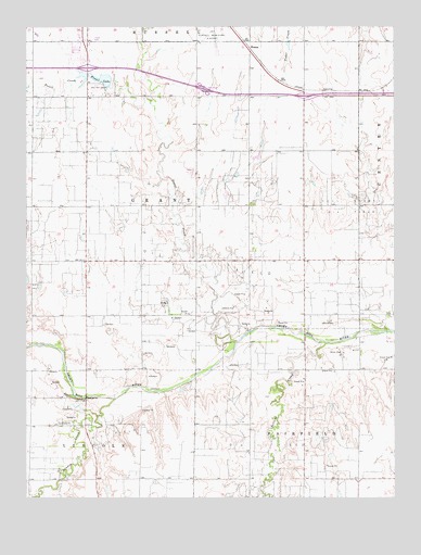
Homer, KS USGS Topographic Map
Click on map above to begin viewing in our Map Viewer.

This topographic map contains these locations and features:
Feature Name Type Latitude Longitude GNIS ID View Map
Bridge (historical)LocaleN38.7833°W98.8551°482560View Map
Dumler Mobile Home EstatesPopulated PlaceN38.8719°W98.8533°2694080View Map
El Privado Camping and Fishing LodgeLocaleN38.7810°W98.8657°2694453View Map
Ell-Saline Elementary SchoolSchoolN38.7770°W98.8606°480936View Map
Fossil CreekStreamN38.7914°W98.8037°475218View Map
Fossil Creek SchoolSchoolN38.8564°W98.8543°475316View Map
Fossil LakeReservoirN38.8613°W98.8509°475320View Map
Grant SchoolSchoolN38.8125°W98.8556°475314View Map
Hall Gurney Oil FieldOilfieldN38.8278°W98.7670°475317View Map
Hawley (historical)LocaleN38.7617°W98.7990°481897View Map
Hawley SchoolSchoolN38.7617°W98.8001°475312View Map
HomerPopulated PlaceN38.8695°W98.7976°484730View Map
Kansas Department of Transportation Russell County Rest AreaLocaleN38.8585°W98.8150°2692533View Map
Kansas Highway Patrol Troop D RussellBuildingN38.8714°W98.8589°2504135View Map
Kennebec (historical)LocaleN38.7686°W98.8559°482559View Map
Landon CreekStreamN38.7764°W98.8451°475318View Map
Oil Patch MuseumBuildingN38.8652°W98.8595°2694342View Map
Pioneer SchoolSchoolN38.8136°W98.7806°475313View Map
Russell Wastewater Treatment PlantLocaleN38.8746°W98.8415°2693556View Map
Sellens CreekStreamN38.7911°W98.7734°475319View Map
Township of GrantCivilN38.8285°W98.8477°475309View Map
Triple - J Camper ParkLocaleN38.8667°W98.8583°2694462View Map

Note: Coordinates in the location and feature list above are referenced to NAD83 datum.


Copyright (C) 2008-2024 Ryan Niemi / Sunset Dynamics ... All Rights Reserved