TopoQuest Logo
Do you find TopoQuest useful?
Help keep TopoQuest running and adding new maps/features by donating!
Bitcoin:  19c7KJd3qBynnjoSw5npx9KScwjBe4ifkT
Litecoin:  LXs6TkuXGGXo1vDsWCkWVdjQX94eUKd6ui
Home View Maps Find Maps Find Places Resources & Links


Bagby Hot Springs, Oregon Topographic Map

USGS Map Title: Bagby Hot Springs, OR
USGS Map MRC: 44122H2
DRG (GeoTIFF) Download: o44122h2.tif


Neighboring USGS Topographic Map Quads:


  Soosap Peak, OR  
45122A3
 

  Wanderers Peak, OR  
45122A2
 

  Fish Creek Mountain, OR  
45122A1
 

  Rooster Rock, OR  
44122H3
 

  Bagby Hot Springs, OR  
44122H2
 

  Bull of the Woods, OR  
44122H1
 

  Elkhorn, OR  
44122G3
 

  Battle Ax, OR  
44122G2
 

  Mother Lode Mountain, OR  
44122G1


Map MRC Location:

N45°
W123°
N45°
W122°
H8 H7 H6 H5 H4 H3 H2 H1
G8 G7 G6 G5 G4 G3 G2 G1
F8 F7 F6 F5 F4 F3 F2 F1
E8 E7 E6 E5 E4 E3 E2 E1
D8 D7 D6 D5 D4 D3 D2 D1
C8 C7 C6 C5 C4 C3 C2 C1
B8 B7 B6 B5 B4 B3 B2 B1
A8 A7 A6 A5 A4 A3 A2 A1
N44°
W123°
N44°
W122°

Bagby Hot Springs, OR USGS 1:24K Topographic Map Preview:
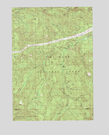
Bagby Hot Springs, OR USGS Topographic Map
Click on map above to begin viewing in our Map Viewer.

This topographic map contains these locations and features:
Feature Name Type Latitude Longitude GNIS ID View Map
Alice CreekStreamN44.9162°W122.1706°1157837View Map
Bagby Hot SpringsSpringN44.9356°W122.1739°1158908View Map
Bagby Hot Springs Guard StationLocaleN44.9357°W122.1737°1157839View Map
Bagby Hot Springs Recreation SiteLocaleN44.9351°W122.1740°1167097View Map
Bagby Natural Research AreaReserveN44.9379°W122.1717°1159327View Map
Baty ButteSummitN44.9960°W122.2012°1157841View Map
Baty Silver King TrailTrailN44.9271°W122.2479°1157842View Map
Betty CreekStreamN44.8976°W122.1509°1157843View Map
Blister CreekStreamN44.9571°W122.1562°1157844View Map
Doris CreekStreamN44.9154°W122.1690°1157847View Map
East Mountain TrailTrailN44.9951°W122.1729°1157850View Map
Hugh CreekStreamN44.9368°W122.2017°1157853View Map
Hugh Creek QuarryMineN44.9041°W122.2156°2754430View Map
Hughs Horse Gravel PitMineN44.9204°W122.1953°2754429View Map
Joyce LakeLakeN44.9451°W122.2488°1157878View Map
Lost Creek MeadowFlatN44.9832°W122.2159°1157855View Map
Molalla TrailTrailN44.9323°W122.1909°1157856View Map
Nohorn CreekStreamN44.9529°W122.1667°1157857View Map
Nohorn TrailTrailN44.9301°W122.2173°1157858View Map
Opal Creek WildernessReserveN44.8757°W122.2413°1987625View Map
Ora CreekStreamN44.9110°W122.1662°1157859View Map
Pal CreekStreamN44.9096°W122.1654°1157860View Map
Pansy CreekStreamN44.9621°W122.1440°1157861View Map
Peggy CreekStreamN44.9376°W122.1737°1738078View Map
Pegleg FallsFallsN44.9590°W122.1591°1157880View Map
Pegleg Falls Recreation SiteLocaleN44.9582°W122.1567°1157879View Map
Perry CreekStreamN44.9615°W122.1473°1157862View Map
Pin CreekStreamN44.9682°W122.1262°1157863View Map
Rock CreekStreamN44.9643°W122.1390°1157864View Map
Shower CreekStreamN44.9307°W122.1723°1157865View Map
Skin CreekStreamN44.9448°W122.1973°1157866View Map
Skookum LakeLakeN44.9976°W122.1641°1157867View Map
Skookum Lake CampgroundLocaleN44.9982°W122.1648°1157882View Map
South Fork Mountain TrailTrailN44.9698°W122.1945°1157869View Map
Spray CreekStreamN44.9260°W122.1712°1157870View Map
Stroupe CreekStreamN44.9696°W122.1720°1157871View Map
Stroupe Creek QuarryMineN44.9669°W122.1903°2754428View Map
Thunder MountainSummitN44.9915°W122.1673°1157873View Map
Whetstone CreekStreamN44.9015°W122.1670°1157875View Map
Whetstone TrailTrailN44.9012°W122.1873°1157876View Map

Note: Coordinates in the location and feature list above are referenced to NAD83 datum.


Copyright (C) 2008-2025 Ryan Niemi / Sunset Dynamics ... All Rights Reserved