TopoQuest Logo
Do you find TopoQuest useful?
Help keep TopoQuest running and adding new maps/features by donating!
Bitcoin:  19c7KJd3qBynnjoSw5npx9KScwjBe4ifkT
Litecoin:  LXs6TkuXGGXo1vDsWCkWVdjQX94eUKd6ui
Home View Maps Find Maps Find Places Resources & Links


Horseshoe Basin, Montana Topographic Map

USGS Map Title: Horseshoe Basin, MT
USGS Map MRC: 48105G8
DRG (GeoTIFF) Download: o48105g8.tif


Neighboring USGS Topographic Map Quads:


  Brockway Spring, MT  
48106H1
 

  Flaherty Coulee, MT  
48105H8
 

  Carbert, MT  
48105H7
 

  Richland, MT  
48106G1
 

  Horseshoe Basin, MT  
48105G8
 

  Peerless, MT  
48105G7
 

  Johnnys Hill, MT  
48106F1
 

  West Fork, MT  
48105F8
 

  West Fork NE, MT  
48105F7


Map MRC Location:

N49°
W106°
N49°
W105°
H8 H7 H6 H5 H4 H3 H2 H1
G8 G7 G6 G5 G4 G3 G2 G1
F8 F7 F6 F5 F4 F3 F2 F1
E8 E7 E6 E5 E4 E3 E2 E1
D8 D7 D6 D5 D4 D3 D2 D1
C8 C7 C6 C5 C4 C3 C2 C1
B8 B7 B6 B5 B4 B3 B2 B1
A8 A7 A6 A5 A4 A3 A2 A1
N48°
W106°
N48°
W105°

Horseshoe Basin, MT USGS 1:24K Topographic Map Preview:
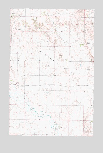
Horseshoe Basin, MT USGS Topographic Map
Click on map above to begin viewing in our Map Viewer.

This topographic map contains these locations and features:
Feature Name Type Latitude Longitude GNIS ID View Map
35N44E04ADCC01 WellWellN48.8175°W105.9608°1636695View Map
35N44E05CCDA01 WellWellN48.8103°W105.9945°1636658View Map
35N44E08BCDA01 WellWellN48.8039°W105.9956°1636627View Map
35N44E08BCDB01 WellWellN48.8034°W105.9958°1636622View Map
35N44E08BCDC01 WellWellN48.8025°W105.9958°1636616View Map
35N44E14AADB01 WellWellN48.7925°W105.9142°1636562View Map
35N44E24BABC01 WellWellN48.7792°W105.9070°1636500View Map
35N44E24BBAD01 WellWellN48.7789°W105.9067°1636497View Map
35N44E24BBDA01 WellWellN48.7786°W105.9070°1636496View Map
35N44E26BDCA01 WellWellN48.7597°W105.9272°1636399View Map
35N44E26BDCA02 WellWellN48.7600°W105.9272°1636404View Map
35N44E26BDCD01 WellWellN48.7595°W105.9270°1636396View Map
35N44E26BDDB01 WellWellN48.7597°W105.9261°1636398View Map
35N44E26BDDB02 WellWellN48.7600°W105.9267°1636403View Map
35N44E26BDDC01 WellWellN48.7597°W105.9258°1636397View Map
35N45E30ABBD01 WellWellN48.7636°W105.8770°1636419View Map
35N45E30ABCA01 WellWellN48.7645°W105.8770°1636421View Map
35N45E30BBBC01 WellWellN48.7647°W105.8892°1636424View Map
36N44E17CCAA01 WellWellN48.8700°W105.9953°1636875View Map
36N44E25DDDA01 WellWellN48.8395°W105.8906°1636783View Map
36N44E25DDDA02 WellWellN48.8395°W105.8908°1636784View Map
36N44E25DDDA03 WellWellN48.8392°W105.8911°1636780View Map
36N44E25DDDD02 WellWellN48.8386°W105.8903°1636777View Map
Blackhawk CouleeValleyN48.7697°W105.9614°768997View Map
Gregerson HillSummitN48.8531°W105.8908°771986View Map
Horseshoe BasinBasinN48.8231°W105.9328°772567View Map

Note: Coordinates in the location and feature list above are referenced to NAD83 datum.


Copyright (C) 2008-2025 Ryan Niemi / Sunset Dynamics ... All Rights Reserved