TopoQuest Logo
Do you find TopoQuest useful?
Help keep TopoQuest running and adding new maps/features by donating!
Bitcoin:  19c7KJd3qBynnjoSw5npx9KScwjBe4ifkT
Litecoin:  LXs6TkuXGGXo1vDsWCkWVdjQX94eUKd6ui
Home View Maps Find Maps Find Places Resources & Links


Hovland, Minnesota Topographic Map

USGS Map Title: Hovland, MN
USGS Map MRC: 47089G8
DRG (GeoTIFF) Download: o47089g8.tif


Neighboring USGS Topographic Map Quads:


  Tom Lake, MN  
47090H1
 

  Farquhar Peak, MN  
47089H8
 

  Mineral Center, MN  
47089H7
 

  Marr Island, MN  
47090G1
 

  Hovland, MN  
47089G8


Map MRC Location:

N48°
W90°
N48°
W89°
H8 H7 H6 H5 H4 H3 H2 H1
G8 G7 G6 G5 G4 G3 G2 G1
F8 F7 F6 F5 F4 F3 F2 F1
E8 E7 E6 E5 E4 E3 E2 E1
D8 D7 D6 D5 D4 D3 D2 D1
C8 C7 C6 C5 C4 C3 C2 C1
B8 B7 B6 B5 B4 B3 B2 B1
A8 A7 A6 A5 A4 A3 A2 A1
N47°
W90°
N47°
W89°

Hovland, MN USGS 1:24K Topographic Map Preview:
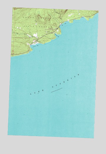
Hovland, MN USGS Topographic Map
Click on map above to begin viewing in our Map Viewer.

This topographic map contains these locations and features:
Feature Name Type Latitude Longitude GNIS ID View Map
Big BayBayN47.8596°W89.9248°655355View Map
Carlson CreekStreamN47.8613°W89.9254°655646View Map
Chicago BayBayN47.8379°W89.9637°655707View Map
Flute Reed RiverStreamN47.8388°W89.9662°656277View Map
Flute Reed River Wayside ParkParkN47.8444°W89.9639°2073037View Map
Horseshoe BayBayN47.8491°W89.9351°656646View Map
HovlandPopulated PlaceN47.8388°W89.9720°656669View Map
Hovland Recreation SiteLocaleN47.8541°W89.9626°659116View Map
Hovland Rest AreaLocaleN47.8529°W89.9634°659117View Map
Hovland Volunteer Fire DepartmentBuildingN47.8455°W89.9602°2666249View Map
Old Settlers CemeteryCemeteryN47.8453°W89.9622°2072908View Map
Otis CreekStreamN47.8445°W89.9422°2567592View Map
Trinity Lutheran ChurchChurchN47.8411°W89.9683°2072949View Map

Note: Coordinates in the location and feature list above are referenced to NAD83 datum.


Copyright (C) 2008-2025 Ryan Niemi / Sunset Dynamics ... All Rights Reserved