TopoQuest Logo
Do you find TopoQuest useful?
Help keep TopoQuest running and adding new maps/features by donating!
Bitcoin:  19c7KJd3qBynnjoSw5npx9KScwjBe4ifkT
Litecoin:  LXs6TkuXGGXo1vDsWCkWVdjQX94eUKd6ui
Home View Maps Find Maps Find Places Resources & Links


Howard Lake, Arizona Topographic Map

USGS Map Title: Howard Lake, AZ
USGS Map MRC: 35112E2
DRG (GeoTIFF) Download: o35112e2.tif


Neighboring USGS Topographic Map Quads:


  Miller Tank, AZ  
35112F3
 

  Valle Tank, AZ  
35112F2
 

  Molly Ann Draw, AZ  
35112F1
 

  Mixon Tank, AZ  
35112E3
 

  Howard Lake, AZ  
35112E2
 

  Hobble Tank, AZ  
35112E1
 

  Cataract Tank, AZ  
35112D3
 

  Howard Mesa, AZ  
35112D2
 

  Squaw Mountain, AZ  
35112D1


Map MRC Location:

N36°
W113°
N36°
W112°
H8 H7 H6 H5 H4 H3 H2 H1
G8 G7 G6 G5 G4 G3 G2 G1
F8 F7 F6 F5 F4 F3 F2 F1
E8 E7 E6 E5 E4 E3 E2 E1
D8 D7 D6 D5 D4 D3 D2 D1
C8 C7 C6 C5 C4 C3 C2 C1
B8 B7 B6 B5 B4 B3 B2 B1
A8 A7 A6 A5 A4 A3 A2 A1
N35°
W113°
N35°
W112°

Howard Lake, AZ USGS 1:24K Topographic Map Preview:
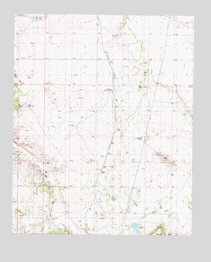
Howard Lake, AZ USGS Topographic Map
Click on map above to begin viewing in our Map Viewer.

This topographic map contains these locations and features:
Feature Name Type Latitude Longitude GNIS ID View Map
Burro TankReservoirN35.5328°W112.2284°27054View Map
Cataract Pumping StationLocaleN35.5250°W112.1666°37704View Map
Cow TankReservoirN35.5344°W112.1416°28095View Map
Eighteen TankReservoirN35.5092°W112.1864°28826View Map
Four HillsSummitN35.5892°W112.2496°29143View Map
Hill TankReservoirN35.5625°W112.2085°29987View Map
Horse TankReservoirN35.5355°W112.2260°30174View Map
Howard LakeLakeN35.5039°W112.1644°30251View Map
La Mesa TankReservoirN35.5125°W112.1536°30829View Map
Mud TankReservoirN35.5592°W112.1785°32145View Map
Mule TankReservoirN35.5405°W112.2275°32175View Map
North TankReservoirN35.5845°W112.1612°32401View Map
Oliver TankReservoirN35.5722°W112.2404°32525View Map
QuiveroPopulated PlaceN35.5325°W112.1907°33295View Map
Quivero Railroad StationBuildingN35.5353°W112.1724°38019View Map
Railroad TankReservoirN35.5821°W112.1827°33334View Map
Red Hill TankReservoirN35.5543°W112.1611°33456View Map
Selman TankReservoirN35.5199°W112.1787°34259View Map
Tom TankReservoirN35.5177°W112.2239°35360View Map
Twentyeight TankReservoirN35.6129°W112.1792°35603View Map
Twentyfour TankReservoirN35.6222°W112.2362°35604View Map
Valle Census Designated PlaceCensusN35.6245°W112.1350°2582888View Map

Note: Coordinates in the location and feature list above are referenced to NAD83 datum.


Copyright (C) 2008-2025 Ryan Niemi / Sunset Dynamics ... All Rights Reserved