TopoQuest Logo
Do you find TopoQuest useful?
Help keep TopoQuest running and adding new maps/features by donating!
Bitcoin:  19c7KJd3qBynnjoSw5npx9KScwjBe4ifkT
Litecoin:  LXs6TkuXGGXo1vDsWCkWVdjQX94eUKd6ui
Home View Maps Find Maps Find Places Resources & Links


Hualapai Peak, Arizona Topographic Map

USGS Map Title: Hualapai Peak, AZ
USGS Map MRC: 35113A8
DRG (GeoTIFF) Download: o35113a8.tif


Neighboring USGS Topographic Map Quads:


  Kingman, AZ  
35114B1
 

  Rattlesnake Hill, AZ  
35113B8
 

  Hualapai Spring, AZ  
35113B7
 

  Kingman SE, AZ  
35114A1
 

  Hualapai Peak, AZ  
35113A8
 

  Dean Peak, AZ  
35113A7
 

  Yucca NE, AZ  
34114H1
 

  Wabayuma Peak, AZ  
34113H8
 

  Hibernia Peak, AZ  
34113H7


Map MRC Location:

N36°
W114°
N36°
W113°
H8 H7 H6 H5 H4 H3 H2 H1
G8 G7 G6 G5 G4 G3 G2 G1
F8 F7 F6 F5 F4 F3 F2 F1
E8 E7 E6 E5 E4 E3 E2 E1
D8 D7 D6 D5 D4 D3 D2 D1
C8 C7 C6 C5 C4 C3 C2 C1
B8 B7 B6 B5 B4 B3 B2 B1
A8 A7 A6 A5 A4 A3 A2 A1
N35°
W114°
N35°
W113°

Hualapai Peak, AZ USGS 1:24K Topographic Map Preview:
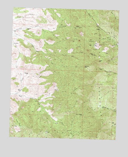
Hualapai Peak, AZ USGS Topographic Map
Click on map above to begin viewing in our Map Viewer.

This topographic map contains these locations and features:
Feature Name Type Latitude Longitude GNIS ID View Map
Black Inky SpringSpringN35.0616°W113.9806°1536View Map
Camp Levi LeviLocaleN35.0900°W113.9041°2407View Map
Camp StephensLocaleN35.1056°W113.8983°2409View Map
Cedar SpringSpringN35.0158°W113.8786°2650View Map
Cottonwood SpringSpringN35.1048°W113.9836°3376View Map
Flag MineMineN35.0778°W113.8838°4654View Map
Grande SpringSpringN35.0904°W113.9990°5228View Map
Hayden PeakSummitN35.0811°W113.9049°5649View Map
Horse CanyonValleyN35.0342°W113.9663°5956View Map
Hualapai Mountain County ParkParkN35.0892°W113.8983°6082View Map
Hualapai PeakSummitN35.0750°W113.9008°6084View Map
KGMN-FM (Kingman)TowerN35.1103°W113.8827°45195View Map
KZZZ-FM (Kingman)TowerN35.1111°W113.8863°45196View Map
Pine Lake Volunteer Fire DepartmentBuildingN35.0928°W113.8752°2672666View Map
Potato PatchAreaN35.0906°W113.9069°9688View Map
Tin Barn WellWellN35.0061°W113.9563°12473View Map
Upper Moss SpringSpringN35.0306°W113.8927°13108View Map
Walnut Creek Mine SpringSpringN35.0229°W113.9160°13312View Map
Whiskey BasinBasinN35.0133°W113.9905°13587View Map
Whiskey SpringSpringN35.1084°W113.9257°13593View Map
Wild Cow SpringSpringN35.0669°W113.8941°13757View Map
Willow CreekStreamN35.0411°W113.9947°13828View Map
Willow SpringSpringN35.0450°W113.9891°13849View Map
Yellow Flower SpringSpringN35.0697°W113.9149°14054View Map

Note: Coordinates in the location and feature list above are referenced to NAD83 datum.


Copyright (C) 2008-2025 Ryan Niemi / Sunset Dynamics ... All Rights Reserved