TopoQuest Logo
Do you find TopoQuest useful?
Help keep TopoQuest running and adding new maps/features by donating!
Bitcoin:  19c7KJd3qBynnjoSw5npx9KScwjBe4ifkT
Litecoin:  LXs6TkuXGGXo1vDsWCkWVdjQX94eUKd6ui
Home View Maps Find Maps Find Places Resources & Links


Hudgins, Kentucky Topographic Map

USGS Map Title: Hudgins, KY
USGS Map MRC: 37085C6
DRG (GeoTIFF) Download: o37085c6.tif


Neighboring USGS Topographic Map Quads:


  Hammonville, KY  
37085D7
 

  Magnolia, KY  
37085D6
 

  Hibernia, KY  
37085D5
 

  Canmer, KY  
37085C7
 

  Hudgins, KY  
37085C6
 

  Summersville, KY  
37085C5
 

  Park, KY  
37085B7
 

  Center, KY  
37085B6
 

  Exie, KY  
37085B5


Map MRC Location:

N38°
W86°
N38°
W85°
H8 H7 H6 H5 H4 H3 H2 H1
G8 G7 G6 G5 G4 G3 G2 G1
F8 F7 F6 F5 F4 F3 F2 F1
E8 E7 E6 E5 E4 E3 E2 E1
D8 D7 D6 D5 D4 D3 D2 D1
C8 C7 C6 C5 C4 C3 C2 C1
B8 B7 B6 B5 B4 B3 B2 B1
A8 A7 A6 A5 A4 A3 A2 A1
N37°
W86°
N37°
W85°

Hudgins, KY USGS 1:24K Topographic Map Preview:
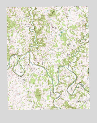
Hudgins, KY USGS Topographic Map
Click on map above to begin viewing in our Map Viewer.

This topographic map contains these locations and features:
Feature Name Type Latitude Longitude GNIS ID View Map
Aetna Grove ChurchChurchN37.3159°W85.6575°485787View Map
Akin CemeteryCemeteryN37.3389°W85.6914°485810View Map
Akin KnobSummitN37.3645°W85.6827°485811View Map
Armour IslandIslandN37.3042°W85.7483°486035View Map
Bayles PondLakeN37.3435°W85.6664°486486View Map
Bell CliffCliffN37.3162°W85.7433°486791View Map
Bells KnobSummitN37.3258°W85.7418°2742508View Map
Big Brush CreekStreamN37.2998°W85.6575°487146View Map
Caven BendBendN37.2876°W85.6614°489144View Map
Caven CemeteryCemeteryN37.2889°W85.6561°489146View Map
Charlie Rhea BendBendN37.2723°W85.6308°489371View Map
Charlie Rhea IslandIslandN37.2806°W85.6372°489372View Map
Conyers CemeteryCemeteryN37.2520°W85.7116°489992View Map
Curry CemeteryCemeteryN37.3448°W85.6714°490502View Map
Davis BendBendN37.3026°W85.7144°490629View Map
Davis CemeteryCemeteryN37.2745°W85.6733°490647View Map
Davis CemeteryCemeteryN37.2967°W85.6997°490648View Map
Davis CemeteryCemeteryN37.2984°W85.7075°490649View Map
Deer PondLakeN37.3691°W85.6539°490760View Map
DefriesPopulated PlaceN37.2684°W85.6847°507838View Map
Dobson CemeteryCemeteryN37.3620°W85.7219°490941View Map
Dobson PondLakeN37.3394°W85.6682°490942View Map
Edwards CemeteryCemeteryN37.3512°W85.7150°491579View Map
EvePopulated PlaceN37.3112°W85.6786°507959View Map
Figett BendBendN37.3051°W85.7427°492073View Map
Garvin CemeteryCemeteryN37.2898°W85.7322°492737View Map
Glen BrookStreamN37.3168°W85.7355°2742509View Map
Graham CemeteryCemeteryN37.3331°W85.6397°493079View Map
Halltown CemeteryCemeteryN37.2584°W85.7202°493606View Map
Hamilton CemeteryCemeteryN37.2717°W85.7205°493616View Map
Hay CemeteryCemeteryN37.2606°W85.6291°493900View Map
Hoffman CemeteryCemeteryN37.2814°W85.7275°494339View Map
Holly BranchStreamN37.3678°W85.6769°494404View Map
Holly Grove CemeteryCemeteryN37.3749°W85.6450°494408View Map
Holly Grove ChurchChurchN37.3745°W85.6441°494409View Map
Hopewell Cumberland Presbyterian ChurchChurchN37.2856°W85.7253°494527View Map
HudginsPopulated PlaceN37.3487°W85.6805°508288View Map
Jaggers CemeteryCemeteryN37.3737°W85.7411°495141View Map
Kessler CemeteryCemeteryN37.3523°W85.7011°495694View Map
Knoxes Creek Baptist ChurchChurchN37.3332°W85.7451°495860View Map
Little Barren RiverStreamN37.2776°W85.6789°496604View Map
Little Brush CreekStreamN37.3342°W85.6316°496646View Map
LobbPopulated PlaceN37.3459°W85.6450°508482View Map
Lobb BendBendN37.2767°W85.6505°496922View Map
Lynn Camp CreekStreamN37.3198°W85.7150°497374View Map
Marcum CemeteryCemeteryN37.3609°W85.6266°497530View Map
Maxey KnobSummitN37.2670°W85.7027°497693View Map
McCubbin CemeteryCemeteryN37.3356°W85.7136°497826View Map
Mitchell CemeteryCemeteryN37.2556°W85.6727°498447View Map
Montgomery CemeteryCemeteryN37.2751°W85.6400°498502View Map
Mount Gilboa Baptist ChurchChurchN37.2601°W85.7168°498726View Map
New Salem SchoolSchoolN37.2592°W85.6397°499399View Map
Oak Grove SchoolSchoolN37.3284°W85.6539°499697View Map
Old Salem ChurchChurchN37.2723°W85.6658°499882View Map
Patton CemeteryCemeteryN37.3212°W85.6291°500261View Map
Perkins CemeteryCemeteryN37.3634°W85.7152°500412View Map
Powder MillPopulated PlaceN37.3470°W85.7133°508867View Map
Puckett KnobSummitN37.3641°W85.6933°501415View Map
Raffety CemeteryCemeteryN37.3676°W85.6613°501520View Map
Reynolds CemeteryCemeteryN37.3628°W85.6569°501746View Map
Rock Lick BranchStreamN37.3523°W85.6266°502130View Map
Round BottomBendN37.2970°W85.7330°502395View Map
Rountree CemeteryCemeteryN37.2926°W85.6966°502417View Map
Scott BendBendN37.2892°W85.6783°503077View Map
Scott CemeteryCemeteryN37.3534°W85.6411°503092View Map
Sidebottom CemeteryCemeteryN37.2995°W85.6491°503486View Map
Sidebottom IslandIslandN37.2842°W85.6475°503487View Map
Sims CemeteryCemeteryN37.3050°W85.7214°503546View Map
The NarrowsGapN37.3089°W85.7330°505136View Map
Three Hundred SpringsSpringN37.2908°W85.7307°505234View Map
Vance CemeteryCemeteryN37.2917°W85.6691°505965View Map
Vance CemeteryCemeteryN37.3128°W85.6758°505966View Map
Vance IslandIslandN37.2923°W85.6725°505971View Map
Wheeler CemeteryCemeteryN37.2870°W85.7272°506531View Map
Wheeler CemeteryCemeteryN37.3109°W85.7186°506533View Map
Whitlow CemeteryCemeteryN37.3734°W85.7025°506692View Map
Williams CemeteryCemeteryN37.3162°W85.7291°506798View Map
Wright CemeteryCemeteryN37.3095°W85.7072°507162View Map

Note: Coordinates in the location and feature list above are referenced to NAD83 datum.


Copyright (C) 2008-2025 Ryan Niemi / Sunset Dynamics ... All Rights Reserved