TopoQuest Logo
Do you find TopoQuest useful?
Help keep TopoQuest running and adding new maps/features by donating!
Bitcoin:  19c7KJd3qBynnjoSw5npx9KScwjBe4ifkT
Litecoin:  LXs6TkuXGGXo1vDsWCkWVdjQX94eUKd6ui
Home View Maps Find Maps Find Places Resources & Links


Hughesville, Missouri Topographic Map

USGS Map Title: Hughesville, MO
USGS Map MRC: 38093G3
DRG (GeoTIFF) Download: o38093g3.tif


Neighboring USGS Topographic Map Quads:


  Sweet Springs, MO  
38093H4
 

  Houstonia, MO  
38093H3
 

  Longwood, MO  
38093H2
 

  La Monte, MO  
38093G4
 

  Hughesville, MO  
38093G3
 

  Beaman, MO  
38093G2
 

  Green Ridge North, MO  
38093F4
 

  Sedalia West, MO  
38093F3
 

  Sedalia East, MO  
38093F2


Map MRC Location:

N39°
W94°
N39°
W93°
H8 H7 H6 H5 H4 H3 H2 H1
G8 G7 G6 G5 G4 G3 G2 G1
F8 F7 F6 F5 F4 F3 F2 F1
E8 E7 E6 E5 E4 E3 E2 E1
D8 D7 D6 D5 D4 D3 D2 D1
C8 C7 C6 C5 C4 C3 C2 C1
B8 B7 B6 B5 B4 B3 B2 B1
A8 A7 A6 A5 A4 A3 A2 A1
N38°
W94°
N38°
W93°

Hughesville, MO USGS 1:24K Topographic Map Preview:
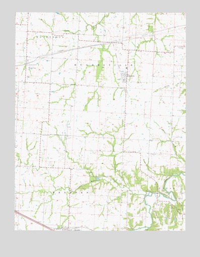
Hughesville, MO USGS Topographic Map
Click on map above to begin viewing in our Map Viewer.

This topographic map contains these locations and features:
Feature Name Type Latitude Longitude GNIS ID View Map
Bethel ChurchChurchN38.7942°W93.2755°714060View Map
Brushy CreekStreamN38.7741°W93.2915°714888View Map
Brushy CreekStreamN38.7517°W93.2767°714898View Map
CraftLocaleN38.7936°W93.2847°741690View Map
DresdenPopulated PlaceN38.7511°W93.3349°717048View Map
High Point CemeteryCemeteryN38.8550°W93.2508°719537View Map
HughesvillePopulated PlaceN38.8386°W93.2955°719978View Map
Hughesville Community Fire DepartmentBuildingN38.8390°W93.2940°2621501View Map
Hughesville Post OfficePost OfficeN38.8367°W93.2958°2782891View Map
Hughesville SchoolSchoolN38.8253°W93.2947°741692View Map
Little Muddy CreekStreamN38.7725°W93.2772°721275View Map
Northwest High SchoolSchoolN38.8433°W93.2934°2545452View Map
Prairie Hill Church (historical)ChurchN38.8042°W93.3558°741694View Map
Prairie Hill Presbyterian CemeteryCemeteryN38.8050°W93.3555°724854View Map
Prairie Hill School (historical)SchoolN38.7861°W93.3447°741693View Map
Smelser SchoolSchoolN38.7920°W93.2560°741691View Map
Township of DresdenCivilN38.7604°W93.3349°767162View Map
Township of HughesvilleCivilN38.8390°W93.2922°767168View Map
Village of HughesvilleCivilN38.8369°W93.2952°2398557View Map
Walnut Grove SchoolSchoolN38.7667°W93.2980°741689View Map

Note: Coordinates in the location and feature list above are referenced to NAD83 datum.


Copyright (C) 2008-2025 Ryan Niemi / Sunset Dynamics ... All Rights Reserved