TopoQuest Logo
Do you find TopoQuest useful?
Help keep TopoQuest running and adding new maps/features by donating!
Bitcoin:  19c7KJd3qBynnjoSw5npx9KScwjBe4ifkT
Litecoin:  LXs6TkuXGGXo1vDsWCkWVdjQX94eUKd6ui
Home View Maps Find Maps Find Places Resources & Links


Humboldt SW, Nebraska Topographic Map

USGS Map Title: Humboldt SW, NE
USGS Map MRC: 40095A8
DRG (GeoTIFF) Download: o40095a8.tif


Neighboring USGS Topographic Map Quads:


  Table Rock, NE  
40096B1
 

  Humboldt, NE  
40095B8
 

  Dawson, NE  
40095B7
 

  Du Bois, NE  
40096A1
 

  Humboldt SW, NE  
40095A8
 

  Humboldt SE, NE  
40095A7
 

  Saint Benedict, KS  
39096H1
 

  Bern, KS  
39095H8
 

  Sabetha, KS  
39095H7


Map MRC Location:

N41°
W96°
N41°
W95°
H8 H7 H6 H5 H4 H3 H2 H1
G8 G7 G6 G5 G4 G3 G2 G1
F8 F7 F6 F5 F4 F3 F2 F1
E8 E7 E6 E5 E4 E3 E2 E1
D8 D7 D6 D5 D4 D3 D2 D1
C8 C7 C6 C5 C4 C3 C2 C1
B8 B7 B6 B5 B4 B3 B2 B1
A8 A7 A6 A5 A4 A3 A2 A1
N40°
W96°
N40°
W95°

Humboldt SW, NE USGS 1:24K Topographic Map Preview:
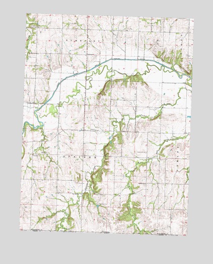
Humboldt SW, NE USGS Topographic Map
Click on map above to begin viewing in our Map Viewer.

This topographic map contains these locations and features:
Feature Name Type Latitude Longitude GNIS ID View Map
Abel LakeReservoirN40.0158°W95.9432°1767849View Map
Athens (historical)Populated PlaceN40.0444°W95.9864°1883540View Map
Athens CemeteryCemeteryN40.0450°W95.9855°827102View Map
Athens Post Office (historical)Post OfficeN40.0444°W95.9864°1883542View Map
Athens SchoolSchoolN40.0433°W95.9917°827103View Map
Bohemian CemeteryCemeteryN40.1175°W95.9958°827543View Map
Boy-Scouts of America Detention DamDamN40.0165°W95.9440°1767848View Map
Cornhusker CampLocaleN40.0169°W95.9419°828348View Map
Dorland DamDamN40.0683°W95.8753°1767856View Map
Dorland ReservoirReservoirN40.0683°W95.8753°1767857View Map
Dry Branch SchoolSchoolN40.1019°W95.9922°828785View Map
Four Mile Creek State Wildlife Management AreaParkN40.0417°W95.9358°1883550View Map
Fourmile ChurchChurchN40.0589°W95.9464°829370View Map
Kinters Ford State Wildlife Management AreaParkN40.0583°W95.9961°1883549View Map
Middleburg SchoolSchoolN40.0294°W95.9075°831274View Map
Middleburgh Post Office (historical)Post OfficeN40.0292°W95.9072°1883522View Map
Pleasant Hill CemeteryCemeteryN40.0472°W95.9078°832167View Map
Rose Dale SchoolSchoolN40.1025°W95.9544°832686View Map
Speiser Election PrecinctCivilN40.0442°W95.9539°1929303View Map
Spring CreekStreamN40.0358°W95.8767°833705View Map
Township of SpeiserCivilN40.0417°W95.9586°1883490View Map
Union Dale SchoolSchoolN40.0733°W95.9922°834274View Map
Union Hill SchoolSchoolN40.0169°W95.9419°834275View Map

Note: Coordinates in the location and feature list above are referenced to NAD83 datum.


Copyright (C) 2008-2024 Ryan Niemi / Sunset Dynamics ... All Rights Reserved