TopoQuest Logo
Do you find TopoQuest useful?
Help keep TopoQuest running and adding new maps/features by donating!
Bitcoin:  19c7KJd3qBynnjoSw5npx9KScwjBe4ifkT
Litecoin:  LXs6TkuXGGXo1vDsWCkWVdjQX94eUKd6ui
Home View Maps Find Maps Find Places Resources & Links


Bain Draw, Wyoming Topographic Map

USGS Map Title: Bain Draw, WY
USGS Map MRC: 43109E4
DRG (GeoTIFF) Download: o43109e4.tif


Neighboring USGS Topographic Map Quads:


  Indian Point, WY  
43109F5
 

  Castle Rock, WY  
43109F4
 

  East Fork Basin, WY  
43109F3
 

  Mason Draw, WY  
43109E5
 

  Bain Draw, WY  
43109E4
 

  Crow Mountain, WY  
43109E3
 

  Torrey Lake, WY  
43109D5
 

  Blue Holes, WY  
43109D4
 

  Wilderness, WY  
43109D3


Map MRC Location:

N44°
W110°
N44°
W109°
H8 H7 H6 H5 H4 H3 H2 H1
G8 G7 G6 G5 G4 G3 G2 G1
F8 F7 F6 F5 F4 F3 F2 F1
E8 E7 E6 E5 E4 E3 E2 E1
D8 D7 D6 D5 D4 D3 D2 D1
C8 C7 C6 C5 C4 C3 C2 C1
B8 B7 B6 B5 B4 B3 B2 B1
A8 A7 A6 A5 A4 A3 A2 A1
N43°
W110°
N43°
W109°

Bain Draw, WY USGS 1:24K Topographic Map Preview:
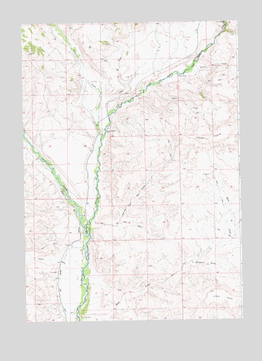
Bain Draw, WY USGS Topographic Map
Click on map above to begin viewing in our Map Viewer.

This topographic map contains these locations and features:
Feature Name Type Latitude Longitude GNIS ID View Map
Abernathy Deposit Number Four MineMineN43.6133°W109.3804°1704398View Map
Abernathy Deposit Number Three MineMineN43.5991°W109.4001°1704397View Map
Bain DrawValleyN43.5022°W109.4701°1585056View Map
Bain PlacePopulated PlaceN43.5013°W109.4663°1597210View Map
Bear CreekStreamN43.5772°W109.4546°1597997View Map
Bitterroot Number 1 DamDamN43.6166°W109.4007°1608442View Map
Bitterroot Number 1 ReservoirReservoirN43.6166°W109.4007°1608443View Map
Circle DitchCanalN43.5297°W109.4757°1604374View Map
Double Diamond Number 1 ReservoirReservoirN43.6183°W109.4040°1608119View Map
Double Diamond Number 1 Reservoir DamDamN43.6183°W109.4040°1608118View Map
Double Diamond RanchLocaleN43.5791°W109.4529°1587734View Map
Finley RanchLocaleN43.6025°W109.4090°1588471View Map
Harvey DrawValleyN43.5408°W109.4618°1589357View Map
Horse DrawValleyN43.6250°W109.4799°1589700View Map
Lake DrawValleyN43.6075°W109.4440°1590473View Map
Lower TableSummitN43.5113°W109.3913°1591100View Map
Pease DrawValleyN43.5163°W109.4679°1602072View Map
Spear CreekStreamN43.5983°W109.4265°1594764View Map
Spring CreekStreamN43.6038°W109.4054°1594879View Map
Upper TableSummitN43.5755°W109.3946°1595886View Map
Wiggins ForkStreamN43.5369°W109.4649°1604164View Map
Windmill DrawValleyN43.5244°W109.4035°1596520View Map

Note: Coordinates in the location and feature list above are referenced to NAD83 datum.


Copyright (C) 2008-2025 Ryan Niemi / Sunset Dynamics ... All Rights Reserved