TopoQuest Logo
Do you find TopoQuest useful?
Help keep TopoQuest running and adding new maps/features by donating!
Bitcoin:  19c7KJd3qBynnjoSw5npx9KScwjBe4ifkT
Litecoin:  LXs6TkuXGGXo1vDsWCkWVdjQX94eUKd6ui
Home View Maps Find Maps Find Places Resources & Links


Hurley West, New Mexico Topographic Map

USGS Map Title: Hurley West, NM
USGS Map MRC: 32108F2
DRG (GeoTIFF) Download: o32108f2.tif


Neighboring USGS Topographic Map Quads:


  Silver City, NM  
32108G3
 

  Fort Bayard, NM  
32108G2
 

  Santa Rita Mine, NM  
32108G1
 

  Tyrone, NM  
32108F3
 

  Hurley West, NM  
32108F2
 

  Hurley East, NM  
32108F1
 

  White Signal, NM  
32108E3
 

  Whitewater, NM  
32108E2
 

  Faywood Station, NM  
32108E1


Map MRC Location:

N33°
W109°
N33°
W108°
H8 H7 H6 H5 H4 H3 H2 H1
G8 G7 G6 G5 G4 G3 G2 G1
F8 F7 F6 F5 F4 F3 F2 F1
E8 E7 E6 E5 E4 E3 E2 E1
D8 D7 D6 D5 D4 D3 D2 D1
C8 C7 C6 C5 C4 C3 C2 C1
B8 B7 B6 B5 B4 B3 B2 B1
A8 A7 A6 A5 A4 A3 A2 A1
N32°
W109°
N32°
W108°

Hurley West, NM USGS 1:24K Topographic Map Preview:
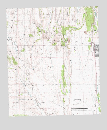
Hurley West, NM USGS Topographic Map
Click on map above to begin viewing in our Map Viewer.

This topographic map contains these locations and features:
Feature Name Type Latitude Longitude GNIS ID View Map
00335 Water WellWellN32.7390°W108.1267°918807View Map
00340 Water WellWellN32.7281°W108.1306°918814View Map
00345 Water WellWellN32.7176°W108.1275°919745View Map
00407 Water WellWellN32.7354°W108.1667°919750View Map
00411 Water WellWellN32.7223°W108.1328°918812View Map
00412 Water WellWellN32.7198°W108.1334°919748View Map
00414 Water WellWellN32.7179°W108.2081°919746View Map
00449 Water WellWellN32.7356°W108.2442°919751View Map
00734 Water WellWellN32.6454°W108.1295°919218View Map
00736 Water WellWellN32.6437°W108.1284°919216View Map
00759 Water WellWellN32.6876°W108.2328°919209View Map
00775 Water WellWellN32.6456°W108.1398°919219View Map
00791 Water WellWellN32.6851°W108.2489°919207View Map
10024 Water WellWellN32.7492°W108.1520°919758View Map
10029 Water WellWellN32.7365°W108.1714°919753View Map
10030 Water WellWellN32.7365°W108.1673°919752View Map
Apache TejoWellN32.6465°W108.1287°900231View Map
Ben Hur MineMineN32.7001°W108.1600°914923View Map
Eighty Four MineMineN32.7004°W108.1770°914953View Map
G 773 Water WellWellN32.6398°W108.2081°918832View Map
G 778 Water WellWellN32.6304°W108.1592°918831View Map
G 790 Water WellWellN32.6856°W108.2487°918819View Map
Grant County AirportAirportN32.6366°W108.1567°937026View Map
Home Ticket MineMineN32.7004°W108.1770°914978View Map
HurleyPopulated PlaceN32.6992°W108.1320°920614View Map
Hurley CemeteryCemeteryN32.6887°W108.1370°890272View Map
Hurley Elementary SchoolSchoolN32.7129°W108.1320°901442View Map
Hurley Fire DepartmentBuildingN32.6973°W108.1286°2658018View Map
Hurley Post OfficePost OfficeN32.6988°W108.1264°2781532View Map
Hurley Town Police DepartmentBuildingN32.6993°W108.1268°2722516View Map
Infant Jesus ParishChurchN32.6992°W108.1320°920403View Map
Joe MineMineN32.7265°W108.2092°939502View Map
Lone MountainSummitN32.7156°W108.1973°891271View Map
Maudes CanyonValleyN32.7142°W108.2445°908466View Map
Monarch MineMineN32.7004°W108.1770°914850View Map
New York MineMineN32.7004°W108.1770°914859View Map
Newton (historical)Populated PlaceN32.7156°W108.1973°919879View Map
North HurleyPopulated PlaceN32.7229°W108.1325°900248View Map
North Hurley Census Designated PlaceCensusN32.7199°W108.1285°2584165View Map
Pipe Line DrawValleyN32.6554°W108.2234°900193View Map
Rio de ArenasStreamN32.6712°W108.2192°910225View Map
San Vincente (historical)LocaleN32.6412°W108.2081°900195View Map
Sweet Home MineMineN32.7265°W108.2092°939503View Map
Town of HurleyCivilN32.6982°W108.1321°2412784View Map
Twin Sisters CreekStreamN32.7434°W108.1528°911936View Map

Note: Coordinates in the location and feature list above are referenced to NAD83 datum.


Copyright (C) 2008-2024 Ryan Niemi / Sunset Dynamics ... All Rights Reserved