TopoQuest Logo
Do you find TopoQuest useful?
Help keep TopoQuest running and adding new maps/features by donating!
Bitcoin:  19c7KJd3qBynnjoSw5npx9KScwjBe4ifkT
Litecoin:  LXs6TkuXGGXo1vDsWCkWVdjQX94eUKd6ui
Home View Maps Find Maps Find Places Resources & Links


Huron, South Dakota Topographic Map

USGS Map Title: Huron, SD
USGS Map MRC: 44098C2
DRG (GeoTIFF) Download: o44098c2.tif


Neighboring USGS Topographic Map Quads:


  Broadland, SD  
44098D3
 

  Huron NW, SD  
44098D2
 

  Huron NE, SD  
44098D1
 

  Wolsey SE, SD  
44098C3
 

  Huron, SD  
44098C2
 

  Cavour, SD  
44098C1
 

  Alpena, SD  
44098B3
 

  Forestburg NW, SD  
44098B2
 

  Forestburg NE, SD  
44098B1


Map MRC Location:

N45°
W99°
N45°
W98°
H8 H7 H6 H5 H4 H3 H2 H1
G8 G7 G6 G5 G4 G3 G2 G1
F8 F7 F6 F5 F4 F3 F2 F1
E8 E7 E6 E5 E4 E3 E2 E1
D8 D7 D6 D5 D4 D3 D2 D1
C8 C7 C6 C5 C4 C3 C2 C1
B8 B7 B6 B5 B4 B3 B2 B1
A8 A7 A6 A5 A4 A3 A2 A1
N44°
W99°
N44°
W98°

Huron, SD USGS 1:24K Topographic Map Preview:
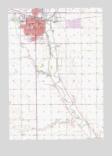
Huron, SD USGS Topographic Map
Click on map above to begin viewing in our Map Viewer.

This topographic map contains these locations and features:
Feature Name Type Latitude Longitude GNIS ID View Map
Beadle County CourthouseBuildingN44.3628°W98.2216°2712615View Map
Beadle County Regional CorrectionBuildingN44.3624°W98.2220°2755649View Map
Beadle County Sheriff's OfficeBuildingN44.3623°W98.2219°2755638View Map
Bible ChurchChurchN44.3414°W98.2076°1253904View Map
Buchanan Elementary SchoolSchoolN44.3605°W98.2371°2728850View Map
Cain CreekStreamN44.2739°W98.1631°1254191View Map
City of HuronCivilN44.3622°W98.2102°1267433View Map
Clifton SchoolSchoolN44.2622°W98.1943°1254404View Map
Custer SchoolSchoolN44.2975°W98.1334°1254584View Map
Grant SchoolSchoolN44.2547°W98.2340°1255335View Map
Holy Trinity Catholic Elementary SchoolSchoolN44.3423°W98.2211°2728806View Map
HuronPopulated PlaceN44.3633°W98.2143°1255722View Map
Huron Ambulance Association.BuildingN44.3414°W98.2085°2658935View Map
Huron City HallBuildingN44.3640°W98.2162°2725069View Map
Huron Fire Department Station SouthBuildingN44.3413°W98.2083°2580655View Map
Huron High SchoolSchoolN44.3463°W98.2270°2728852View Map
Huron MallLocaleN44.3442°W98.2315°1259538View Map
Huron Middle SchoolSchoolN44.3471°W98.2323°2728853View Map
Huron Police DepartmentBuildingN44.3640°W98.2163°2755529View Map
Huron Post OfficePost OfficeN44.3617°W98.2137°2710047View Map
Huron Public LibraryBuildingN44.3605°W98.2146°2723593View Map
Huron Regional Medical CenterHospitalN44.3613°W98.2106°2610939View Map
Huron UniversitySchoolN44.3575°W98.2195°1255723View Map
Ideal CemeteryCemeteryN44.3364°W98.1956°1255732View Map
Jefferson Elementary SchoolSchoolN44.3568°W98.2081°1255821View Map
Jehovah Kingdom HallChurchN44.3333°W98.2170°1264378View Map
KIJV-AM (Huron)TowerN44.3461°W98.2098°1259338View Map
KOKK-AM (Huron)TowerN44.3622°W98.1529°1259331View Map
KURO-FM (Huron)TowerN44.3461°W98.2098°1259264View Map
Lincoln SchoolSchoolN44.3553°W98.2170°1256127View Map
Madison Elementary SchoolSchoolN44.3467°W98.2087°1256298View Map
McKinley SchoolSchoolN44.3750°W98.2151°1256392View Map
Medas (historical)LocaleN44.3194°W98.1626°1263167View Map
MorningsidePopulated PlaceN44.3658°W98.1884°1256539View Map
Morningside Census Designated PlaceCensusN44.3663°W98.1835°2584561View Map
Pearl CreekStreamN44.2505°W98.1381°1266886View Map
Prospect ParkParkN44.3478°W98.2101°1257235View Map
Ravine Park DamDamN44.3680°W98.2023°1260492View Map
Restlawn Memory GardenCemeteryN44.3166°W98.2170°1264377View Map
Riverside CemeteryCemeteryN44.3397°W98.1976°1257403View Map
Riverside ParkParkN44.3619°W98.2004°1257409View Map
Saint Johns HospitalHospitalN44.3619°W98.2115°1257633View Map
Saint Martin CemeteryCemeteryN44.3411°W98.1834°1257668View Map
Saint Theresa SchoolSchoolN44.3605°W98.2115°1257750View Map
Southgate Shopping CenterLocaleN44.3442°W98.2156°1259537View Map
Stoney Run DamDamN44.3117°W98.2154°1260103View Map
Stony RunStreamN44.3108°W98.1904°1258378View Map
Stony Run LakeReservoirN44.3141°W98.2041°1258380View Map
Tiger StadiumLocaleN44.3477°W98.2288°2728287View Map
Township of CusterCivilN44.3232°W98.1500°1267890View Map
Washington Elementary SchoolSchoolN44.3497°W98.2215°1258833View Map
West 22d Street SchoolSchoolN44.3422°W98.2334°1258873View Map
Wilson SchoolSchoolN44.3589°W98.2237°1259042View Map

Note: Coordinates in the location and feature list above are referenced to NAD83 datum.


Copyright (C) 2008-2025 Ryan Niemi / Sunset Dynamics ... All Rights Reserved