TopoQuest Logo
Do you find TopoQuest useful?
Help keep TopoQuest running and adding new maps/features by donating!
Bitcoin:  19c7KJd3qBynnjoSw5npx9KScwjBe4ifkT
Litecoin:  LXs6TkuXGGXo1vDsWCkWVdjQX94eUKd6ui
Home View Maps Find Maps Find Places Resources & Links


Huron, California Topographic Map

USGS Map Title: Huron, CA
USGS Map MRC: 36120B1
DRG (GeoTIFF) Download: o36120b1.tif


Neighboring USGS Topographic Map Quads:


  Harris Ranch, CA  
36120C2
 

  Calflax, CA  
36120C1
 

  Vanguard, CA  
36119C8
 

  Guijarral Hills, CA  
36120B2
 

  Huron, CA  
36120B1
 

  Westhaven, CA  
36119B8
 

  Avenal, CA  
36120A2
 

  La Cima, CA  
36120A1
 

  Kettleman City, CA  
36119A8


Map MRC Location:

N37°
W121°
N37°
W120°
H8 H7 H6 H5 H4 H3 H2 H1
G8 G7 G6 G5 G4 G3 G2 G1
F8 F7 F6 F5 F4 F3 F2 F1
E8 E7 E6 E5 E4 E3 E2 E1
D8 D7 D6 D5 D4 D3 D2 D1
C8 C7 C6 C5 C4 C3 C2 C1
B8 B7 B6 B5 B4 B3 B2 B1
A8 A7 A6 A5 A4 A3 A2 A1
N36°
W121°
N36°
W120°

Huron, CA USGS 1:24K Topographic Map Preview:
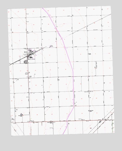
Huron, CA USGS Topographic Map
Click on map above to begin viewing in our Map Viewer.

This topographic map contains these locations and features:
Feature Name Type Latitude Longitude GNIS ID View Map
Airway FarmsLocaleN36.1669°W120.0307°238461View Map
Chestnut ParkParkN36.2088°W120.0982°1811937View Map
City of HuronCivilN36.2040°W120.0962°2410081View Map
Fresno County Fire Protection District Station 93 HuronBuildingN36.2046°W120.1043°2624004View Map
Half Moon RanchLocaleN36.1472°W120.0304°243117View Map
HuronPopulated PlaceN36.2027°W120.1029°1652725View Map
Huron Branch Coalinga-Huron LibraryBuildingN36.2094°W120.0990°1811973View Map
Huron City HallBuildingN36.2050°W120.1040°1811974View Map
Huron Elementary SchoolSchoolN36.2083°W120.0991°1811975View Map
Huron Police DepartmentBuildingN36.2053°W120.1041°2755877View Map
Huron Post OfficePost OfficeN36.2094°W120.1032°2769433View Map
Huron Recreation CenterParkN36.2100°W120.0996°1811976View Map
Huron SubstationLocaleN36.1861°W120.1038°1654669View Map
Keenan Community CenterBuildingN36.2011°W120.1040°1811978View Map
Keenan ParkParkN36.2013°W120.1046°1811979View Map
Los Gatos CreekStreamN36.2222°W120.1246°255635View Map
O'Neill RanchLocaleN36.1819°W120.1029°246702View Map
Sommerville FarmsLocaleN36.1455°W120.1129°249662View Map
Vernon Thomas RanchLocaleN36.1366°W120.0757°251005View Map
Willett Field (historical)AirportN36.2008°W120.0871°1653541View Map
Woods RanchLocaleN36.2033°W120.0299°251800View Map

Note: Coordinates in the location and feature list above are referenced to NAD83 datum.


Copyright (C) 2008-2024 Ryan Niemi / Sunset Dynamics ... All Rights Reserved