TopoQuest Logo
Do you find TopoQuest useful?
Help keep TopoQuest running and adding new maps/features by donating!
Bitcoin:  19c7KJd3qBynnjoSw5npx9KScwjBe4ifkT
Litecoin:  LXs6TkuXGGXo1vDsWCkWVdjQX94eUKd6ui
Home View Maps Find Maps Find Places Resources & Links


Ima SE, New Mexico Topographic Map

USGS Map Title: Ima SE, NM
USGS Map MRC: 34104G1
DRG (GeoTIFF) Download: o34104g1.tif


Neighboring USGS Topographic Map Quads:


  Ima NW, NM  
34104H2
 

  Ima, NM  
34104H1
 

  Circle S Mesa, NM  
34103H8
 

  Ima SW, NM  
34104G2
 

  Ima SE, NM  
34104G1
 

  Cunavea Basin, NM  
34103G8
 

  Twin Mesa NW, NM  
34104F2
 

  Hassell, NM  
34104F1
 

  House, NM  
34103F8


Map MRC Location:

N35°
W105°
N35°
W104°
H8 H7 H6 H5 H4 H3 H2 H1
G8 G7 G6 G5 G4 G3 G2 G1
F8 F7 F6 F5 F4 F3 F2 F1
E8 E7 E6 E5 E4 E3 E2 E1
D8 D7 D6 D5 D4 D3 D2 D1
C8 C7 C6 C5 C4 C3 C2 C1
B8 B7 B6 B5 B4 B3 B2 B1
A8 A7 A6 A5 A4 A3 A2 A1
N34°
W105°
N34°
W104°

Ima SE, NM USGS 1:24K Topographic Map Preview:
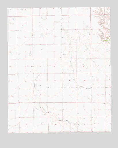
Ima SE, NM USGS Topographic Map
Click on map above to begin viewing in our Map Viewer.

This topographic map contains these locations and features:
Feature Name Type Latitude Longitude GNIS ID View Map
10202 Water WellWellN34.7637°W104.0200°935631View Map
10261 Water WellWellN34.8645°W104.1039°935609View Map
10262 Water WellWellN34.8645°W104.0991°935608View Map
10313 Water WellWellN34.7673°W104.0414°935633View Map
10314 Water WellWellN34.7684°W104.0766°935634View Map
10332 Water WellWellN34.7623°W104.0330°935629View Map
10527 Water WellWellN34.7920°W104.0219°935626View Map
10531 Water WellWellN34.8445°W104.0947°935615View Map
10532 Water WellWellN34.8498°W104.0761°935616View Map
10533 Water WellWellN34.8423°W104.0600°935613View Map
10534 Water WellWellN34.8334°W104.0955°935612View Map
10541 Water WellWellN34.8617°W104.0777°935606View Map
10543 Water WellWellN34.8423°W104.0600°935614View Map
10544 Water WellWellN34.8076°W104.0761°935617View Map
10786 Water WellWellN34.8148°W104.0666°935622View Map
Hartford (historical)Populated PlaceN34.7606°W104.0733°938527View Map
Ima CemeteryCemeteryN34.8525°W104.0686°890291View Map
Ima Community HouseLocaleN34.7940°W104.0247°890292View Map
Jordan Fire District Station 2BuildingN34.7943°W104.0250°2658131View Map
KrillingLocaleN34.7920°W104.0205°929611View Map
Lawrence RanchLocaleN34.7620°W104.0611°890994View Map
NorthcuttLocaleN34.8278°W104.0975°929562View Map
PeacockLocaleN34.8159°W104.0944°929619View Map
Peacock RanchLocaleN34.8165°W104.0947°893139View Map
Sparks RanchLocaleN34.8448°W104.0597°895218View Map
Williams RanchLocaleN34.8290°W104.1125°896634View Map

Note: Coordinates in the location and feature list above are referenced to NAD83 datum.


Copyright (C) 2008-2025 Ryan Niemi / Sunset Dynamics ... All Rights Reserved