TopoQuest Logo
Do you find TopoQuest useful?
Help keep TopoQuest running and adding new maps/features by donating!
Bitcoin:  19c7KJd3qBynnjoSw5npx9KScwjBe4ifkT
Litecoin:  LXs6TkuXGGXo1vDsWCkWVdjQX94eUKd6ui
Home View Maps Find Maps Find Places Resources & Links


Imogene, South Dakota Topographic Map

USGS Map Title: Imogene, SD
USGS Map MRC: 45102B6
DRG (GeoTIFF) Download: o45102b6.tif


Neighboring USGS Topographic Map Quads:


  Sorum SE, SD  
45102C7
 

  Date, SD  
45102C6
 

  Rabbit Butte, SD  
45102C5


  Imogene, SD  
45102B6
 

  Bixby, SD  
45102B5


  Cedar Canyon, SD  
45102A6
 

  Maurine, SD  
45102A5


Map MRC Location:

N46°
W103°
N46°
W102°
H8 H7 H6 H5 H4 H3 H2 H1
G8 G7 G6 G5 G4 G3 G2 G1
F8 F7 F6 F5 F4 F3 F2 F1
E8 E7 E6 E5 E4 E3 E2 E1
D8 D7 D6 D5 D4 D3 D2 D1
C8 C7 C6 C5 C4 C3 C2 C1
B8 B7 B6 B5 B4 B3 B2 B1
A8 A7 A6 A5 A4 A3 A2 A1
N45°
W103°
N45°
W102°

Imogene, SD USGS 1:24K Topographic Map Preview:
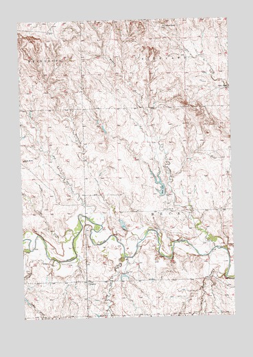
Imogene, SD USGS Topographic Map
Click on map above to begin viewing in our Map Viewer.

This topographic map contains these locations and features:
Feature Name Type Latitude Longitude GNIS ID View Map
Ash CreekStreamN45.1611°W102.7171°1253708View Map
BadlandsSummitN45.2208°W102.7310°1264396View Map
Beck LakeReservoirN45.1780°W102.6695°1253825View Map
Big Cedar CreekStreamN45.1503°W102.6899°1253912View Map
Blomberg 42 Ranch Private Airport (historical)AirportN45.2000°W102.6504°1260239View Map
Brushy CreekStreamN45.1536°W102.6363°1254099View Map
Cottonwood CreekStreamN45.1575°W102.6799°1254476View Map
Dillon DrawValleyN45.1495°W102.7322°1254689View Map
Frank Gebracht DamDamN45.2117°W102.7471°1260035View Map
Herman Kaubish DamDamN45.1633°W102.6488°1260032View Map
Herman Kaubish DamDamN45.1350°W102.7004°1260033View Map
ImogenePopulated PlaceN45.1405°W102.7129°1261022View Map
Little Cedar CreekStreamN45.1408°W102.6302°1256153View Map
Mud CreekStreamN45.1669°W102.7110°1256589View Map
Nelson FarmLocaleN45.2208°W102.6260°1256659View Map
Rocky ButteSummitN45.1917°W102.7488°1257443View Map
School Number 73SchoolN45.1700°W102.6663°1257969View Map
Stillwell RanchLocaleN45.2475°W102.6629°1258349View Map
Township of Beck (historical)CivilN45.1917°W102.6699°1269033View Map
Township of Beck-HighlandCivilN45.2128°W102.6515°2424939View Map
Vern Anders DamDamN45.1617°W102.6854°1260034View Map

Note: Coordinates in the location and feature list above are referenced to NAD83 datum.


Copyright (C) 2008-2025 Ryan Niemi / Sunset Dynamics ... All Rights Reserved