TopoQuest Logo
Do you find TopoQuest useful?
Help keep TopoQuest running and adding new maps/features by donating!
Bitcoin:  19c7KJd3qBynnjoSw5npx9KScwjBe4ifkT
Litecoin:  LXs6TkuXGGXo1vDsWCkWVdjQX94eUKd6ui
Home View Maps Find Maps Find Places Resources & Links


Imperial, Nebraska Topographic Map

USGS Map Title: Imperial, NE
USGS Map MRC: 40101E6
DRG (GeoTIFF) Download: o40101e6.tif


Neighboring USGS Topographic Map Quads:


  Lamar NE, NE  
40101F7
 

  Imperial NW, NE  
40101F6
 

  Imperial NE, NE  
40101F5
 

  Chase, NE  
40101E7
 

  Imperial, NE  
40101E6
 

  Imperial Municipal Airport, NE  
40101E5
 

  Reservoir Lake, NE  
40101D7
 

  Champion, NE  
40101D6
 

  Enders, NE  
40101D5


Map MRC Location:

N41°
W102°
N41°
W101°
H8 H7 H6 H5 H4 H3 H2 H1
G8 G7 G6 G5 G4 G3 G2 G1
F8 F7 F6 F5 F4 F3 F2 F1
E8 E7 E6 E5 E4 E3 E2 E1
D8 D7 D6 D5 D4 D3 D2 D1
C8 C7 C6 C5 C4 C3 C2 C1
B8 B7 B6 B5 B4 B3 B2 B1
A8 A7 A6 A5 A4 A3 A2 A1
N40°
W102°
N40°
W101°

Imperial, NE USGS 1:24K Topographic Map Preview:
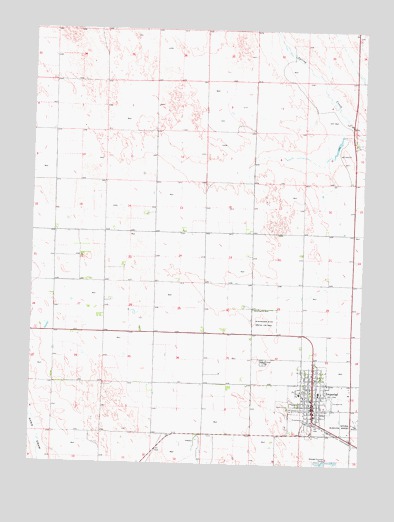
Imperial, NE USGS Topographic Map
Click on map above to begin viewing in our Map Viewer.

This topographic map contains these locations and features:
Feature Name Type Latitude Longitude GNIS ID View Map
Berean Fundamental ChurchChurchN40.5278°W101.6427°1838863View Map
Carmans Mobile ParkPopulated PlaceN40.5125°W101.6410°1838845View Map
Chase CountyCivilN40.5242°W101.6979°835836View Map
Chase County Community HospitalHospitalN40.5241°W101.6506°1838848View Map
Chase County Court HouseBuildingN40.5206°W101.6443°1838842View Map
Chase County Fair GroundsLocaleN40.5181°W101.6366°1838841View Map
Chase County High SchoolSchoolN40.5208°W101.6407°1838839View Map
Chase County SheriffBuildingN40.5202°W101.6432°1838843View Map
Christian Faith OutreachChurchN40.5169°W101.6432°1838865View Map
Church of ChristChurchN40.5169°W101.6432°1838864View Map
City of ImperialCivilN40.5146°W101.6381°2394466View Map
First United Methodist ChurchChurchN40.5158°W101.6360°1838862View Map
Frenchman Valley Family PracticeHospitalN40.5236°W101.6499°1838849View Map
Frenchman Valley Farmers Coop ElevatorLocaleN40.5117°W101.6435°1838834View Map
Heartland Counseling ClinicHospitalN40.5194°W101.6463°1838850View Map
ImperialPopulated PlaceN40.5169°W101.6432°830263View Map
ImperialLocaleN40.5119°W101.6421°1838828View Map
Imperial Bible ChurchChurchN40.5222°W101.6554°1838861View Map
Imperial Capitol Mobile CourtPopulated PlaceN40.5233°W101.6371°1838846View Map
Imperial City ParkParkN40.5175°W101.6485°1838833View Map
Imperial Country ClubLocaleN40.5167°W101.6546°1838840View Map
Imperial East Election PrecinctCivilN40.5117°W101.6327°1928976View Map
Imperial Elementary SchoolSchoolN40.5208°W101.6407°1838838View Map
Imperial Emergency Medical ServicesBuildingN40.5174°W101.6435°2553771View Map
Imperial Heights Retirement CenterHospitalN40.5203°W101.6482°1838851View Map
Imperial Manor Nursing HomeHospitalN40.5203°W101.6485°1838852View Map
Imperial Municipal AirportAirportN40.5126°W101.6265°837607View Map
Imperial Police DeptBuildingN40.5173°W101.6432°1838837View Map
Imperial Post OfficePost OfficeN40.5164°W101.6419°1838829View Map
Imperial Public LibraryBuildingN40.5208°W101.6463°1838836View Map
Imperial Rural Election PrecinctCivilN40.5446°W101.6597°1928977View Map
Imperial Volunteer Fire DepartmentBuildingN40.5174°W101.6435°1838844View Map
Imperial West Election PrecinctCivilN40.5204°W101.6487°1928978View Map
Jehovahs Witnesses Kingdom HallChurchN40.5244°W101.6460°1838860View Map
KKEI-FM (Imperial)TowerN40.5417°W101.7088°837398View Map
Longan Chiropractic ClinicHospitalN40.5153°W101.6435°1838854View Map
Max Addition ParkParkN40.5214°W101.6504°1838830View Map
Meyer Eye ClinicHospitalN40.5167°W101.6427°1838853View Map
Mount Hope CemeteryCemeteryN40.5297°W101.6613°831455View Map
Reorganized Church of Jesus Christ of Latter Day SaintsChurchN40.5158°W101.6516°1838859View Map
Saint Patricks Catholic ChurchChurchN40.5183°W101.6418°1838858View Map
Schroeder ParkParkN40.5139°W101.6366°1838831View Map
Trinidad Bean and Elevator Company ElevatorLocaleN40.5083°W101.6282°1838835View Map
Wanamaker State Wildlife Management AreaParkN40.5411°W101.6621°834470View Map
Wesleyan ChurchChurchN40.5297°W101.6463°1838857View Map
West ParkParkN40.5175°W101.6504°1838832View Map
Westside Church of ChristChurchN40.5214°W101.6479°1838856View Map
Winters Mobile Home ParkPopulated PlaceN40.5286°W101.6407°1838847View Map
Zion Lutheran ChurchChurchN40.5247°W101.6435°1838855View Map

Note: Coordinates in the location and feature list above are referenced to NAD83 datum.


Copyright (C) 2008-2024 Ryan Niemi / Sunset Dynamics ... All Rights Reserved