TopoQuest Logo
Do you find TopoQuest useful?
Help keep TopoQuest running and adding new maps/features by donating!
Bitcoin:  19c7KJd3qBynnjoSw5npx9KScwjBe4ifkT
Litecoin:  LXs6TkuXGGXo1vDsWCkWVdjQX94eUKd6ui
Home View Maps Find Maps Find Places Resources & Links


Indian Bathtub, New Mexico Topographic Map

USGS Map Title: Indian Bathtub, NM
USGS Map MRC: 35103G5
DRG (GeoTIFF) Download: o35103g5.tif


Neighboring USGS Topographic Map Quads:


  Bueyeros, NM  
35103H6
 

  Bueyeros NE, NM  
35103H5
 

  Cottonwood Springs, NM  
35103H4
 

  Circle Bar Ranch, NM  
35103G6
 

  Indian Bathtub, NM  
35103G5
 

  Rosebud, NM  
35103G4
 

  Buffalo Springs, NM  
35103F6
 

  Gallegos NE, NM  
35103F5
 

  McCloy Ranch, NM  
35103F4


Map MRC Location:

N36°
W104°
N36°
W103°
H8 H7 H6 H5 H4 H3 H2 H1
G8 G7 G6 G5 G4 G3 G2 G1
F8 F7 F6 F5 F4 F3 F2 F1
E8 E7 E6 E5 E4 E3 E2 E1
D8 D7 D6 D5 D4 D3 D2 D1
C8 C7 C6 C5 C4 C3 C2 C1
B8 B7 B6 B5 B4 B3 B2 B1
A8 A7 A6 A5 A4 A3 A2 A1
N35°
W104°
N35°
W103°

Indian Bathtub, NM USGS 1:24K Topographic Map Preview:
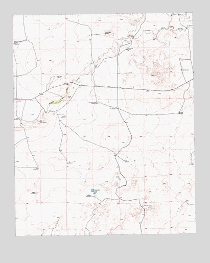
Indian Bathtub, NM USGS Topographic Map
Click on map above to begin viewing in our Map Viewer.

This topographic map contains these locations and features:
Feature Name Type Latitude Longitude GNIS ID View Map
Cejita CemeteryCemeteryN35.8275°W103.5869°887366View Map
East Graveyard WindmillLocaleN35.8211°W103.5536°888662View Map
East Twin WindmillLocaleN35.8145°W103.6077°888724View Map
Garden WindmillLocaleN35.8170°W103.5897°889343View Map
Harris WindmillsLocaleN35.8589°W103.6247°889800View Map
Indian BathtubLakeN35.7741°W103.6108°890296View Map
LambertLocaleN35.8300°W103.5913°924355View Map
Largo WindmillLocaleN35.7917°W103.5491°890938View Map
Little Johnny WindmillLocaleN35.8548°W103.5466°891152View Map
Lonez Well Number 1WellN35.8739°W103.5105°898001View Map
Lopez Well Number 2WellN35.8425°W103.5088°898002View Map
Louis WindmillsLocaleN35.8164°W103.6216°891397View Map
Medano WindmillLocaleN35.7659°W103.5336°891818View Map
New Pasture WindmillLocaleN35.8623°W103.5416°892453View Map
North Creek WindmillLocaleN35.8634°W103.5611°892575View Map
Poso WindmillLocaleN35.7909°W103.5886°893425View Map
Rosebud WindmillLocaleN35.8181°W103.5113°894161View Map
Salada WindmillLocaleN35.7720°W103.5730°894299View Map
Salt LakesLakeN35.7752°W103.5716°894358View Map
Sheep Fence WindmillLocaleN35.8398°W103.5958°894777View Map
Twin WindmillsLocaleN35.7884°W103.6088°895979View Map
West Graveyard WindmillLocaleN35.8242°W103.5680°896374View Map

Note: Coordinates in the location and feature list above are referenced to NAD83 datum.


Copyright (C) 2008-2025 Ryan Niemi / Sunset Dynamics ... All Rights Reserved