TopoQuest Logo
Do you find TopoQuest useful?
Help keep TopoQuest running and adding new maps/features by donating!
Bitcoin:  19c7KJd3qBynnjoSw5npx9KScwjBe4ifkT
Litecoin:  LXs6TkuXGGXo1vDsWCkWVdjQX94eUKd6ui
Home View Maps Find Maps Find Places Resources & Links


Indian Cove, California Topographic Map

USGS Map Title: Indian Cove, CA
USGS Map MRC: 34116A2
DRG (GeoTIFF) Download: o34116a2.tif


Neighboring USGS Topographic Map Quads:


  Joshua Tree North, CA  
34116B3
 

  Sunfair, CA  
34116B2
 

  Twentynine Palms, CA  
34116B1
 

  Joshua Tree South, CA  
34116A3
 

  Indian Cove, CA  
34116A2
 

  Queen Mountain, CA  
34116A1
 

  East Deception Canyon, CA  
33116H3
 

  Keys View, CA  
33116H2
 

  Malapai Hill, CA  
33116H1


Map MRC Location:

N35°
W117°
N35°
W116°
H8 H7 H6 H5 H4 H3 H2 H1
G8 G7 G6 G5 G4 G3 G2 G1
F8 F7 F6 F5 F4 F3 F2 F1
E8 E7 E6 E5 E4 E3 E2 E1
D8 D7 D6 D5 D4 D3 D2 D1
C8 C7 C6 C5 C4 C3 C2 C1
B8 B7 B6 B5 B4 B3 B2 B1
A8 A7 A6 A5 A4 A3 A2 A1
N34°
W117°
N34°
W116°

Indian Cove, CA USGS 1:24K Topographic Map Preview:
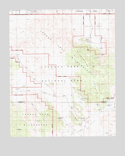
Indian Cove, CA USGS Topographic Map
Click on map above to begin viewing in our Map Viewer.

This topographic map contains these locations and features:
Feature Name Type Latitude Longitude GNIS ID View Map
Barker DamDamN34.0308°W116.1461°238988View Map
Cow Camp DamDamN34.0378°W116.1622°241018View Map
Desert Queen WellWellN34.0303°W116.1344°241440View Map
Hidden ValleyValleyN34.0219°W116.1808°243431View Map
Hidden Valley CampgroundLocaleN34.0172°W116.1625°243433View Map
Indian CoveValleyN34.1222°W116.1534°243806View Map
Indian Cove CampgroundLocaleN34.0936°W116.1583°243807View Map
Indian Cove Ranger StationLocaleN34.1200°W116.1558°243808View Map
Johnny Lang CanyonValleyN34.0413°W116.2321°244098View Map
Johnson SpringSpringN34.0857°W116.1593°244115View Map
Keys RanchLocaleN34.0461°W116.1692°244290View Map
Lang MineMineN34.0156°W116.2186°244579View Map
Lost Horse Ranger StationLocaleN34.0183°W116.1900°245209View Map
Lost Horse ValleyValleyN34.0096°W116.1790°245210View Map
Mount Minerva HoytSummitN34.0133°W116.2268°2740412View Map
Panorama HeightsPopulated PlaceN34.1242°W116.2208°1661190View Map
Quail MountainSummitN34.0072°W116.2415°247849View Map
Rattlesnake CanyonValleyN34.0845°W116.1392°247983View Map
Ryan Mountain TrailTrailN34.0020°W116.1303°248492View Map
Samuelsons RockPillarN34.0472°W116.2425°248783View Map
Sneakeye SpringSpringN34.0903°W116.1675°1667149View Map
Wall Street MillLocaleN34.0364°W116.1336°251141View Map
Willow HoleBasinN34.0689°W116.1531°251619View Map
Wonderland of RocksAreaN34.0642°W116.1517°251760View Map
Wonderland Ranch WashArroyoN34.0772°W116.1458°1839674View Map

Note: Coordinates in the location and feature list above are referenced to NAD83 datum.


Copyright (C) 2008-2024 Ryan Niemi / Sunset Dynamics ... All Rights Reserved