TopoQuest Logo
Do you find TopoQuest useful?
Help keep TopoQuest running and adding new maps/features by donating!
Bitcoin:  19c7KJd3qBynnjoSw5npx9KScwjBe4ifkT
Litecoin:  LXs6TkuXGGXo1vDsWCkWVdjQX94eUKd6ui
Home View Maps Find Maps Find Places Resources & Links


Indian Hot Springs, Texas Topographic Map

USGS Map Title: Indian Hot Springs, TX
USGS Map MRC: 30105G3
DRG (GeoTIFF) Download: o30105g3.tif


Neighboring USGS Topographic Map Quads:


  Schroder Arroyo, TX  
30105H4
 

  Cedar Arroyo, TX  
30105H3
 

  Eagle Mountains NW, TX  
30105H2


  Indian Hot Springs, TX  
30105G3
 

  Eagle Mountains SW, TX  
30105G2


Map MRC Location:

N31°
W106°
N31°
W105°
H8 H7 H6 H5 H4 H3 H2 H1
G8 G7 G6 G5 G4 G3 G2 G1
F8 F7 F6 F5 F4 F3 F2 F1
E8 E7 E6 E5 E4 E3 E2 E1
D8 D7 D6 D5 D4 D3 D2 D1
C8 C7 C6 C5 C4 C3 C2 C1
B8 B7 B6 B5 B4 B3 B2 B1
A8 A7 A6 A5 A4 A3 A2 A1
N30°
W106°
N30°
W105°

Indian Hot Springs, TX USGS 1:24K Topographic Map Preview:
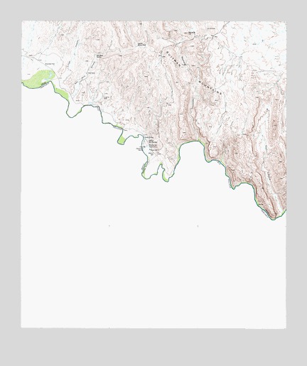
Indian Hot Springs, TX USGS Topographic Map
Click on map above to begin viewing in our Map Viewer.

This topographic map contains these locations and features:
Feature Name Type Latitude Longitude GNIS ID View Map
Arroyo CaballoValleyN30.8462°W105.3594°1351283View Map
Beauty SpringSpringN30.8246°W105.3153°1351716View Map
Chief SpringsSpringN30.8240°W105.3160°1354389View Map
Dynamite SpringSpringN30.8232°W105.3175°1356518View Map
Gibson DamDamN30.8385°W105.3355°1858084View Map
Gibson ReservoirReservoirN30.8385°W105.3355°1858085View Map
Goat CanyonValleyN30.7967°W105.2523°1358078View Map
Indian Hot SpringsSpringN30.8251°W105.3255°2025143View Map
Indian Hot SpringsPopulated PlaceN30.8262°W105.3175°1359963View Map
Indian Water HoleLakeN30.8649°W105.3205°1359995View Map
Masins SpringSpringN30.8219°W105.3146°1362251View Map
Mayfield CanyonValleyN30.8263°W105.2923°1362327View Map
Red Bull CanyonValleyN30.8445°W105.3515°1366135View Map
Red Bull HillSummitN30.8701°W105.2972°1366136View Map
Red Bull SpringSpringN30.8611°W105.3401°1366137View Map
Soda SpringSpringN30.8278°W105.3174°1368583View Map
Squaw SpringSpringN30.8239°W105.3153°1369074View Map
Stump SpringSpringN30.8227°W105.3150°1369306View Map
Suicide FlatFlatN30.8568°W105.3619°1369330View Map
Talley RanchLocaleN30.8537°W105.3444°1376375View Map

Note: Coordinates in the location and feature list above are referenced to NAD83 datum.


Copyright (C) 2008-2024 Ryan Niemi / Sunset Dynamics ... All Rights Reserved