TopoQuest Logo
Do you find TopoQuest useful?
Help keep TopoQuest running and adding new maps/features by donating!
Bitcoin:  19c7KJd3qBynnjoSw5npx9KScwjBe4ifkT
Litecoin:  LXs6TkuXGGXo1vDsWCkWVdjQX94eUKd6ui
Home View Maps Find Maps Find Places Resources & Links


Indian Springs, Nevada Topographic Map

USGS Map Title: Indian Springs, NV
USGS Map MRC: 36115E6
DRG (GeoTIFF) Download: o36115e6.tif


Neighboring USGS Topographic Map Quads:


  Mercury NE, NV  
36115F7
 

  Indian Springs NW, NV  
36115F6
 

  Heavens Well, NV  
36115F5
 

  Mercury SE, NV  
36115E7
 

  Indian Springs, NV  
36115E6
 

  Indian Springs SE, NV  
36115E5
 

  Willow Peak, NV  
36115D7
 

  Cold Creek, NV  
36115D6
 

  Charleston Peak NE, NV  
36115D5


Map MRC Location:

N37°
W116°
N37°
W115°
H8 H7 H6 H5 H4 H3 H2 H1
G8 G7 G6 G5 G4 G3 G2 G1
F8 F7 F6 F5 F4 F3 F2 F1
E8 E7 E6 E5 E4 E3 E2 E1
D8 D7 D6 D5 D4 D3 D2 D1
C8 C7 C6 C5 C4 C3 C2 C1
B8 B7 B6 B5 B4 B3 B2 B1
A8 A7 A6 A5 A4 A3 A2 A1
N36°
W116°
N36°
W115°

Indian Springs, NV USGS 1:24K Topographic Map Preview:
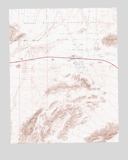
Indian Springs, NV USGS Topographic Map
Click on map above to begin viewing in our Map Viewer.

This topographic map contains these locations and features:
Feature Name Type Latitude Longitude GNIS ID View Map
Cactus SpringsPopulated PlaceN36.5777°W115.7275°855982View Map
Clark County Fire Department Station 83BuildingN36.5696°W115.6768°2473049View Map
Creech Air Force BaseAirportN36.5921°W115.6666°2443872View Map
Creech Air Force BaseMilitaryN36.5895°W115.6797°2512155View Map
Indian RidgeRidgeN36.5047°W115.6470°860126View Map
Indian SpringSpringN36.5651°W115.6693°856491View Map
Indian SpringsPopulated PlaceN36.5697°W115.6706°847373View Map
Indian Springs Census Designated PlaceCensusN36.5718°W115.7202°2408423View Map
Indian Springs Elementary SchoolSchoolN36.5747°W115.6759°855089View Map
Indian Springs High SchoolSchoolN36.5742°W115.6767°2084194View Map
Indian Springs Middle SchoolSchoolN36.5741°W115.6767°855087View Map
Indian Springs ParkParkN36.5752°W115.6778°2473327View Map
Indian Springs PoolParkN36.5752°W115.6778°2473328View Map
Indian Springs Post OfficePost OfficeN36.5775°W115.6709°864962View Map
Mesquite SpringSpringN36.5763°W115.7281°851266View Map
Nevada Highway Patrol Southern Command Indian Springs SubstationBuildingN36.5706°W115.6712°2740061View Map
P Guest RanchLocaleN36.5650°W115.6692°856875View Map
Willow CreekStreamN36.5761°W115.7325°862034View Map

Note: Coordinates in the location and feature list above are referenced to NAD83 datum.


Copyright (C) 2008-2025 Ryan Niemi / Sunset Dynamics ... All Rights Reserved