TopoQuest Logo
Do you find TopoQuest useful?
Help keep TopoQuest running and adding new maps/features by donating!
Bitcoin:  19c7KJd3qBynnjoSw5npx9KScwjBe4ifkT
Litecoin:  LXs6TkuXGGXo1vDsWCkWVdjQX94eUKd6ui
Home View Maps Find Maps Find Places Resources & Links


Indiantown SE, Florida Topographic Map

USGS Map Title: Indiantown SE, FL
USGS Map MRC: 27080A3
DRG (GeoTIFF) Download: o27080a3.tif


Neighboring USGS Topographic Map Quads:


  Indiantown NW, FL  
27080B4
 

  Palm City, FL  
27080B3
 

  Saint Lucie Inlet, FL  
27080B2
 

  Indiantown, FL  
27080A4
 

  Indiantown SE, FL  
27080A3
 

  Gomez, FL  
27080A2


  West of Rood, FL  
26080H3
 

  Rood, FL  
26080H2


Map MRC Location:

N28°
W81°
N28°
W80°
H8 H7 H6 H5 H4 H3 H2 H1
G8 G7 G6 G5 G4 G3 G2 G1
F8 F7 F6 F5 F4 F3 F2 F1
E8 E7 E6 E5 E4 E3 E2 E1
D8 D7 D6 D5 D4 D3 D2 D1
C8 C7 C6 C5 C4 C3 C2 C1
B8 B7 B6 B5 B4 B3 B2 B1
A8 A7 A6 A5 A4 A3 A2 A1
N27°
W81°
N27°
W80°

Indiantown SE, FL USGS 1:24K Topographic Map Preview:
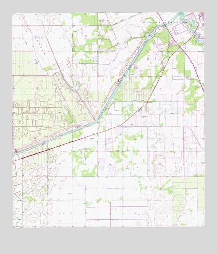
Indiantown SE, FL USGS Topographic Map
Click on map above to begin viewing in our Map Viewer.

This topographic map contains these locations and features:
Feature Name Type Latitude Longitude GNIS ID View Map
Ackel Mobile Home EstatesPopulated PlaceN27.0931°W80.2774°2452446View Map
ArundelPopulated PlaceN27.0881°W80.2984°294658View Map
Calvary Baptist ChurchChurchN27.1072°W80.3187°2451813View Map
Christian Victory CenterChurchN27.0888°W80.2843°2452455View Map
Hanson Grant OutletCanalN27.1212°W80.2998°283698View Map
Hog CreekStreamN27.1128°W80.2848°284075View Map
Martin County Fire Rescue Station 22BuildingN27.1020°W80.2796°2331159View Map
Queens ParkPopulated PlaceN27.1067°W80.2748°301133View Map
Roebuck CreekStreamN27.1162°W80.2734°289920View Map
Saint Lucie Lock and DamDamN27.1118°W80.2846°290268View Map
South Fork High SchoolSchoolN27.0766°W80.2527°298355View Map
Stuart Yacht MarinaHarborN27.1201°W80.2595°2452443View Map
The Vines Golf and Country ClubLocaleN27.0935°W80.2680°2452434View Map
Thomas Mauvel BridgeBridgeN27.1156°W80.2664°303585View Map
Towering Pines Mobile Home ParkPopulated PlaceN27.0949°W80.2757°2452454View Map
Tropical Farms Baptist ChurchChurchN27.0957°W80.2761°2452474View Map
Tropical ParkPopulated PlaceN27.0984°W80.2775°301134View Map
Tropical Plantation Airport (historical)AirportN27.1019°W80.2943°309799View Map

Note: Coordinates in the location and feature list above are referenced to NAD83 datum.


Copyright (C) 2008-2024 Ryan Niemi / Sunset Dynamics ... All Rights Reserved